|
|
|
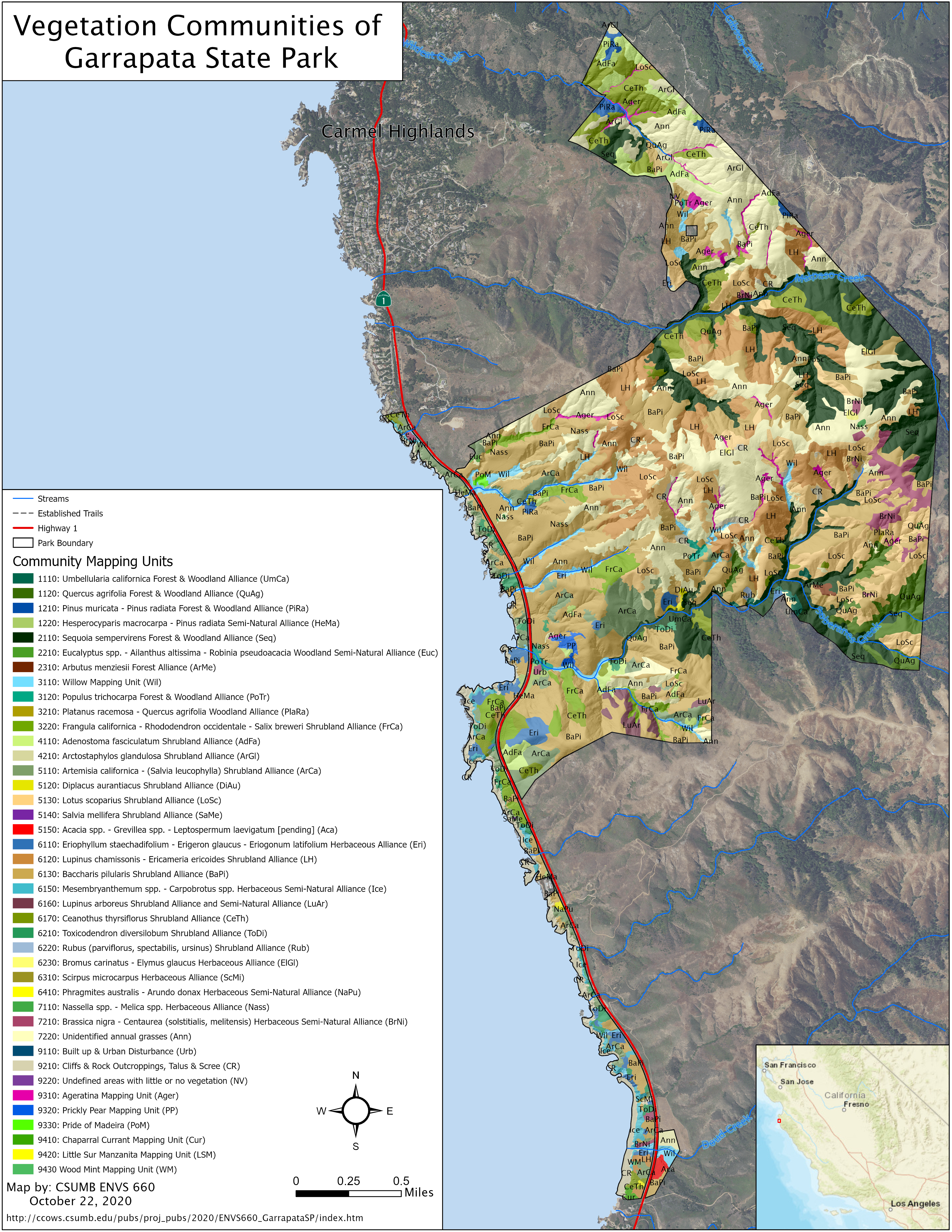
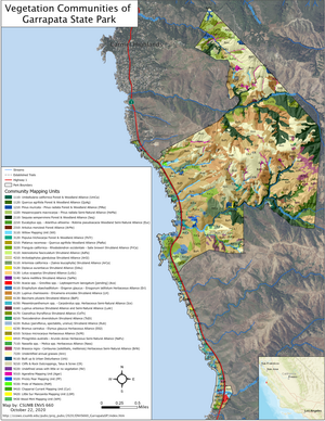
Mapping of vegetation communities, invasive plants, and sensitive plants at Garrapata State Park, Monterey County, California
An 8-week class project by CSUMB grad students in ENVS 660 Professional Environmental Science. Fall 2020.
Project documents & data
- Report:
- Erratum: We recently (Feb 2020) noticed some confusion between Lupinus chamissonis and L. albifrons in the report & map. Some of what we'd called L. chamissonis is actually L. albifrons. This may fall under an MCV alliance not mentioned in the report:
"Lotus scoparius - Lupinus albifrons - Eriodictyon spp. [pending]"
Another possibility althogh perhaps less likely is:
"Lupinus albifrons Shrubland Alliance"
We'll try and clarify this a bit more with some additional field visits.
- Large-format map of vegetation communities:
- Zipped Geodatabases:
|