|
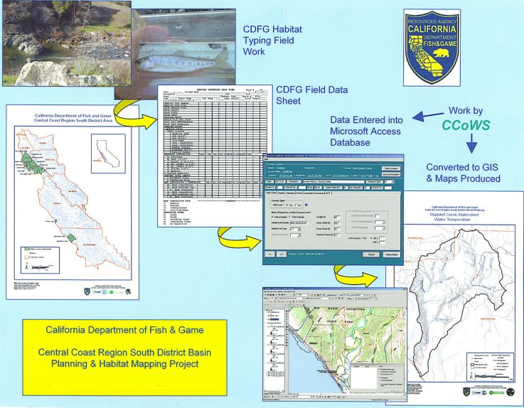
THIS SITE IS UNDER CONSTRUCTION AS OF FEBRUARY 28, 2008. IT WILL BE COMPLETED ON MARCH 31,2008. Welcome to the CCoWS California Department of Fish and Game South Coast District Planning website. CCoWS has been mapping central coast fish habitat collected from CDFG field data since 2004. The purpose of this project was to use GIS technnology to create maps that disseminate and reference fish habitat characteristics of South Coast District watersheds creating a new avenue of data analysis. These GIS maps graphically present the location and frequency of particular critical habitat types, fish species distribution and use, identified problem sites, and other important watershed features. These maps are useful in planning, evaluation, and monitoring process associated with watershed and stream improvement programs. This website acts as an online filing system that provides a means of distribution of habitat maps created in conjunction with the California Department of Fish and Game.
Personnel
|