File:GWP D final.png
From CCoWS Wiki
Size of this preview: 800 × 600 pixels.
Original file (960 × 720 pixels, file size: 88 KB, MIME type: image/png)
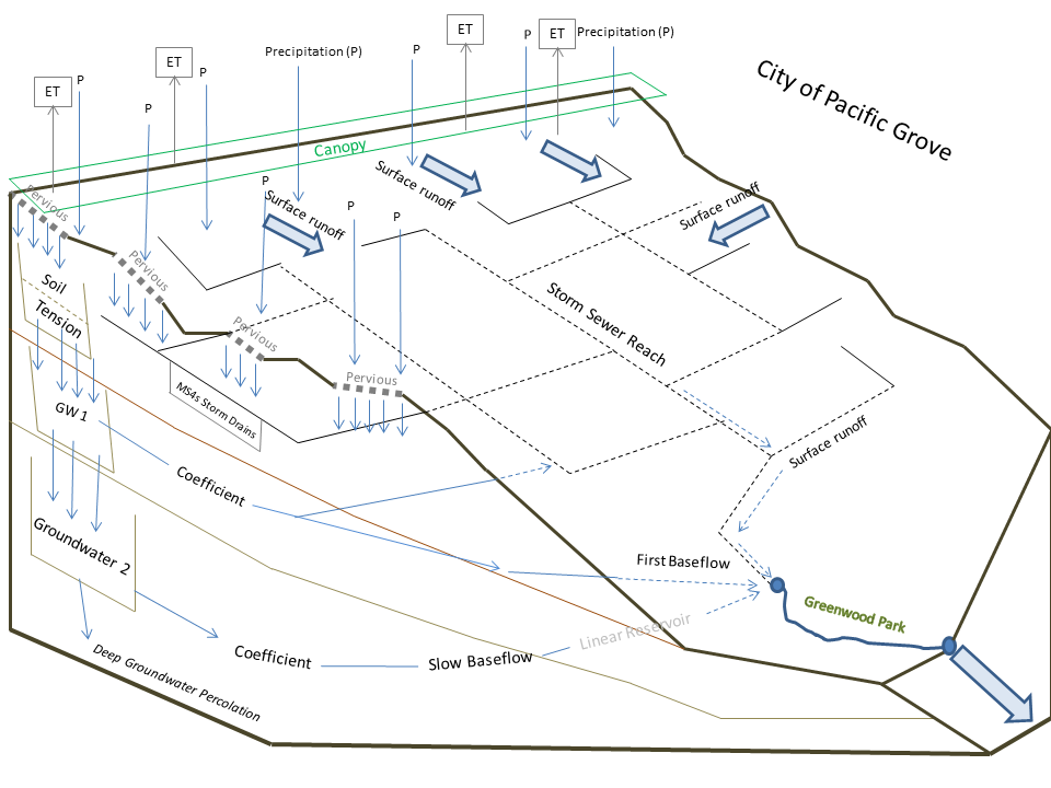
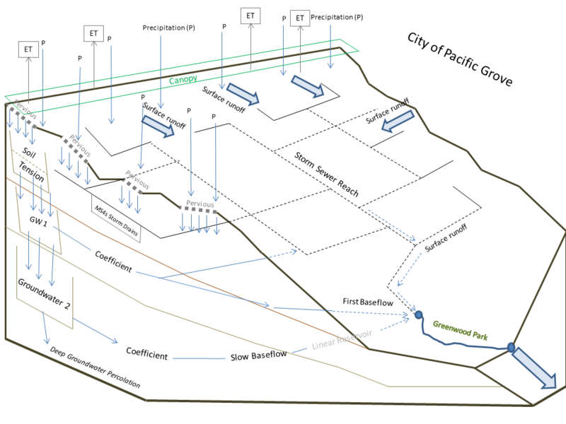
The City of Pacific Grove is located on the NW portion of the Monterey Peninsula. The city contains multiple watershed including the Greenwood Park Watershed which is highly urbanized producing large volumes of stormflow runoff which is discharged into the Monterey Bay ASBS. Nearly 43% of the watershed is covered by impervious surfaces and maintains an average slope of 8% which can result in minimal percolation of seasonal precipitation. Map by: Kirk Post
File history
Click on a date/time to view the file as it appeared at that time.
| Date/Time | Thumbnail | Dimensions | User | Comment | |
|---|---|---|---|---|---|
| current | 02:41, 29 March 2012 | | 960 × 720 (88 KB) | Kirkp (Talk | contribs) | The City of Pacific Grove is located on the NW portion of the Monterey Peninsula. The city contains multiple watershed including the Greenwood Park Watershed which is highly urbanized producing large volumes of stormflow runoff which is discharged into th |
- You cannot overwrite this file.
File usage
There are no pages that link to this file.