File:Salinas River Map.png
From CCoWS Wiki
Size of this preview: 587 × 600 pixels.
Original file (695 × 710 pixels, file size: 630 KB, MIME type: image/png)
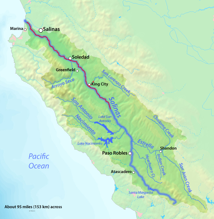
Description English: Map of the Salinas River watershed. The river and its tributaries drain a large portion of the central California Coast Ranges. Date 30 January 2010 Source Background and river courses from http://www2.demis.nl/mapserver/mapper.asp Author Background layer attributed to DEMIS Mapserver, map created by Shannon1 Permission (Reusing this file) Map created from DEMIS Mapserver, which are public domain.
File history
Click on a date/time to view the file as it appeared at that time.
| Date/Time | Thumbnail | Dimensions | User | Comment | |
|---|---|---|---|---|---|
| current | 13:19, 7 April 2014 | | 695 × 710 (630 KB) | Seann (Talk | contribs) | Description English: Map of the Salinas River watershed. The river and its tributaries drain a large portion of the central California Coast Ranges. Date 30 January 2010 Source Background and river courses from http://www2.demis.nl/mapserver/mapper.as... |
- You cannot overwrite this file.
File usage
The following page links to this file: