File:Soberanes burn severity2016.png
From CCoWS Wiki

Size of this preview: 650 × 600 pixels.
Original file (975 × 900 pixels, file size: 1.67 MB, MIME type: image/png)
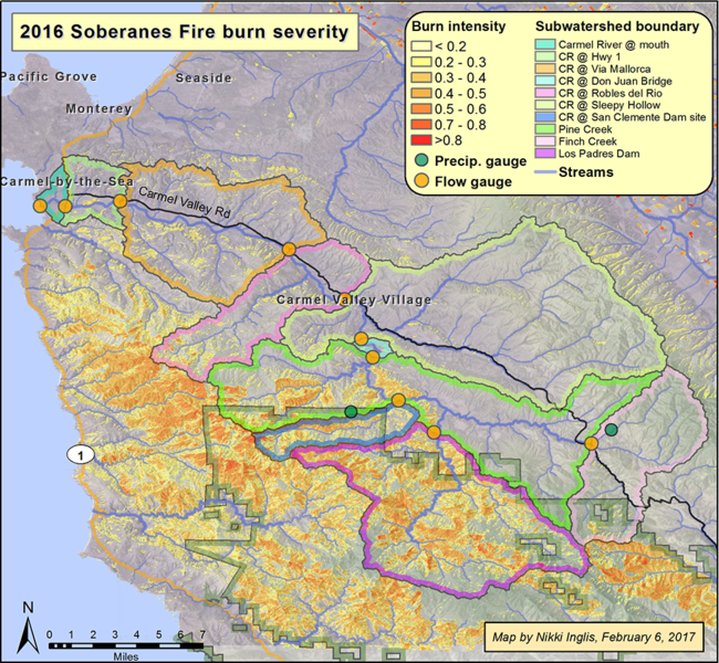
For metadeta and alternative version see Carmel River Watershed: 2016 Soberanes Fire Burn Severity
File history
Click on a date/time to view the file as it appeared at that time.
| Date/Time | Thumbnail | Dimensions | User | Comment | |
|---|---|---|---|---|---|
| current | 17:52, 28 March 2017 | | 975 × 900 (1.67 MB) | Nikkii (Talk | contribs) | Difference in normalized burn ratio before and after the Soberanes Fire. Measurements were taken on June 20, 2016 and Oct. 27, 2017 using Landsat imagery.. Projection: WGS 1984 UTM Zone 10N |
- You cannot overwrite this file.
File usage
The following 2 pages link to this file: