Difference between revisions of "Carmel River Watershed: Map of Soil Erosion Index"
From CCoWS Wiki
| Line 1: | Line 1: | ||
| − | + | [[Image:Soil_erosion_index.png|200px|thumb]] | |
| − | + | * [[Media:Soil_erosion_index.pdf|PDF file - for printing]] | |
| + | * [[Media:Soil_erosion_index.png|PNG file]] | ||
| − | + | == Metadata == | |
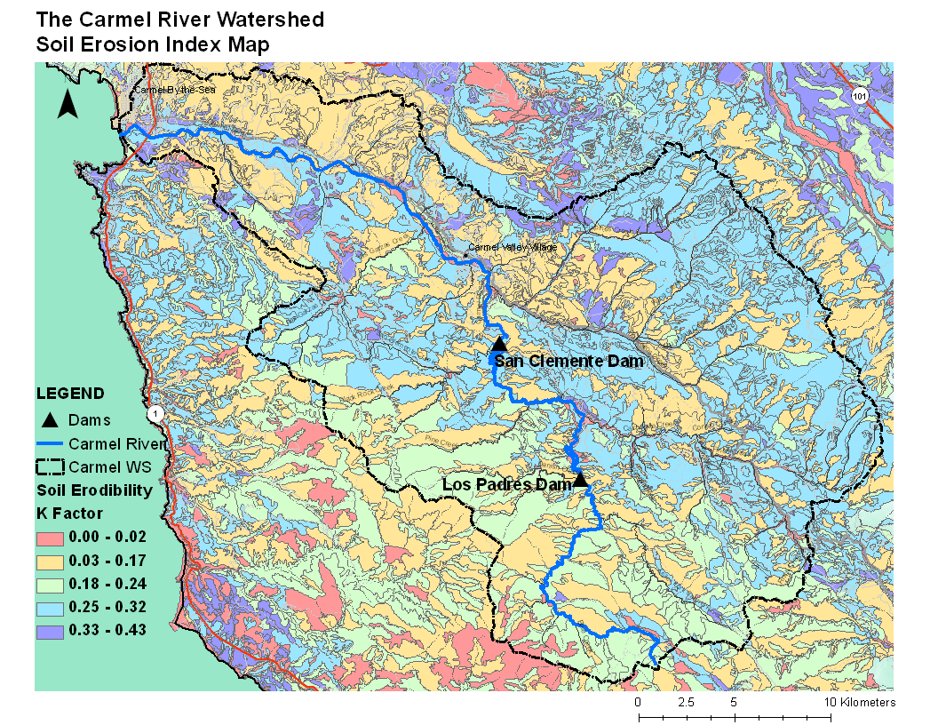
| − | + | * Original source of data: SSURGO - [http://soils.usda.gov/survey/geography/ssurgo/ http://soils.usda.gov/survey/geography/ssurgo/] | |
| + | * Map produced by: | ||
| + | * Projected Coordinate System: NAD_1983_UTM_Zone_10N | ||
| + | ** Projection: Transverse_Mercator | ||
| + | * Geographic Coordinate System: GCS_North_American_1983 | ||
| + | ** Datum: D_North_American_1983 | ||
| + | ** Prime Meridian: Greenwich | ||
| − | + | == Processing Steps == | |
| − | + | # Obtain soil data from SSURGO website | |
| − | + | # Classify K-factor ( soil erodibility factor ) | |
| − | + | # Clip soil data to Carmel watershed boundary ( optional ) | |
| − | + | ||
| − | + | ||
| − | + | ||
| − | + | ||
| − | + | ||
| − | + | ||
| − | + | ||
| − | + | ||
| − | + | ||
| − | + | ||
Revision as of 23:44, 5 February 2009

Metadata
- Original source of data: SSURGO - http://soils.usda.gov/survey/geography/ssurgo/
- Map produced by:
- Projected Coordinate System: NAD_1983_UTM_Zone_10N
- Projection: Transverse_Mercator
- Geographic Coordinate System: GCS_North_American_1983
- Datum: D_North_American_1983
- Prime Meridian: Greenwich
Processing Steps
- Obtain soil data from SSURGO website
- Classify K-factor ( soil erodibility factor )
- Clip soil data to Carmel watershed boundary ( optional )