Difference between revisions of "California Central Coast Gage Locations"
From CCoWS Wiki
(→Flow Gaging Sites) |
(→Flow Gaging Sites) |
||
| Line 211: | Line 211: | ||
| ... | | ... | ||
| [[CDEC]] site [http://cdec.water.ca.gov/cgi-progs/queryF?SLG SLG]] | | [[CDEC]] site [http://cdec.water.ca.gov/cgi-progs/queryF?SLG SLG]] | ||
| + | |- | ||
|'''Note:''' Easting/Northing, Lat/Long, and Watershed Area are all estimates. Watershed Area will vary depending on how many | |'''Note:''' Easting/Northing, Lat/Long, and Watershed Area are all estimates. Watershed Area will vary depending on how many | ||
| gages are used in a study. | | gages are used in a study. | ||
Revision as of 17:37, 29 March 2016
Flow Gaging Sites
| Watershed | Name | CCoWS name | Agency | Easting | Northing | Lat/Long | ID Number | Close to | Watershed area | See also |
| Carmel | Los Padres Reservoir | ... | ... | 619375 | 4027633 | (36.386227°, -121.669033°) | ... | Los Padres Dam | 116.04 km2 | ... |
| Carmel | Former San Clemente Dam | ... | ... | 615743.24 | 4033050 | (36.435696°, -121.708680°) | ... | Former San Clemente Dam | 131.1 km2 | ... |
| Carneros | Sill Rd | ... | CSUMB | 613850 | 4080418 | (36.861965°, -121.722738°) | ... | ... | ... | ... |
| Carneros | Johnson Rd | ... | CSUMB | 615198 | 4080109 | (36.859882°, -121.707658°) | ... | ... | ... | ... |
| Carmel | Carmel River below Los Padres | ... | MPWMD | 619595 | 4027901 | ... | ... | ... | ... | ... |
| Carmel | Carmel River at Sleepy Hollow Weir | ... | MPWMD | 615562 | 4034093 | (36.444923°, -121.710265°) | ... | ... | 1.6 km2 | ... |
| Carmel | Carmel River at Robles del Rio | CAR-ESQ [1] | USGS | 613917 | 4037311 | (36.475624°, -121.726726°) | 11143200 | Carmel Valley Village | 171.5 km2 | CDEC site RDR |
| Carmel | Carmel River at Don Juan Bridge (Garland Park) | ... | MPWMD | 610654 | 4040994 | (36.508410°, -121.764001°) | DJ | Garland Park | 55.2 km2 | ... |
| Carmel | Carmel River near Carmel | CAR-VIA | USGS | 601108 | 4044069 | (36.538168°, -121.875464°) | 11143250 | Via Mallorca Rd | 77.7 km2 | CDEC site CML |
| Carmel | Carmel River at Highway 1 Bridge | CAR-HWY | MPWMD | 597353.47 | 4043981.92 | (36.536014°, -121.911777°) | H1 | ... | 21.8 km2 | CDEC site CMR |
| Carmel | Carmel Lagoon (scroll down) | ... | ... | ... | ... | ... | ... | ... | ... | |
| Carmel | Pine Creek | ... | MPWMD | 617316 | 4029858[2] | (36.407982°, -121.693150°) | PI | San Clemente Reservoir | 19.9 km2 | ... |
| Carmel | Finch Creek | ... | MPWMD | ... | ... | (36.386534°, -121.668855°) | ... | Hastings Reservation Rd bridge | 57.5 km^2 | ... |
| Gabilan | USGS Gabilan Creek near Salinas | GAB-HEB | ... | ... | ... | ... | ... | ... | ||
| Gabilan | USGS Reclamation Ditch near Salinas | REC-JON | ... | ... | ... | ... | ... | ... | ||
| Salinas | Salinas R nr Spreckels | SAL-SPR | USGS | ... | ... | ... | ... | ... | ||
| Salinas | Salinas River Lagoon | ... | ... | ... | ... | ... | ... | ... | ... | CDEC site SLG] |
| Note: Easting/Northing, Lat/Long, and Watershed Area are all estimates. Watershed Area will vary depending on how many | gages are used in a study. |
Precipitation Gages
| Watershed | Gage name | Data Logger | Hourly? | Source | Coordinates | Elevation (ft) | ID Number | Status | Excel data sample |
| North of the City of Monterey | |||||||||
| Carneros | Aromas? | ... | Hourly | USGS? | ... | ... | ??? | ... | ... |
| Carneros | Castroville | ... | Hourly | CDEC | ... | ... | ??? | ... | ... |
| Carneros | Chittenden | ... | Hourly | USGS | ... | ... | ??? | ... | ... |
| Carneros | San Juan | ... | Hourly | CDEC | ... | ... | ??? | ... | ... |
| Carneros | Pajaro | CR10 | Yes | CIMIS | 36.902778,-121.741931 | 65 | 129 | Active | ... |
| Carneros | Watsonville West II | CR10 | Yes | CIMIS | 36.913083,-121.823653 | 240 | 209 | Active | ... |
| Carneros | Green Valley Road | CR10 | Yes | CIMIS | 36.943964,-121.763942 | 110 | 111 | Active | ... |
| Gabilan | Castroville | CR10 | Yes | CIMIS | 36.768167,-121.773636 | 9 | 19 | Active | ... |
| Llagas and Uvas | Gilroy | CR1000 | Yes | CIMIS | 37.015026,-121.53704 | 185 | 211 | Active | ... |
| Pajaro | San Juan Valley | CR10 | Yes | CIMIS | 36.822861,-121.467869 | 254 | 143 | Active | ... |
| Pajaro | San Benito | CR10 | Yes | CIMIS | 36.854833,-121.362753 | 340 | 126 | Active | ... |
| Pajaro | Pajaro River at Chittenden | Tipping Bucket | No | CDEC | 36.900230°N, 121.597725°W | 82 | CHT | Active | ... |
| Pajaro | Pleasant Valley | Tipping Bucket | No | CDEC | 36.989700°N, 121.830600°W | 360 | PLV | Active | ... |
| Pajaro | Corralitos Creek at Freedom | Tipping Bucket | No | CDEC | 36.939200°N, 121.769200°W | 100 | CCF | Active | ... |
| Pajaro | Corralitos | Accummulated Precipiation | Hourly | CDEC | 36.992000°N, 121.797000°W | 450 | COR | Active | ... |
| Salinas* | Salinas North | CR10 | Yes | CIMIS | 36.716806,-121.691889 | 61 | 116 | Active | ... |
| San Lorenzo | Soquel Creek | Accummulated Precipitation | No | CDEC | 36.983000°N, 121.950000°W | 30 | SQL | Active | ... |
| Santa Cruz* | De Laveaga | CR10 | Yes | CIMIS | 36.997444,-121.996758 | 300 | 104 | Active | ... |
| Near the City of Monterey | |||||||||
| Arroyo Seco | Arroyo Seco | CR10 | Yes | CIMIS | 36.347306,-121.29135 | 235 | 114 | Active | ... |
| Arroyo Seco | Arroyo Seco | Accummulated Precipication | Yes | CDEC | 36.230000°N,121.488000°W | 980 | ARY | Active | ... |
| Carmel | Monterey Airport | DATA XCHG-NWS | Daily | CDEC | 36.590557°N, 121.847504°W | 217 | MTY | Active | ... |
| Carmel | Carmel | CR10 | Yes | CIMIS | 36.540889,-121.881958 | 75 | 210 | Active | ... |
| Carmel | Ponciano Ridge | Tipping Bucket | No | CDEC | (36.4000N,121.7230W)(614512,4029073) | 2610 | PNR | Active | File:CDEC Precip PNR PoncainoRidge.xlsx |
| Carmel | Ventana Cone | Tipping Bucket | No | CDEC | 36.300000°N, 121.714000°W | 4750 | VTC | Site says Active but no data | ... |
| Carmel | Chews Ridge | Tipping Bucket | No | CDEC | 36.312000°N, 121.570000°W | 5040 | CHW | Active | ... |
| Carmel | Cahoon | Accummulated Precipitation | Hourly | CDEC | 36.358000°N, 121.542000°W | 2230 | CAH | Deactivated. Data available from 01/01/1995 to 12/10/1996 | ... |
| Carmel | Hastings | Accummulated Precipitation | Hourly | CDEC | 36.388000°N, 121.551000°W | 1824 | HTG | Active | ... |
| Canyon Del Rey | Laguna Seca | CR1000 | Hourly | CIMIS | 36.57,-121.786389 | 320 | 229 | Active | ... |
| Peninsula | 18th Street | ... | 5-min | Wunderground | Private | ... | ??? | ... | ... |
| Peninsula | Point Pinos | CR1000 | Yes | CIMIS | 36.633685,-121.934812 | 50 | 193 | Active | ... |
| Peninsula | Point Pinos | Accumulated Precipitation | Yes | CDEC | 36.518000°N 121.931000°W | 55 | PPN | Active | ... |
| Fort Ord | Fort Ord | Accummulated Precipitation | Yes | CDEC | 36.599000°N, 121.753000°W | 768 | FTD | Active | ... |
| Fort Ord | Fort Ord #1 | ... | Yes | CDEC | 36.627000°N, 121.798000°W | 460 | FO1 | Inactive since 04/12/2007 | ... |
| Fort Ord | Fort Ord #2 | Accumulated Precipitation | Yes | CDEC | 36.627000°N, 121.786000°W | 490 | FO2 | Active | ... |
| South of the City of Monterey | |||||||||
| Big Sur | Big Sur State Park | Accumulated - Manual Entry | Monthly | CDEC | 36.247000°N, 121.811000°W | 240 | BGS | Active | ... |
| King City* | King City-Oasis Rd. | CR10 | Yes | CIMIS | 36.121083,-121.084572 | 540 | 113 | Active | ... |
| Paso Robles* | Atascadero | CR10X | Yes | CIMIS | 35.472556,-120.648142 | 885 | 163 | Active | ... |
| San Luis Obispo* | San Luis Obispo | CR1000 | Yes | CIMIS | 35.305442,-120.661783 | 330 | 52 | Active | ... |
| San Luis Obispo* | San Luis Obispo West | CR10X | Yes | CIMIS | 35.335261,-120.735881 | 285 | 160 | Active | ... |
| Monterey Coast* | Mining Ridge | Tipping Bucket | No | CDEC | 36.081000°N,121.496000°W | 4710 | MNG | Active | ... |
Note: * denotes uncertainty of specific watershed
Notes and References
- ↑ Additional Gage Information
- ↑ Approx, from map in Croyle's thesis.
Links
- ENVS 560/L Watershed Systems
- Watershed Issues on the Central Coast of California
- Hydrology and Water Quality CEQA Mitigation Measures
- Potential watershed impacts on Elkhorn Slough
- CCoWS list of local links for weather, rivers, lagoons etc.
- USGS list of local stream gages
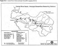
- This MPWMD map has gages named and marked:
- This CCoWS map has gages marked on it: http://ccows.csumb.edu/pubs/maps/crwa/Poster/Carmel_Map1-2_36x44.pdf
- How to edit tables in MediaWiki
- Carmel Watershed
- Clickable map of USGS Surface Water Gages: http://waterdata.usgs.gov/nwis/rt
- Coordinates on USGS web sites are probably not as accurate as coordinates you can get from Google Earth.
- To get coordinates from Google Earth, find the gage, and create a Placemark. The coordinates will be displayed. To get them in a different projection, go to Tools --> Options
- Gages in Monterey are consolidated on this website: http://waterdata.usgs.gov/ca/nwis/current?huc_cd=18060004&huc_cd=18060005&huc_cd=18060006&huc_cd=18060011&huc_cd=18060012&index_pmcode_STATION_NM=1&index_pmcode_DATETIME=2&index_pmcode_00065=3&index_pmcode_00060=4&index_pmcode_MEAN=&index_pmcode_MEDIAN=&index_pmc [1]
- Calculator for converting Lat/Lon coordinates to UTM WGS84 Easting and Northing coordinates: http://www.uwgb.edu/dutchs/UsefulData/HowUseExcel.HTM
- On the web page click the "Spreadsheet For UTM Conversions" link.
- Go tho the "Main Page" tab and enter your information.
- It would be great if someone could check its accuracy.
