Difference between revisions of "Maps of the Carmel River Watershed"
From CCoWS Wiki
| Line 3: | Line 3: | ||
{| | {| | ||
|- | |- | ||
| − | | Elevation [[Media:Carmel_BaseMap_+Elev.pdf|PDF]] | + | | Elevation [[Media:Carmel_BaseMap_+Elev.pdf|PDF]], [[Media:Carmel_BaseMap_+Elev_400w.png|PNG]] |
[[Image:Carmel_BaseMap_+Elev_400w.png|100px]] | [[Image:Carmel_BaseMap_+Elev_400w.png|100px]] | ||
| Slope [[Media:Carmel_Slope.pdf|PDF]] | | Slope [[Media:Carmel_Slope.pdf|PDF]] | ||
Revision as of 23:04, 5 February 2009
Table of thumbnails
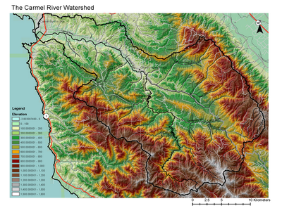
Elevation PDF, PNG
|
Slope PDF | Fires of 2008 PDF
|
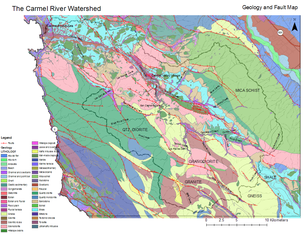
Geology PDF, PNG, META
|
Precipitation PDF
|
Soil type PDF
|
Soil erosion index PDF
|
Land cover PDF
|
Land use and ownership PDF
|


- Terrain
- Elevation
- Slope
- Land use / land cover:
- Geology
- Lithology and Faults
- Meta Data
- Lithology and Faults
- Soils
- Soil type:
- Carmel_River_Watershed_Soils Meta Data
- Soil erosion index
- Soil type:
- Fires
- 2008 Basin Complex Fire:
- Carmel River Watershed Burn Severity Meta Data
- Historical fires
- 2008 Basin Complex Fire:
- Climate
- Mean annual precipitation:
- Carmel_River_Watershed_Precipitation Meta Data
- Mean temperature of coldest month
- Mean temperature of warmest month
- Mean annual precipitation:
- Land use and ownership
- Points of interest