Difference between revisions of "Carmel River Watershed: Map of Land Use and Ownership"
From CCoWS Wiki
| Line 1: | Line 1: | ||
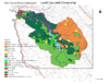
| + | Land use and ownership [[Media:Carmel_LandUse_Map.pdf|PDF]] | ||
| + | [[Image:Carmel_LandUse_Map.png|100px]] | ||
| + | |||
Projected Coordinate System: NAD_1983_UTM_Zone_10N | Projected Coordinate System: NAD_1983_UTM_Zone_10N | ||
Projection: Transverse_Mercator | Projection: Transverse_Mercator | ||
Revision as of 23:24, 5 February 2009
Land use and ownership PDF

Projected Coordinate System: NAD_1983_UTM_Zone_10N Projection: Transverse_Mercator
Geographic Coordinate System: GCS_North_American_1983 Datum: D_North_American_1983 Prime Meridian: Greenwich