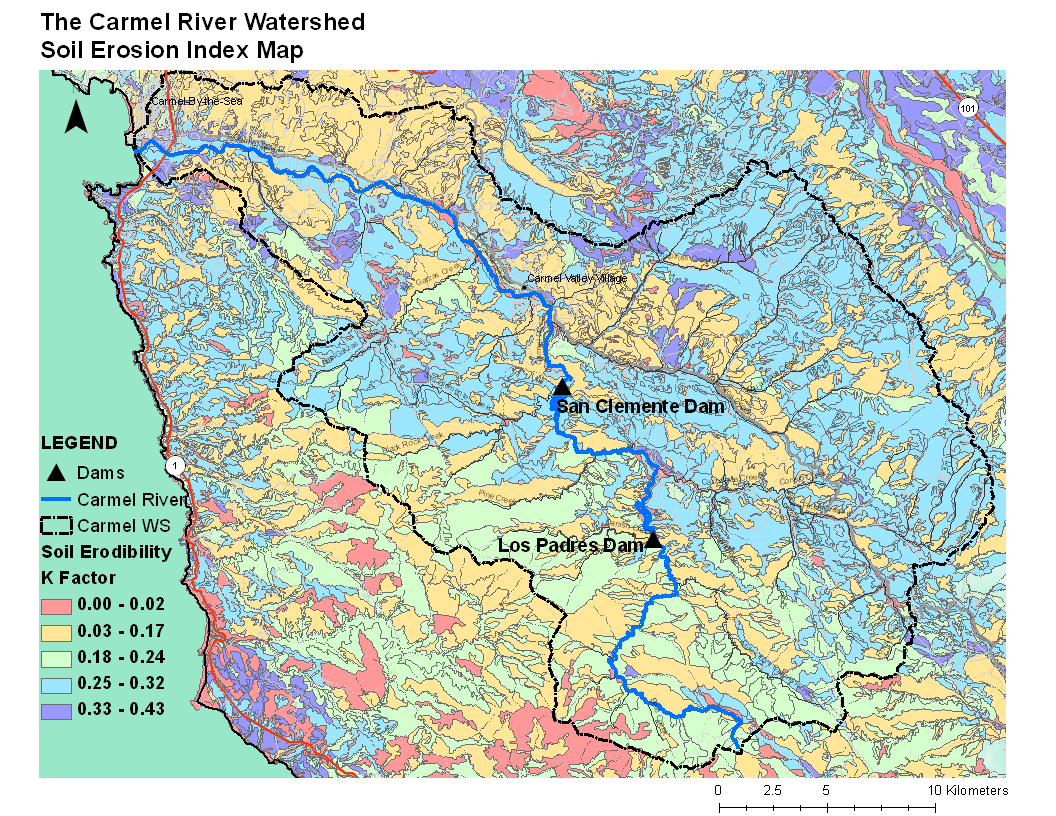
Carmel River Watershed: Map of Soil Erosion Index
From CCoWS Wiki

Metadata
- Original source of data: SSURGO - http://soils.usda.gov/survey/geography/ssurgo/
- Map produced by: Steve Quan
- Projected Coordinate System: NAD_1983_UTM_Zone_10N
- Projection: Transverse_Mercator
- Geographic Coordinate System: GCS_North_American_1983
- Datum: D_North_American_1983
- Prime Meridian: Greenwich
Processing Steps
- Obtain soil data from SSURGO website
- Classify K-factor ( soil erodibility factor )
- Clip soil data to Carmel watershed boundary ( optional )