Search results
From CCoWS Wiki
Create the page "Image" on this wiki!
Page title matches
File:Image-PICT0108.JPG (1,920 × 2,560 (1.66 MB)) - 10:22, 4 February 2010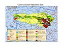
File:Image-CarnerosSoil.jpg (1,056 × 816 (715 KB)) - 00:26, 10 February 2011
File:Image-Lower Salinas River Watershed.pdf (4.39 MB) - 14:30, 12 April 2011


Page text matches

File:Soil type3.png Larger Picture of Soil Types: [[Image:Carmel Soils.pdf]](44 × 34 (2 KB)) - 08:37, 3 February 2009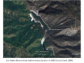
File:Los Padres 2009.png This image was obtained from Google Earth and is reproduced here on a non-commercial b(960 × 720 (1.37 MB)) - 17:27, 3 February 2010File:TripleMMap Laurel.PDF Location of Triple M Ranch, image courtesy of Laurel Marcus & Associates. Also available from: http://elkhorn(320 KB) - 23:43, 2 February 2011File:TripleMMap Laurel.pdf Location of Triple M Ranch, image courtesy of Laurel Marcus & Associates. Also available from: http://elkhorn(320 KB) - 23:49, 2 February 2011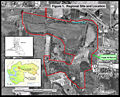
File:TripleMMap Laurel.jpg Image courtesy of Laurel Marcus & Associates, Triple M Ranch Land Management Plan(2,559 × 2,064 (806 KB)) - 15:11, 10 February 2011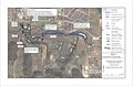
File:Restoration map.jpg Image courtesy of Largay Hydrologic Sciences, LLC.(2,548 × 1,648 (342 KB)) - 15:07, 10 February 2011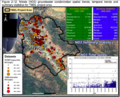
File:Nitrate Map 2012TMDLDraftReport.png Public agency, public domain image(973 × 787 (1.02 MB)) - 00:46, 29 March 2012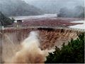
File:Sanclementedam 2 NOAA.jpg ...lemente Dam being overtopped by highly sedimented water during rain storm. Image: NOAA(1,502 × 1,127 (266 KB)) - 23:48, 27 March 2013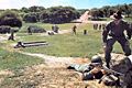
File:Fort Ord BCT.jpg Image from: ''The Fort Ord I Remember'' website (lockwood-m.tripod.com)(450 × 300 (33 KB)) - 22:51, 1 April 2013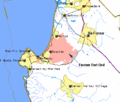
File:Fort Ord Map.gif Image from: http://lockwood-m.tripod.com(422 × 359 (11 KB)) - 23:54, 1 April 2013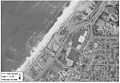
File:Aerial2.jpg Image 1. Aerial photo of site location.(584 × 402 (108 KB)) - 23:16, 3 April 2013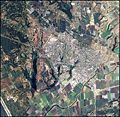
File:Watsonville CA.jpg Aerial Image of Watsonville, CA(476 × 464 (105 KB)) - 10:15, 4 April 2013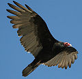
File:TurkeyVulture.jpg Image from: http://www.calliebowdish.com/TurkeyVulture.htm(960 × 925 (210 KB)) - 12:39, 4 April 2013
File:SalinasWaterServiceBoundaries.jpg ...s water service providers California Water Service and Alco Water Service. Image source: [http://www.ci.salinas.ca.us/services/commdev/generalplan/GeneralPl(696 × 957 (367 KB)) - 12:36, 14 April 2016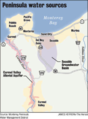
File:SeasideBasin.png Image originally from Monterey Peninsula Water Management District.(625 × 848 (418 KB)) - 13:23, 7 April 2014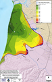
File:180ft-intrusion.png Image from State of the Salinas River Groundwater Basin Report (Jan. 2015)(990 × 1,547 (1.14 MB)) - 15:35, 29 March 2016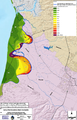
File:400ft-intrusion.png Image from State of the Salinas River Groundwater Basin Report (Jan. 2015)(989 × 1,547 (1.18 MB)) - 15:35, 29 March 2016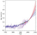
File:IPCC Sea Level 2013.jpg ...obal mean sea level rise scenarios, all relative to pre-industrial levels. Image sourced from IPCC Climate Change 2013<ref>http://www.ipcc.ch/pdf/assessment(1,051 × 994 (255 KB)) - 20:39, 3 April 2016
File:BSLT CarmelRiverFREE.JPG Image sourced from the [http://www.bigsurlandtrust.org/blog/carmel-river-free-37.(700 × 251 (56 KB)) - 13:30, 5 April 2016File:BSLT CarmelRiverFREE.PDF Image sourced from [http://www.bigsurlandtrust.org/blog/carmel-river-free-37.htm(280 KB) - 13:27, 5 April 2016


