Difference between revisions of "Carmel River Watershed: 2016 Soberanes Fire Burn Severity"
From CCoWS Wiki
(Created page with "thumb *PDF file - for printing * PNG file == Metadata == ...") |
|||
| Line 1: | Line 1: | ||
[[Image:soberanes_burn_severity2016.png|200px|thumb]] | [[Image:soberanes_burn_severity2016.png|200px|thumb]] | ||
| − | *[[Media: | + | *[[Media:soberanes_burn_severity2016.pdf|PDF file - for printing]] |
* [[Media:soberanes_burn_severity2016.png|PNG file]] | * [[Media:soberanes_burn_severity2016.png|PNG file]] | ||
Latest revision as of 12:52, 30 March 2017

Contents
Metadata
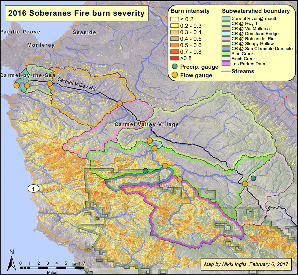
- Map produced by: Nikki Inglis
- Burn severity projected Coordinate System: WGS_1984_UTM_Zone_10N
- Datum: WGS_1984
Processing Steps
- Burn severity was calculated by taking the delta Normalized Burn Ratio (dNBR), or difference in burn severity, between June 20, 2016 and Oct. 27, 2017 using Landsat Imagery. Methodology based on Key and Benson (2006) [1].
Links
References
- ↑ Key, CH, Benson, NC. 2006. Landscape Assessment (LA). Fire effects monitoring and inventory system. Gen. Tech. Rep. RMRS-GTR-164-CD. Fort Collins, CO: U.S. Department of Agriculture, Forest Service, Rocky Mountain Research Station. LA-1-55.