Difference between revisions of "Carmel River Watershed: Map of 2008 Burn Severity"
From CCoWS Wiki
| (5 intermediate revisions by 2 users not shown) | |||
| Line 1: | Line 1: | ||
| − | + | [[Image:2008_Burn_Severity.png|200px|thumb]] | |
| + | * [[Media:2008_Burn_Severity.pdf|PDF file - for printing]] | ||
| + | * [[Media:2008_Burn_Severity.png|PNG file]] | ||
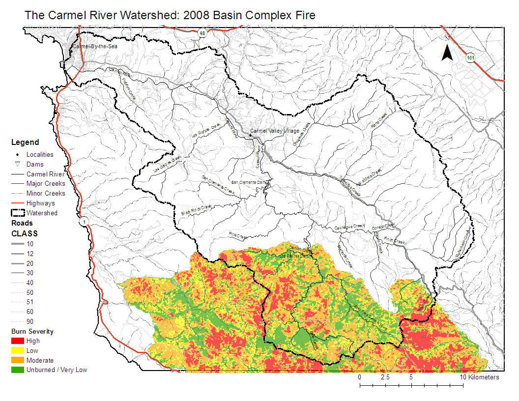
| − | + | == Metadata == | |
| − | Projected Coordinate System: NAD_1983_UTM_Zone_10N | + | * Original source of data: Burned Area Emergency Response (BAER) remote imaging: [http://www.fs.fed.us/eng/rsac/baer/] |
| − | Projection: Transverse_Mercator | + | * Data anlysis: ArcMap |
| + | * Map produced by: Erin Stanfield | ||
| + | * Projected Coordinate System: NAD_1983_UTM_Zone_10N | ||
| + | ** Projection: Transverse_Mercator | ||
| + | * Geographic Coordinate System: GCS_North_American_1983 | ||
| + | ** Datum: D_North_American_1983 | ||
| + | ** Prime Meridian: Greenwich | ||
| − | + | == Processing Steps == | |
| − | + | ||
| − | + | ||
| + | # Add Basin_Complex_Soils_Burn_Severity.shp to Carmel River Watershed base map | ||
| + | # Select symbology of burn severity (low, medium, high and unburned) with appropriate colors | ||
| + | # Assemble layout with base map settings with emphasis on legibility, efficiency and aesthetics | ||
| − | + | == Links == | |
| + | |||
| + | * [[Maps of the Carmel River Watershed]] | ||
Latest revision as of 09:19, 6 February 2009

Metadata
- Original source of data: Burned Area Emergency Response (BAER) remote imaging: [1]
- Data anlysis: ArcMap
- Map produced by: Erin Stanfield
- Projected Coordinate System: NAD_1983_UTM_Zone_10N
- Projection: Transverse_Mercator
- Geographic Coordinate System: GCS_North_American_1983
- Datum: D_North_American_1983
- Prime Meridian: Greenwich
Processing Steps
- Add Basin_Complex_Soils_Burn_Severity.shp to Carmel River Watershed base map
- Select symbology of burn severity (low, medium, high and unburned) with appropriate colors
- Assemble layout with base map settings with emphasis on legibility, efficiency and aesthetics