Difference between revisions of "Carmel River Watershed: Map of Geology"
From CCoWS Wiki
| (5 intermediate revisions by 2 users not shown) | |||
| Line 1: | Line 1: | ||
| − | + | [[Image:Geol.Fault.Map.png|200px|thumb]] | |
| − | + | * [[Media:Geo.Fault.Map.pdf|PDF file - for printing]] | |
| + | * [[Media:Geol.Fault.Map.png|PNG file]] | ||
| − | + | == Metadata == | |
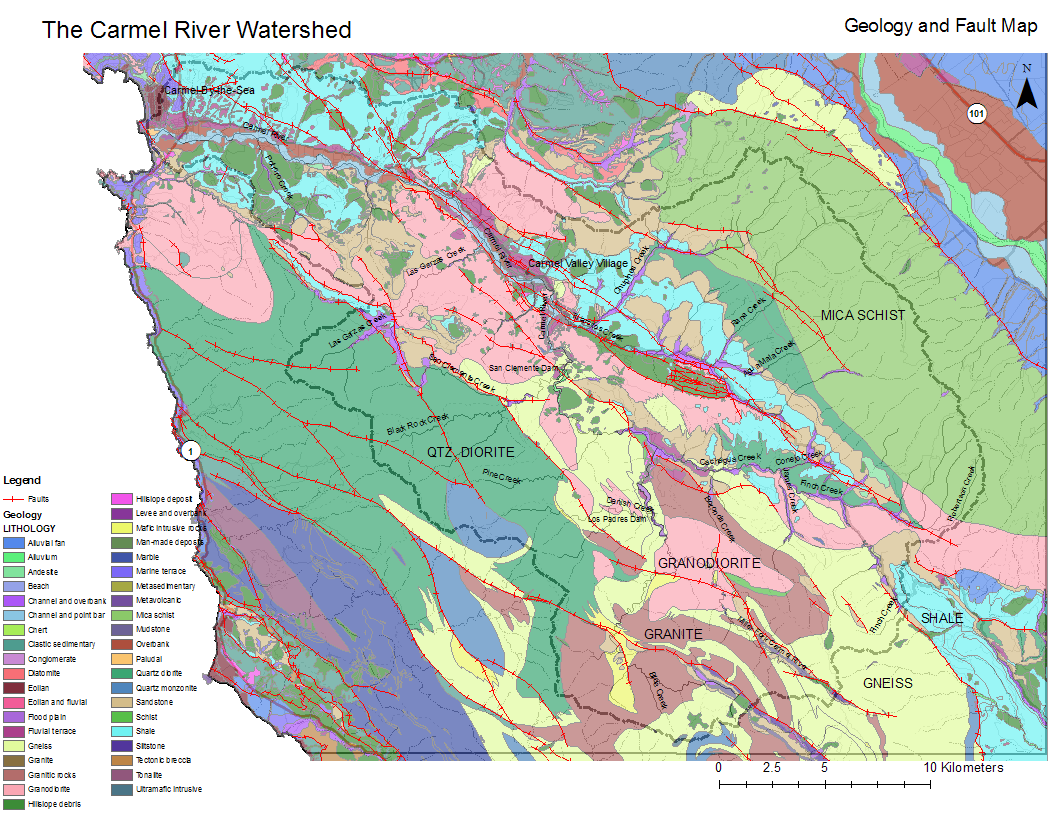
| − | Geographic Coordinate System: GCS_North_American_1983 Datum: D_North_American_1983 Prime Meridian: Greenwich | + | * Original source of data: Monterey County - Rosenberg |
| + | * Data anlysis: USGS data collated and processed by Wendi Newman and [[Fred Watson]] at CSUMB | ||
| + | * Map produced by: Randy Holloway and [[Fred Watson]] | ||
| + | * Projected Coordinate System: NAD_1983_UTM_Zone_10N | ||
| + | ** Projection: Transverse_Mercator | ||
| + | * Geographic Coordinate System: GCS_North_American_1983 | ||
| + | ** Datum: D_North_American_1983 | ||
| + | ** Prime Meridian: Greenwich | ||
| + | == Processing Steps == | ||
| − | + | # Retreived geology and fault data | |
| + | # Clipped to basemap size | ||
| + | # Picked symbology colors | ||
| + | # Changed symbol type for faults | ||
| + | # Overlaid layers | ||
| + | # Added titles and legend formatting | ||
| − | + | == Links == | |
| + | |||
| + | * [[Maps of the Carmel River Watershed]] | ||
Latest revision as of 08:32, 6 February 2011

Metadata
- Original source of data: Monterey County - Rosenberg
- Data anlysis: USGS data collated and processed by Wendi Newman and Fred Watson at CSUMB
- Map produced by: Randy Holloway and Fred Watson
- Projected Coordinate System: NAD_1983_UTM_Zone_10N
- Projection: Transverse_Mercator
- Geographic Coordinate System: GCS_North_American_1983
- Datum: D_North_American_1983
- Prime Meridian: Greenwich
Processing Steps
- Retreived geology and fault data
- Clipped to basemap size
- Picked symbology colors
- Changed symbol type for faults
- Overlaid layers
- Added titles and legend formatting