Difference between revisions of "Carmel River Watershed: Map of Land Use and Ownership"
From CCoWS Wiki
| (6 intermediate revisions by one user not shown) | |||
| Line 1: | Line 1: | ||
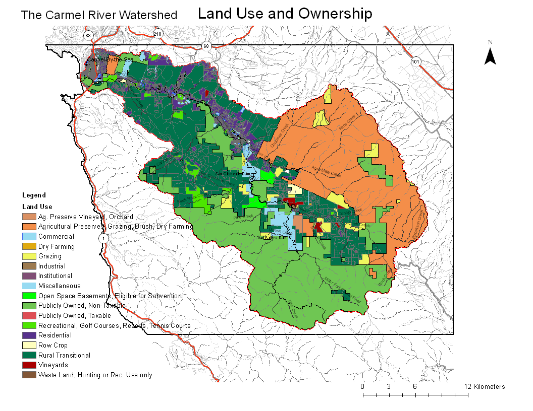
| − | + | [[Image:Carmel_LandUse_Map.png|200px|thumb]] | |
| − | + | ||
| − | + | * [[Media:Carmel_LandUse_Map.pdf|PDF file - for printing]] | |
| − | + | * [[Media:Carmel_LandUse_Map.png|PNG file]] | |
| − | + | == Metadata == | |
| − | + | ||
| − | + | * Original source of data: [http://www.co.monterey.ca.us/assessor/ Monterey County Assessor's Office] (obtained Feb 2009) | |
| + | * Map produced by: Bart Kowalski | ||
| + | |||
| + | == Processing Steps == | ||
| + | |||
| + | # ... | ||
| + | |||
| + | == Links == | ||
| + | |||
| + | * [[Maps of the Carmel River Watershed]] | ||
Latest revision as of 19:12, 6 February 2011

Metadata
- Original source of data: Monterey County Assessor's Office (obtained Feb 2009)
- Map produced by: Bart Kowalski
Processing Steps
- ...