Difference between revisions of "Carmel River Watershed: Map of Precipitation 2"
From CCoWS Wiki
| Line 10: | Line 10: | ||
* Coordinate system: UTM Zone 10 | * Coordinate system: UTM Zone 10 | ||
* Datum: NAD 83 | * Datum: NAD 83 | ||
| + | * Data obtained from '''[http://http://www.prism.oregonstate.edu/products/matrix.phtml?vartype=ppt&view=maps OSU Prism Products]''' | ||
== Links == | == Links == | ||
* [[Maps of the Carmel River Watershed]] | * [[Maps of the Carmel River Watershed]] | ||
Revision as of 15:16, 11 February 2010

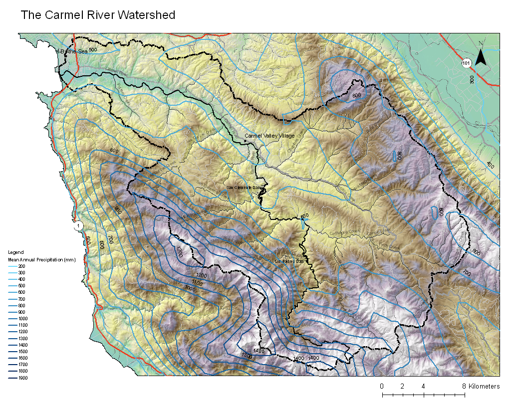
Metadata
- Original source of data: USGS
- Data anlysis: USGS data collated and processed by Wendi Newman and Fred Watson at CSUMB
- Map produced by: Ty Brandt
- Coordinate system: UTM Zone 10
- Datum: NAD 83
- Data obtained from OSU Prism Products