Difference between revisions of "Carmel River Watershed: Map of Precipitation 2"
From CCoWS Wiki
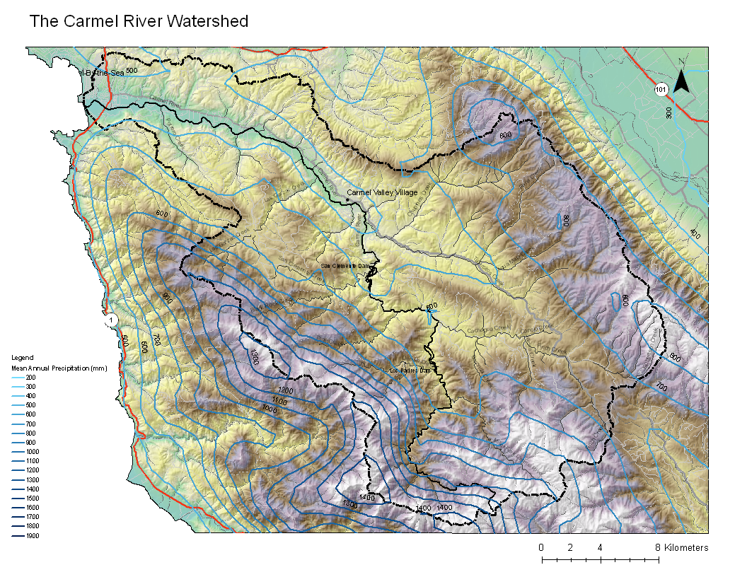
(New page: thumb * PDF file - for printing * PNG file == Metadata == * Original source ...) |
|||
| (4 intermediate revisions by one user not shown) | |||
| Line 1: | Line 1: | ||
[[Image:Carmel_Precip_Final2.png|200px|thumb]] | [[Image:Carmel_Precip_Final2.png|200px|thumb]] | ||
* [[Media:Carmel_Precip_Final2.pdf|PDF file - for printing]] | * [[Media:Carmel_Precip_Final2.pdf|PDF file - for printing]] | ||
| − | * [[Media: | + | * [[Media:Carmel_Precip_Final2.png|PNG file]] |
== Metadata == | == Metadata == | ||
| Line 10: | Line 10: | ||
* Coordinate system: UTM Zone 10 | * Coordinate system: UTM Zone 10 | ||
* Datum: NAD 83 | * Datum: NAD 83 | ||
| + | * Data obtained from '''[http://prism.oregonstate.edu/products/matrix.phtml OSU Prism Products]''' | ||
| + | |||
| + | == Alternate versions == | ||
| + | |||
| + | * A version with precipitation mapped as a solid color is here: [[Carmel River Watershed: Map of Precipitation]] | ||
== Links == | == Links == | ||
* [[Maps of the Carmel River Watershed]] | * [[Maps of the Carmel River Watershed]] | ||
Latest revision as of 08:36, 6 February 2011

Metadata
- Original source of data: USGS
- Data anlysis: USGS data collated and processed by Wendi Newman and Fred Watson at CSUMB
- Map produced by: Ty Brandt
- Coordinate system: UTM Zone 10
- Datum: NAD 83
- Data obtained from OSU Prism Products
Alternate versions
- A version with precipitation mapped as a solid color is here: Carmel River Watershed: Map of Precipitation