Difference between revisions of "Carmel River Watershed: Map of Slope"
From CCoWS Wiki
| Line 15: | Line 15: | ||
# Open the Tools -> Surface -> Slope | # Open the Tools -> Surface -> Slope | ||
# Select the DEM you want to calculate slope from | # Select the DEM you want to calculate slope from | ||
| − | # Modify colors and | + | # Modify colors and category breaks as needed |
| + | |||
| + | == Alternate versions == | ||
| + | |||
| + | * An alternate version that is clipped to the watershed boundary is: [[Carmel River Watershed: Map of Slope 2]] | ||
== Links == | == Links == | ||
* [[Maps of the Carmel River Watershed]] | * [[Maps of the Carmel River Watershed]] | ||
Revision as of 08:17, 6 February 2011

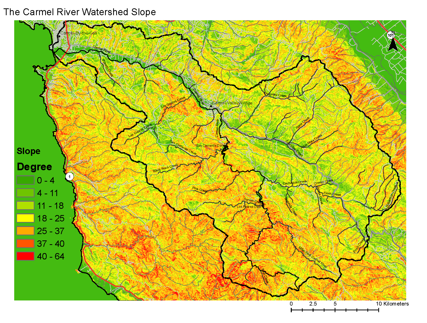
Metadata
- Original source of data: See Carmel River Watershed: Map of Elevation
- Data anlysis: ArcMap
- Map produced by:
- Coordinate system: UTM Zone 10
- Datum: NAD 83
Processing Steps
- Open the Tools -> Surface -> Slope
- Select the DEM you want to calculate slope from
- Modify colors and category breaks as needed
Alternate versions
- An alternate version that is clipped to the watershed boundary is: Carmel River Watershed: Map of Slope 2