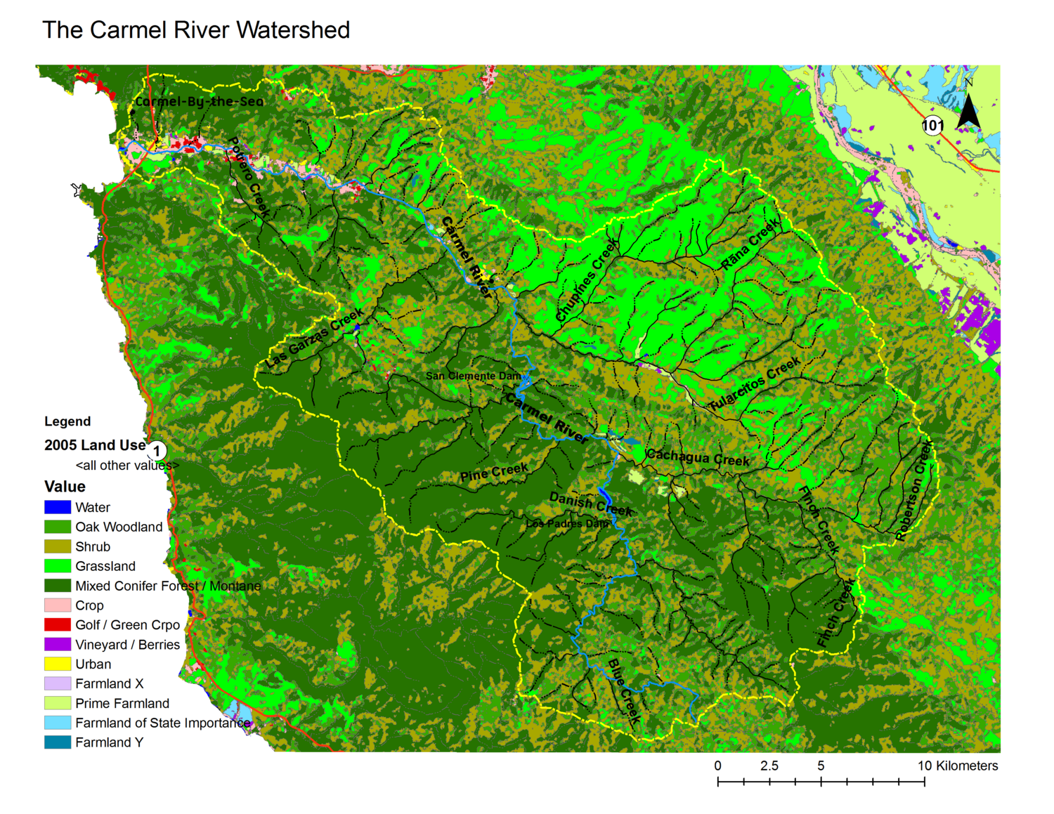
Carmel River Watershed Land use/ land cover
From CCoWS Wiki
Original Meta data retrieved developed by CCoWS [1].
Projected Coordinate System: NAD_1983_UTM_Zone_10N Projection: Transverse_Mercator
Geographic Coordinate System: GCS_North_American_1983 Datum: D_North_American_1983
To see all the maps created for this project visit Maps of the Carmel River Watershed[2]
