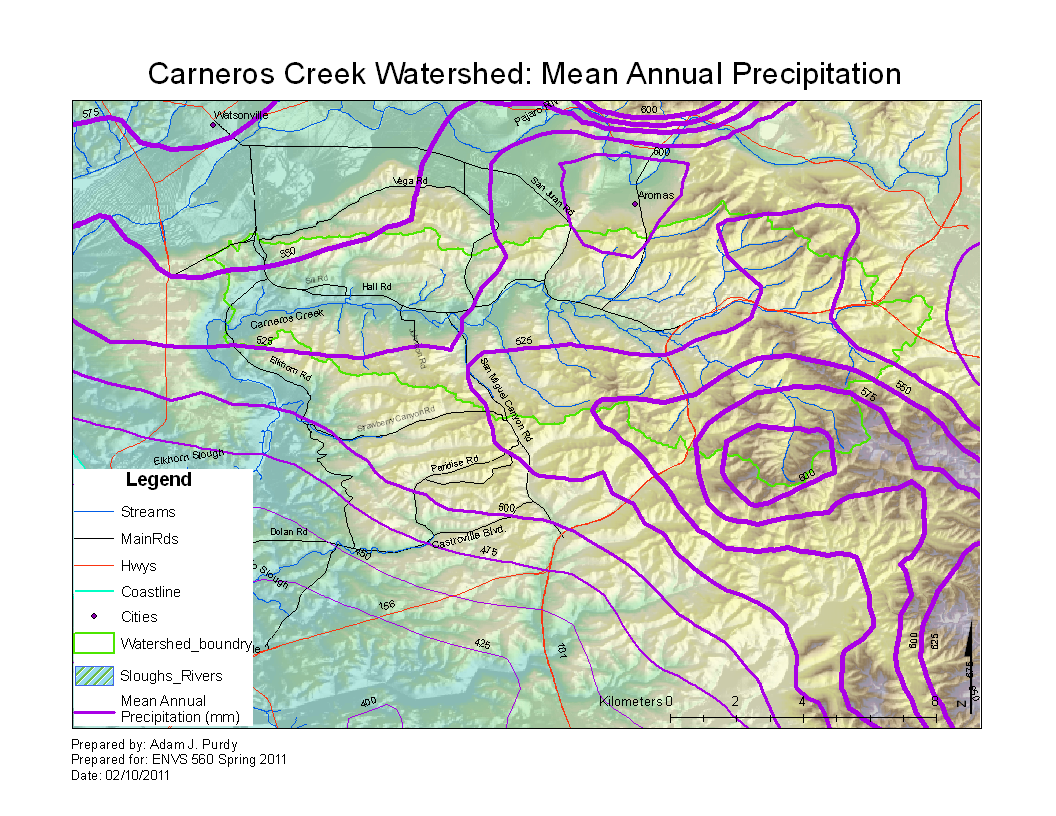
Carneros Watershed: Precipitation 2
From CCoWS Wiki

Metadata
- Original source of data: See PRISM
- Data anlysis: ArcMap
- Map produced by: Adam J. Purdy
- Coordinate system: UTM Zone 10
- Datum: NAD 83
Processing Steps
- Convert ASCII grid file to Raster using Conversion Tools
- Define Projection
- Crop Raster to Central California Coast using Spatial Analyst Tool
- Create contour lines from the raster image using the Spacial Analyst Tool
- Symbolize contour lines by width and choose to label
- Select appropriate color scheme
- Add DEM and hillshade layers for aesthetics
Links
- Maps of the Carneros Watershed
- Alternative Version Carneros Watershed: Precipitation 1