File:CanyondelReySlopeMap.JPG
From CCoWS Wiki
No higher resolution available.
CanyondelReySlopeMap.JPG (707 × 545 pixels, file size: 95 KB, MIME type: image/jpeg)
File history
Click on a date/time to view the file as it appeared at that time.
| Date/Time | Thumbnail | Dimensions | User | Comment | |
|---|---|---|---|---|---|
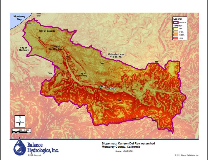
| current | 00:23, 5 April 2020 | | 707 × 545 (95 KB) | RyanB (Talk | contribs) | A slope map of the Canyon del Rey Watershed created by Balance Hydrologics Inc and included in the 2014 Canyon del Rey Master Drainage Plan prepared for the Monterey Peninsula Water Management District. |
| 00:19, 5 April 2020 |  | 707 × 545 (95 KB) | RyanB (Talk | contribs) |
- You cannot overwrite this file.
File usage
There are no pages that link to this file.