File:Carmel LandUse Map.png
From CCoWS Wiki
Size of this preview: 776 × 600 pixels.
Original file (1,056 × 816 pixels, file size: 146 KB, MIME type: image/png)
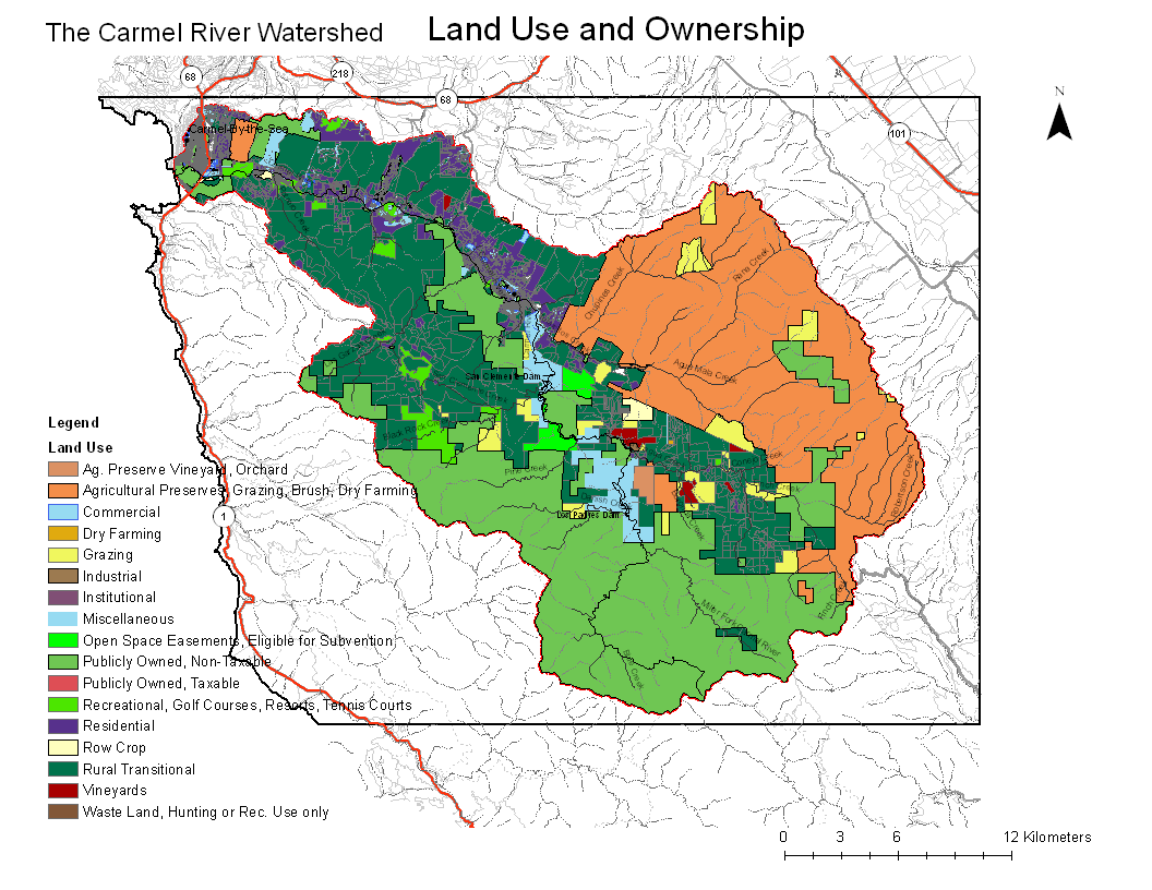
For meta data and alternate versions, see: Carmel River Watershed: Map of Land Use and Ownership
File history
Click on a date/time to view the file as it appeared at that time.
| Date/Time | Thumbnail | Dimensions | User | Comment | |
|---|---|---|---|---|---|
| current | 22:43, 5 February 2009 | | 1,056 × 816 (146 KB) | Bartk (Talk | contribs) |
- You cannot overwrite this file.
File usage
The following 2 pages link to this file: