Difference between revisions of "File:MPWMD and Aquifer Boundary.jpg"
From CCoWS Wiki
(Monterey Bay Water District and aquifer boundaries.) |
|||
| Line 1: | Line 1: | ||
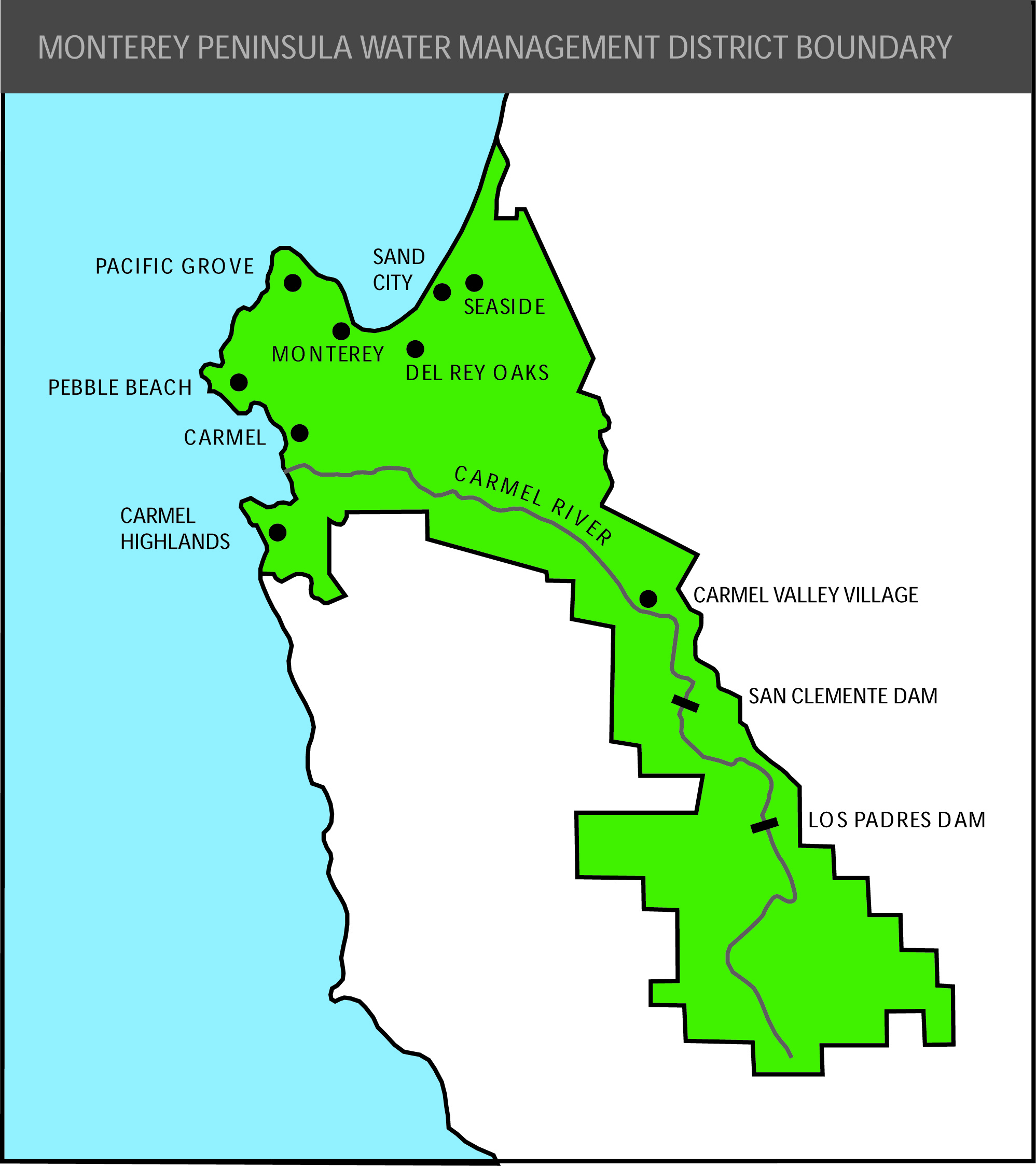
| − | Monterey Bay Water District and aquifer boundaries. | + | Monterey Bay Water District and aquifer boundaries. Image sources: [http://www.mpwmd.net/maps/mpwmd/bndyws_c_web.jpg MPWMD Website] and [http://www.groundwatervoices.com/wp-content/uploads/2014/08/Central-Coast-Groundwater-Report-Aug-2014.pdf Central Coast Groundwater Report] |
Revision as of 12:07, 14 April 2016
Monterey Bay Water District and aquifer boundaries. Image sources: MPWMD Website and Central Coast Groundwater Report
File history
Click on a date/time to view the file as it appeared at that time.
| Date/Time | Thumbnail | Dimensions | User | Comment | |
|---|---|---|---|---|---|
| current | 12:06, 14 April 2016 | 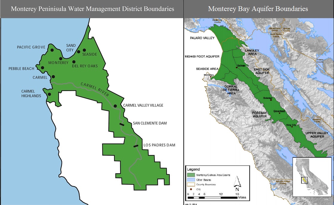 | 1,118 × 689 (213 KB) | Gabem (Talk | contribs) | Monterey Bay Water District and aquifer boundaries. |
- You cannot overwrite this file.
File usage
The following page links to this file: