File:PublicLandCenCal.gif
From CCoWS Wiki
No higher resolution available.
PublicLandCenCal.gif (563 × 493 pixels, file size: 16 KB, MIME type: image/gif)
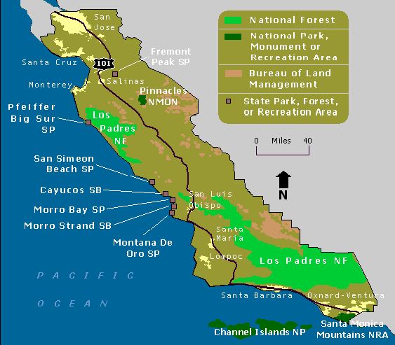
Map of public lands in Central CA
File history
Click on a date/time to view the file as it appeared at that time.
| Date/Time | Thumbnail | Dimensions | User | Comment | |
|---|---|---|---|---|---|
| current | 21:25, 3 April 2017 | | 563 × 493 (16 KB) | Lizzye (Talk | contribs) | Map of public lands in Central CA |
- You cannot overwrite this file.
File usage
There are no pages that link to this file.