File:Region map.jpg
From CCoWS Wiki

Size of this preview: 450 × 600 pixels.
Original file (480 × 640 pixels, file size: 54 KB, MIME type: image/jpeg)
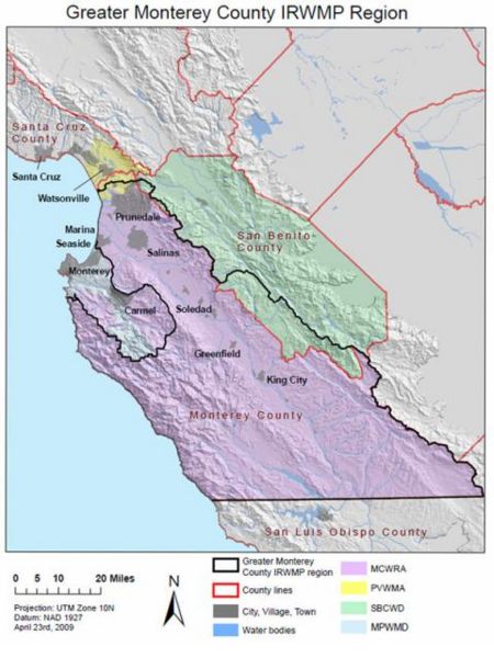
Integrated Regional Water Management Plan (IRWMP) for the Greater Monterey County. Provided by the Central Coast Wetlands Group[1]
Cite error: <ref> tags exist, but no <references/> tag was found
File history
Click on a date/time to view the file as it appeared at that time.
| Date/Time | Thumbnail | Dimensions | User | Comment | |
|---|---|---|---|---|---|
| current | 21:47, 28 March 2012 | | 480 × 640 (54 KB) | Shanek (Talk | contribs) | alt text Integrated Regional Water Management Plan (IRWMP) for the Greater Monterey County. Provided by the Central Coast Wetlands Group<ref>http://www.google.com/imgres?um=1&hl=en&safe=off&client=firefox-a&sa=N&rls=org |
| 21:45, 28 March 2012 |  | 480 × 640 (54 KB) | Shanek (Talk | contribs) | Integrated Regional Water Management Plan (IRWMP) for the Greater Monterey County. Provided by the Central Coast Wetlands Group<ref>http://www.google.com/imgres?um=1&hl=en&safe=off&client=firefox-a&sa=N&rls=org.mozilla:en-US:official&authuser=0&biw=984&bi |
- You cannot overwrite this file.
File usage
The following page links to this file: