File:SCProgramBoundary.JPG
From CCoWS Wiki
Size of this preview: 794 × 599 pixels. Other resolution: 795 × 600 pixels.
Original file (844 × 637 pixels, file size: 88 KB, MIME type: image/jpeg)
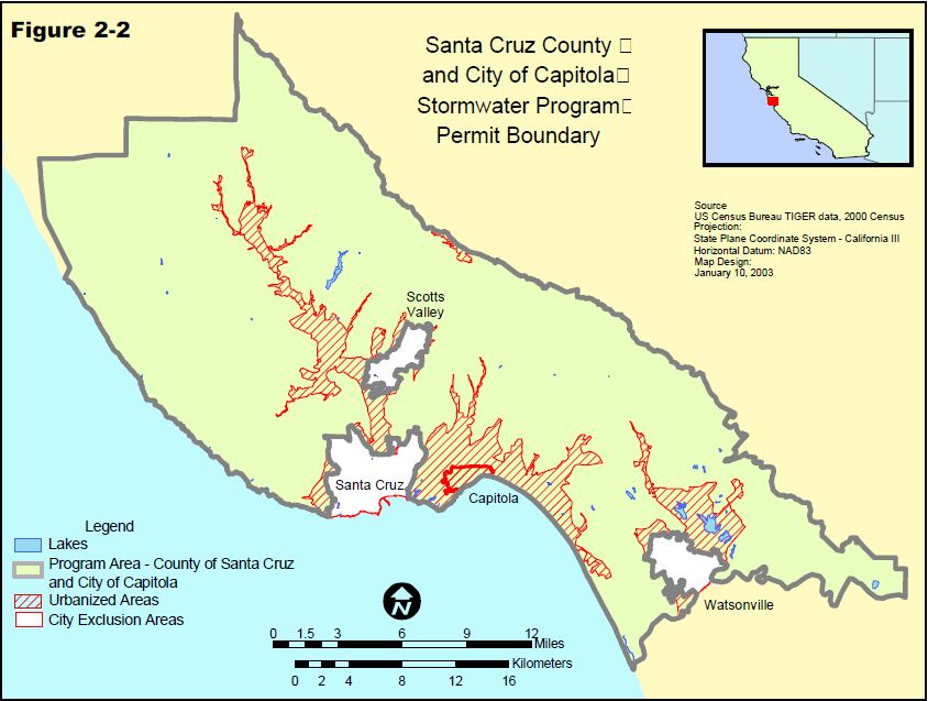
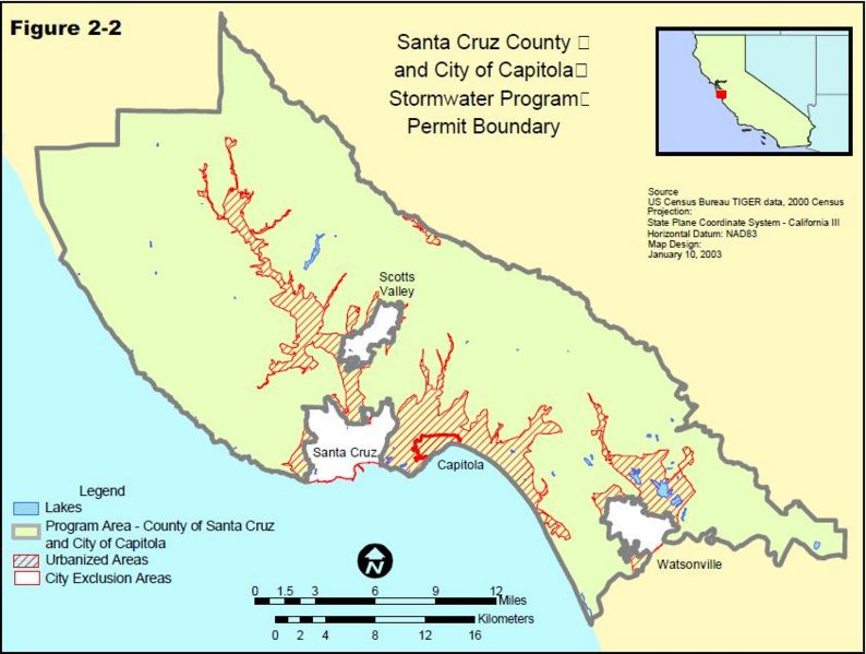
Santa Cruz County Storm Water Program Boundary Map
File history
Click on a date/time to view the file as it appeared at that time.
| Date/Time | Thumbnail | Dimensions | User | Comment | |
|---|---|---|---|---|---|
| current | 22:45, 28 March 2013 | | 844 × 637 (88 KB) | Ambers (Talk | contribs) | Santa Cruz County Storm Water Program Boundary Map |
- You cannot overwrite this file.
File usage
The following file is a duplicate of this file (more details):
There are no pages that link to this file.