Difference between revisions of "File:Soberanes burn severity2016.png"
From CCoWS Wiki
(Difference in normalized burn ratio before and after the Soberanes Fire. Measurements were taken on June 20, 2016 and Oct. 27, 2017 using Landsat imagery.. Projection: WGS 1984 UTM Zone 10N) |
|||
| Line 1: | Line 1: | ||
| − | Difference in normalized burn ratio before and after the Soberanes Fire. Measurements were taken on June 20, 2016 and Oct. 27, 2017 using Landsat imagery. | + | Difference in normalized burn ratio before and after the Soberanes Fire. Measurements were taken on June 20, 2016 and Oct. 27, 2017 using Landsat imagery. |
| + | |||
| + | Projection: WGS 1984 UTM Zone 10N | ||
Revision as of 17:56, 28 March 2017
Difference in normalized burn ratio before and after the Soberanes Fire. Measurements were taken on June 20, 2016 and Oct. 27, 2017 using Landsat imagery.
Projection: WGS 1984 UTM Zone 10N
File history
Click on a date/time to view the file as it appeared at that time.
| Date/Time | Thumbnail | Dimensions | User | Comment | |
|---|---|---|---|---|---|
| current | 17:52, 28 March 2017 | 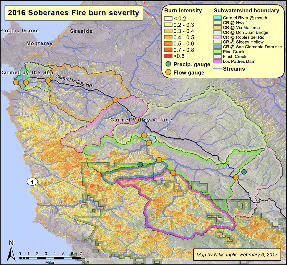 | 975 × 900 (1.67 MB) | Nikkii (Talk | contribs) | Difference in normalized burn ratio before and after the Soberanes Fire. Measurements were taken on June 20, 2016 and Oct. 27, 2017 using Landsat imagery.. Projection: WGS 1984 UTM Zone 10N |
- You cannot overwrite this file.
File usage
The following 2 pages link to this file: