Map of California Condor Release Sites
From CCoWS Wiki

Contents
Description
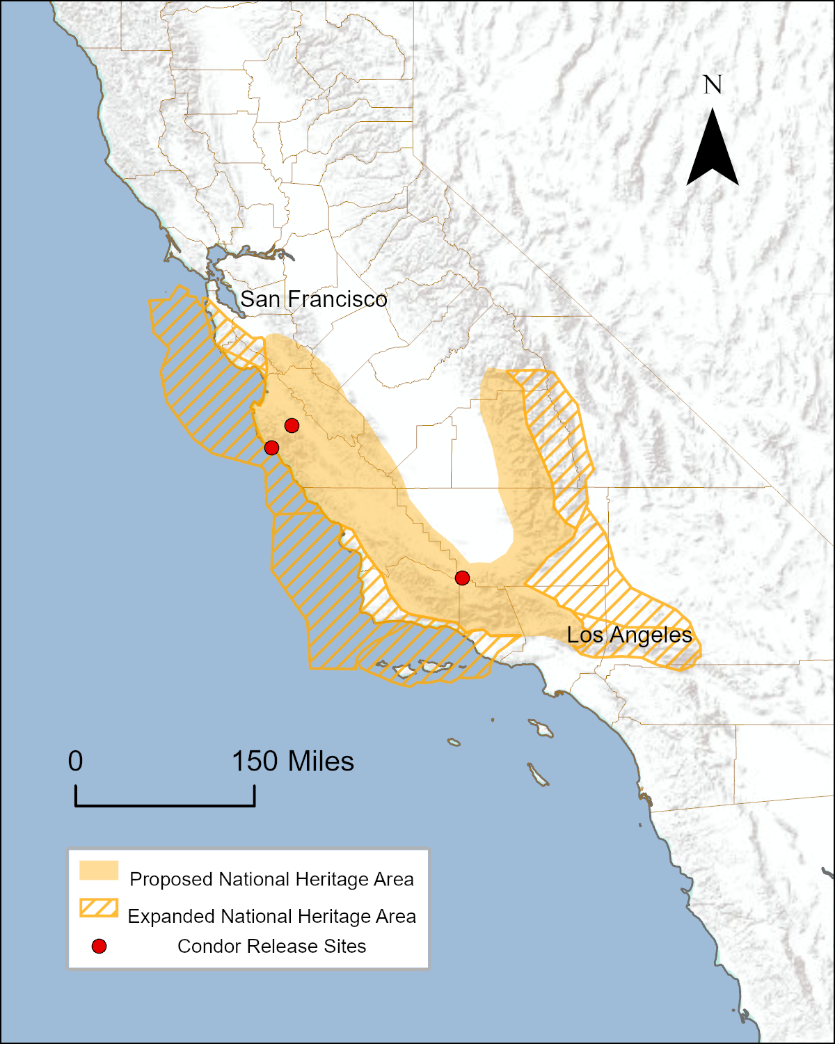
This map shows the approximate range of the California Condor within the state of California. Condor release sites are symbolized in red. The sites from north to south are at Pinnacles National Park, Ventana Wilderness, and Bitter Creek National Wildlife Refuge. All of Monterey County is within the approximate range of the California Condor and would be included in the Range of the Condor National Heritage Area.
Metadata
- Map produced by: Aubrie Heckel
- Map produced using: ArcMap
- Approximate range digitized using USFWS imagery
Links
- California Condor
- Range of the Condor National Heritage Area
- Conservancy for the Range of the Condor
- The Condor Trail
- Lands that could potentially be designated for inclusion in the Range of the Condor National Heritage Area
- Maps of the proposed Range of the Condor National Heritage Area
- Organizations that are potential partners in the Range of the Condor National Heritage Area
- How to Post a Map on the Wiki
Disclaimer
This page may contain student work completed as part of assigned coursework. It may not be accurate. It does not necessary reflect the opinion or policy of CSUMB, its staff, or students.