Difference between revisions of "Map of the current range of the California Condor"
From CCoWS Wiki
(→Metadata) |
(→Metadata) |
||
| Line 9: | Line 9: | ||
* Map prodcued by: Adrian Gonzalez | * Map prodcued by: Adrian Gonzalez | ||
* Map produced using: [[ArcGIS Pro]] | * Map produced using: [[ArcGIS Pro]] | ||
| − | * Approximate range digitized with data available from the [[United States Fish and Wildlife Service (USFWS)]] ECOS Service https://ecos.fws.gov/ecp/species/8193 | + | * Approximate range digitized with data available from the [[United States Fish and Wildlife Service (USFWS)]] ECOS Service https://ecos.fws.gov/ecp/species/8193. The boundary appears to be based on the 1977 federal register, available at https://ecos.fws.gov/docs/federal_register/fr161.pdf. |
== Links == | == Links == | ||
Revision as of 14:13, 16 March 2021

Contents
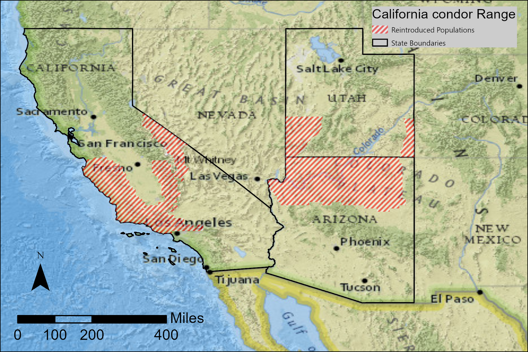
Description
This map shows the current range of the California Condor.
Metadata
- Map prodcued by: Adrian Gonzalez
- Map produced using: ArcGIS Pro
- Approximate range digitized with data available from the United States Fish and Wildlife Service (USFWS) ECOS Service https://ecos.fws.gov/ecp/species/8193. The boundary appears to be based on the 1977 federal register, available at https://ecos.fws.gov/docs/federal_register/fr161.pdf.
Links
- Range of the Condor National Heritage Area
- Maps relating to the proposed Range of the Condor National Heritage Area
- Conservancy for the Range of the Condor
- Lands that could potentially be designated for inclusion in the Range of the Condor National Heritage Area
- Organizations that are potential partners in the Range of the Condor National Heritage Area
Disclaimer
This page may contain student work completed as part of assigned coursework. It may not be accurate. It does not necessary reflect the opinion or policy of CSUMB, its staff, or students.