Precipitation 1
From CCoWS Wiki

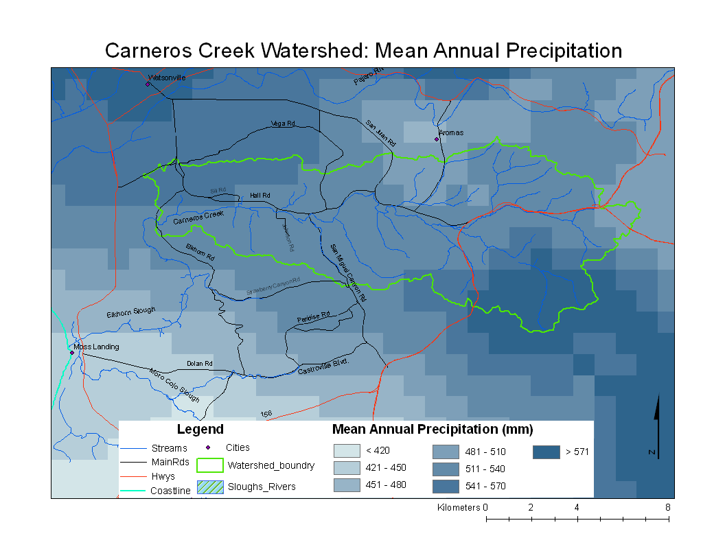
Metadata
- Original source of data: See PRISM
- Data anlysis: ArcMap
- Map produced by: Adam J. Purdy
- Projected Coordinate System: NAD 1983 UTM Zone 10
- Projection: Transverse Mercator
- Geographic Coordinate System: NAD 1983
- Dataum (North American 1983
- Prime Meridian: Greenwich
Processing Steps
- Convert ASCII grid file to Raster using Conversion Tools
- Define Projection
- Crop Raster to Central California Coast using Spatial Analyst Tool
- Symbolize by manually creating equal interval breaks
- Select appropriate color scheme