File list
From CCoWS Wiki
This special page shows all uploaded files.
| Date | Thumbnail | Size | User | Description | Versions | |
|---|---|---|---|---|---|---|
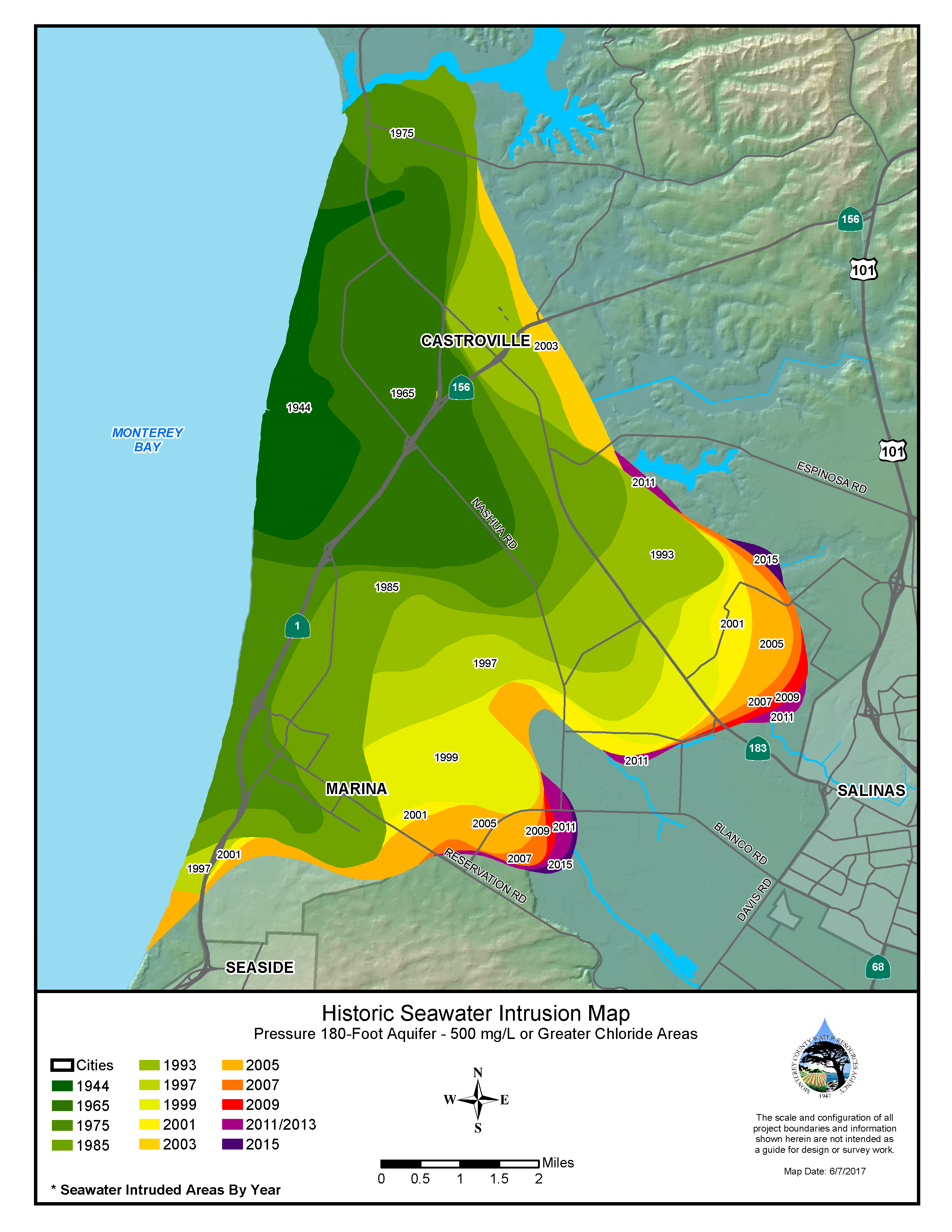
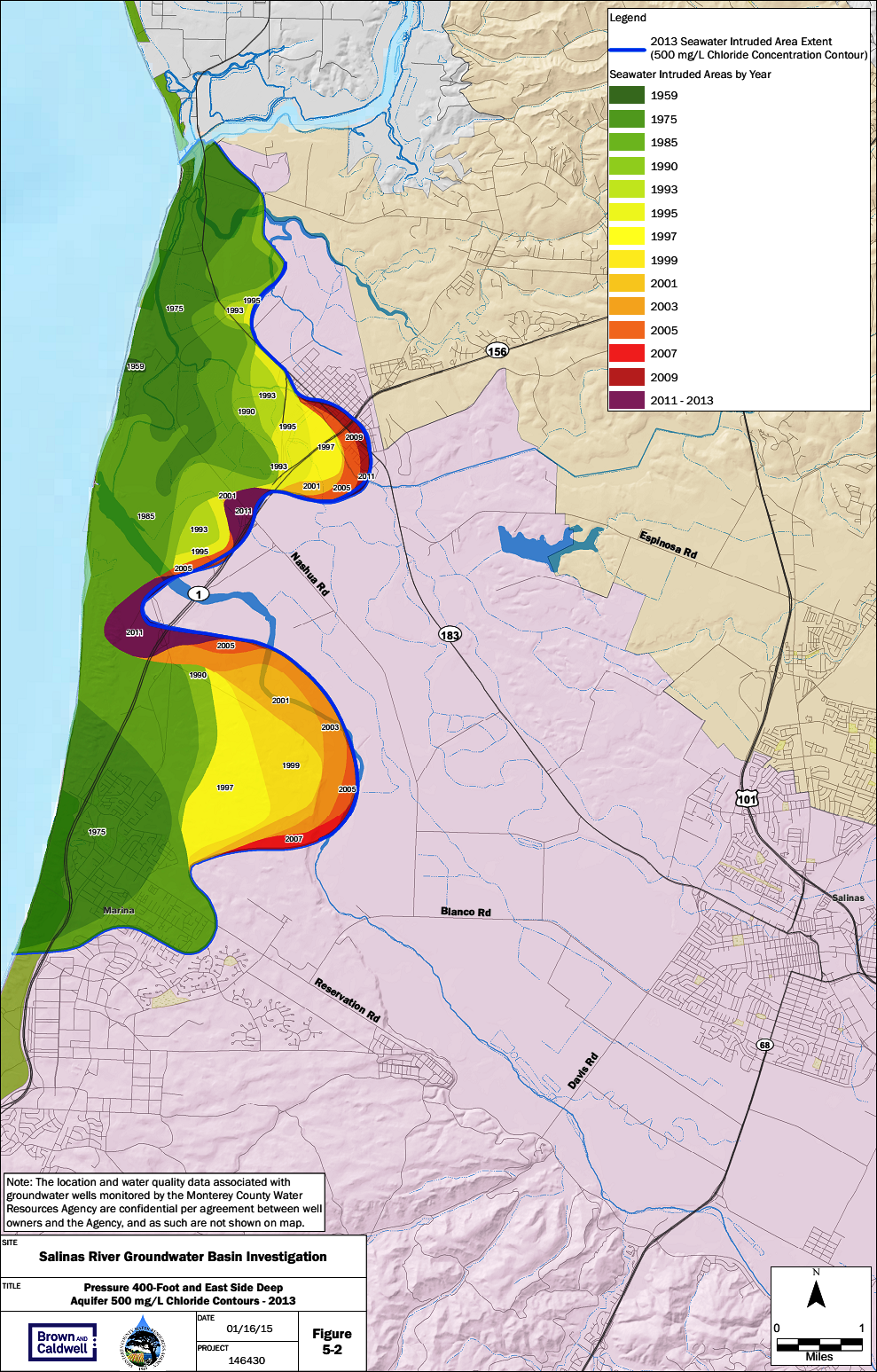
| 15:29, 29 March 2016 | 180ft-intrusion.png (file) |  |
1.14 MB | Gabem | Summarizes the rates of seawater instrusion from 1944 to 2013 for the 180-foot aquifer in the Salinas Valley, as measured from the historical extents. Chloride concentration is used as an indicator of seawater intruded into aquifers because chloride b... | 1 |
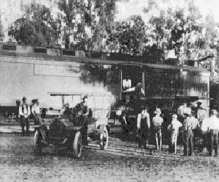
| 13:29, 3 April 2017 | 1915troutstocking.jpg (file) |  |
22 KB | Mattr | 1 | |
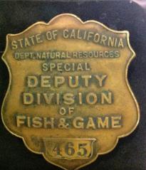
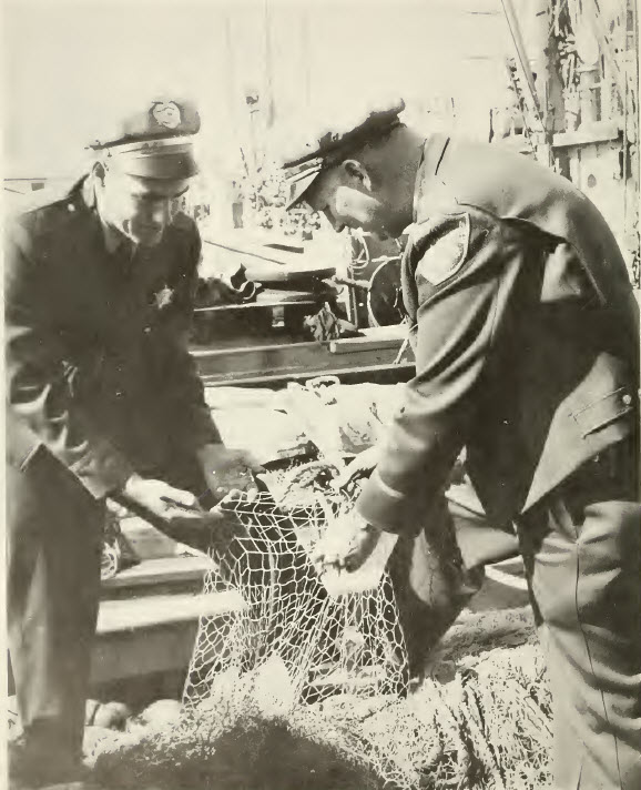
| 13:33, 3 April 2017 | 1928wardenbadge.jpg (file) |  |
11 KB | Mattr | 1 | |
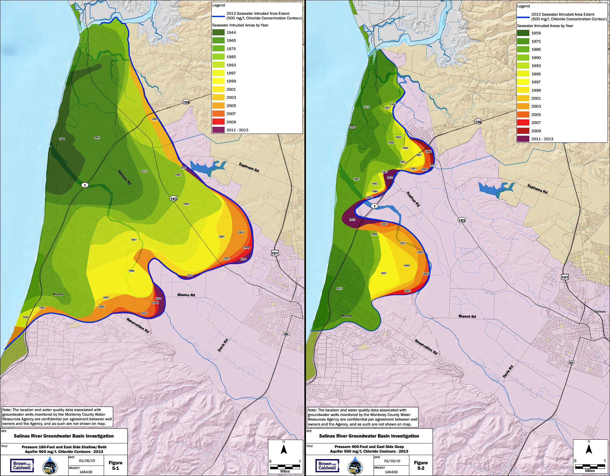
| 15:56, 29 March 2016 | 1944to2013-intrusion.jpg (file) |  |
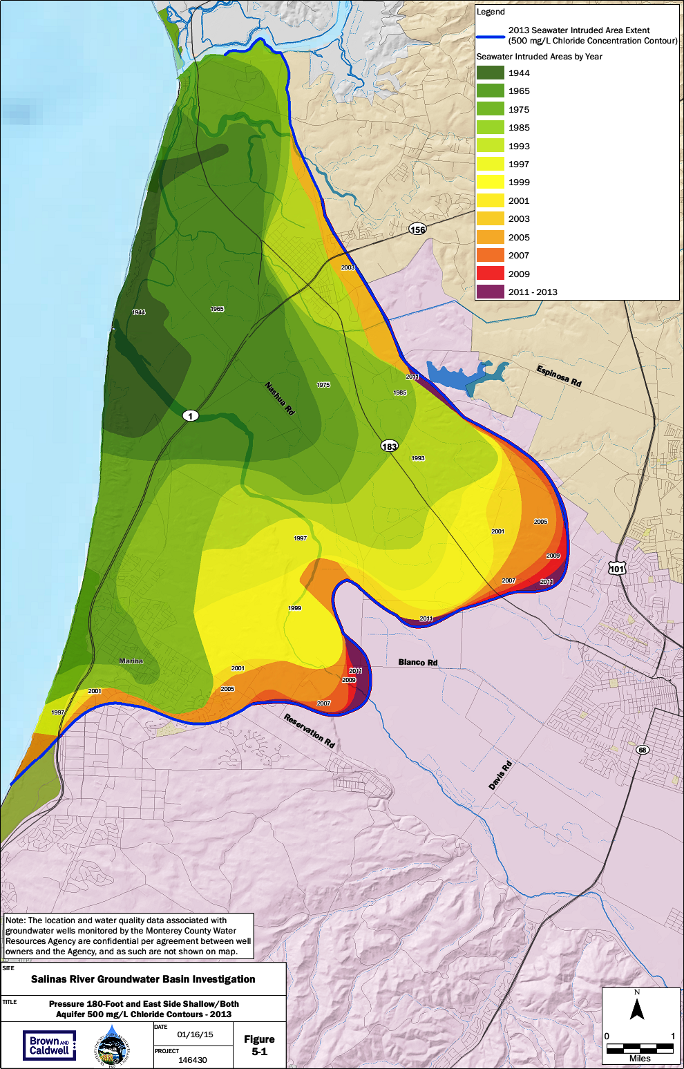
518 KB | Gabem | Summarizes the rates of seawater instrusion from 1944 to 2013 for the 180-foot (left) and 400-foot (right) aquifer in the Salinas Valley, as measured from the historical extents. Chloride concentration is used as an indicator of seawater intruded into... | 1 |
| 13:34, 3 April 2017 | 1958marinewardens.jpg (file) |  |
90 KB | Mattr | 1 | |
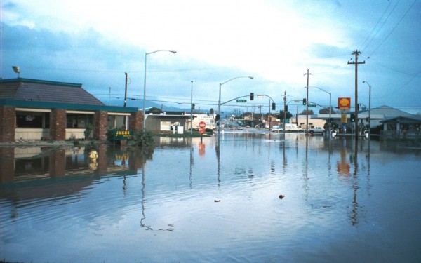
| 20:59, 30 March 2017 | 1998 salinas flood.jpg (file) |  |
53 KB | Shawnteg | 1998 flooding on Kern and E Market | 1 |
| 15:19, 12 April 2011 | 2002 - TMDL for Nutrients San Diego Creek and Newport Bay.pdf (file) | 78 KB | Rogera | 1 | ||
| 16:46, 7 April 2011 | 2003 - Santa Clara River Nitrogen TMDL.pdf (file) | 725 KB | Rogera | EPA Approved Santa Clara River Nitrogen TMDL | 1 | |
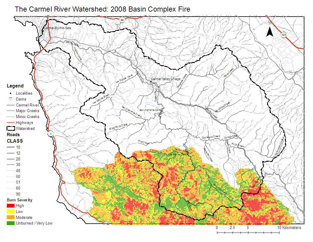
| 21:33, 4 February 2009 | 2008 Burn Severity.pdf (file) | 612 KB | Erins | 2 | ||
| 21:32, 4 February 2009 | 2008 Burn Severity.png (file) |  |
178 KB | Erins | 2 | |
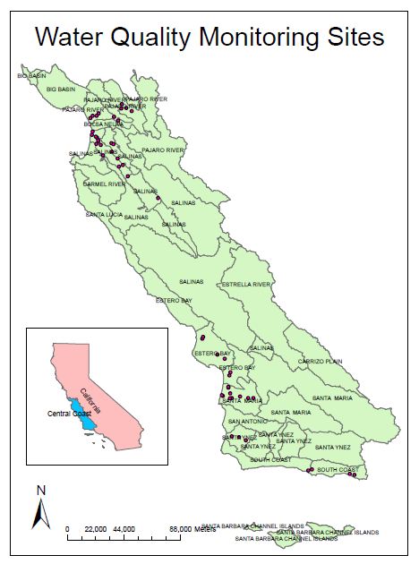
| 19:49, 28 March 2012 | 2009 region3 map.JPG (file) |  |
52 KB | Gwenm | map of Central Coast Preservation Inc sample location | 1 |
| 19:30, 28 March 2012 | 2009 region3 map.pdf (file) | 336 KB | Gwenm | 1 | ||
| 20:00, 28 March 2012 | 2009 region3 map.png (file) |  |
97 KB | Gwenm | 1 | |
| 11:24, 5 April 2018 | 2015.PNG (file) |  |
316 KB | ArevMarkarian | 1 | |
| 11:24, 5 April 2018 | 2016.PNG (file) |  |
369 KB | ArevMarkarian | 1 | |
| 09:37, 30 March 2018 | 2017HistoricSeawaterInstrusionMap 180ftAquifer.pdf (file) | 1.89 MB | JesseDoyle | 1 | ||
| 09:39, 30 March 2018 | 2017HistoricSeawaterInstrusionMap 180ftAquifer.png (file) |  |
1.77 MB | JesseDoyle | 1 | |
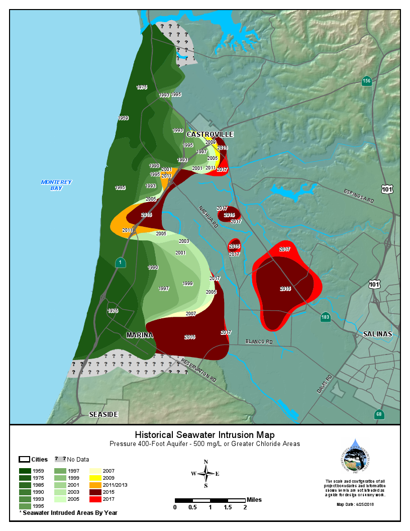
| 09:42, 30 March 2018 | 2017HistoricSeawaterInstrusionMap 400ftAquifer.png (file) |  |
1.48 MB | JesseDoyle | 1 | |
| 13:15, 29 March 2019 | 2018HistoricSeawaterInstrusionMap180ftAquifer.pdf (file) | 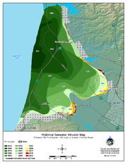 |
503 KB | StefanieK | Reverted to version as of 20:14, 29 March 2019 | 5 |
| 13:03, 29 March 2019 | 2018HistoricSeawaterInstrusionMap180ftAquifer.png (file) |  |
600 KB | StefanieK | Reverted to version as of 22:18, 28 March 2019 | 5 |
| 13:18, 29 March 2019 | 2018HistoricSeawaterInstrusionMap400ftAquifer.png (file) |  |
544 KB | StefanieK | 1 | |
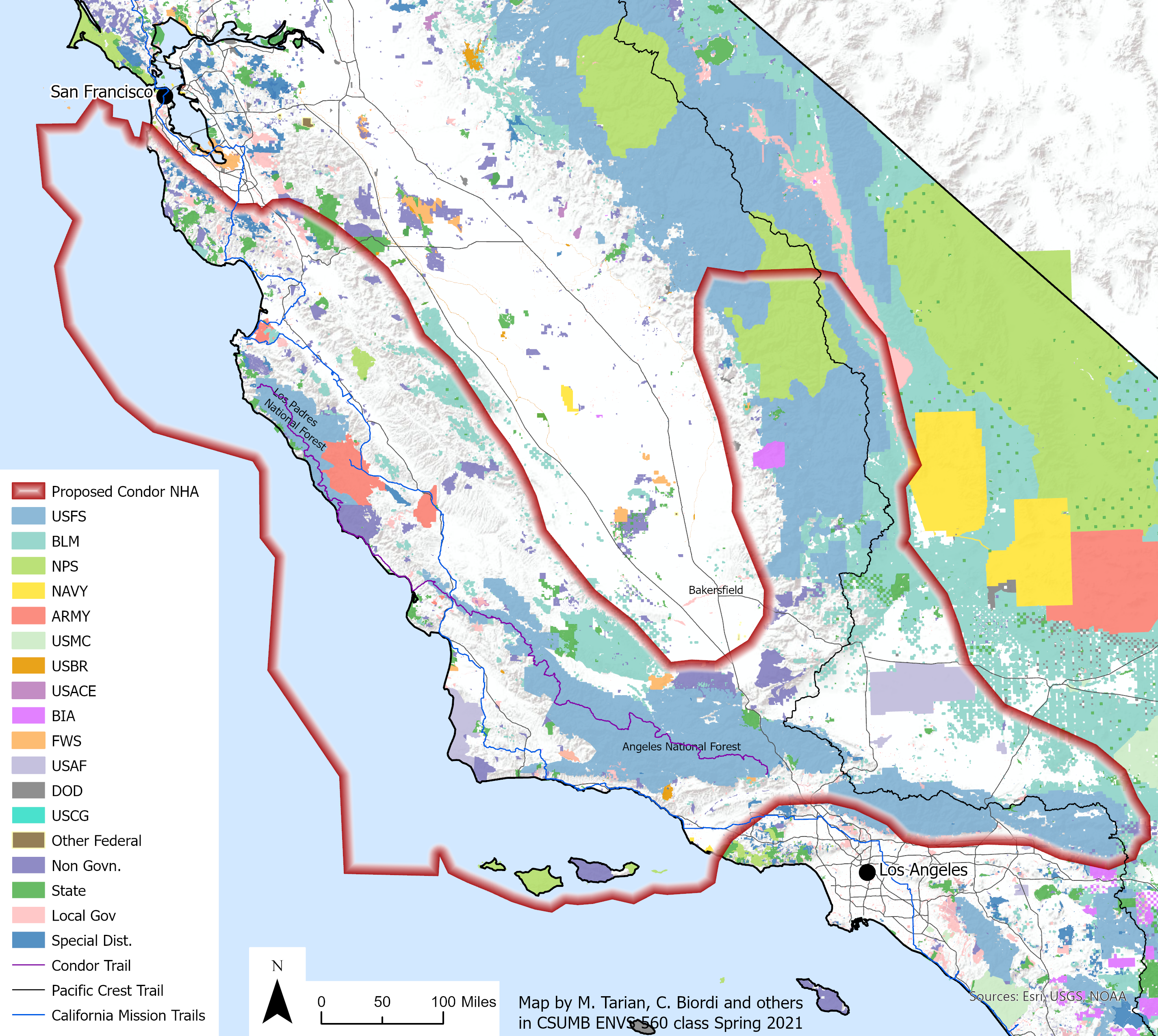
| 16:00, 16 March 2021 | 210308 CNHA SMA.png (file) |  |
4.44 MB | MichelleT | Reverted to version as of 22:58, 16 March 2021 | 13 |
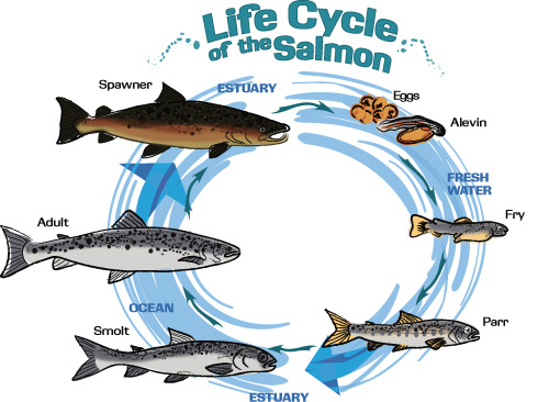
| 14:14, 10 April 2012 | 2salmonhistory.jpeg (file) |  |
119 KB | Gwenm | 1 | |
| 15:35, 29 March 2016 | 400ft-intrusion.png (file) |  |
1.18 MB | Gabem | Summarizes the rates of seawater instrusion from 1944 to 2013 for the 400-foot aquifer in the Salinas Valley, as measured from the historical extents. Chloride concentration is used as an indicator of seawater intruded into aquifers because chloride b... | 1 |
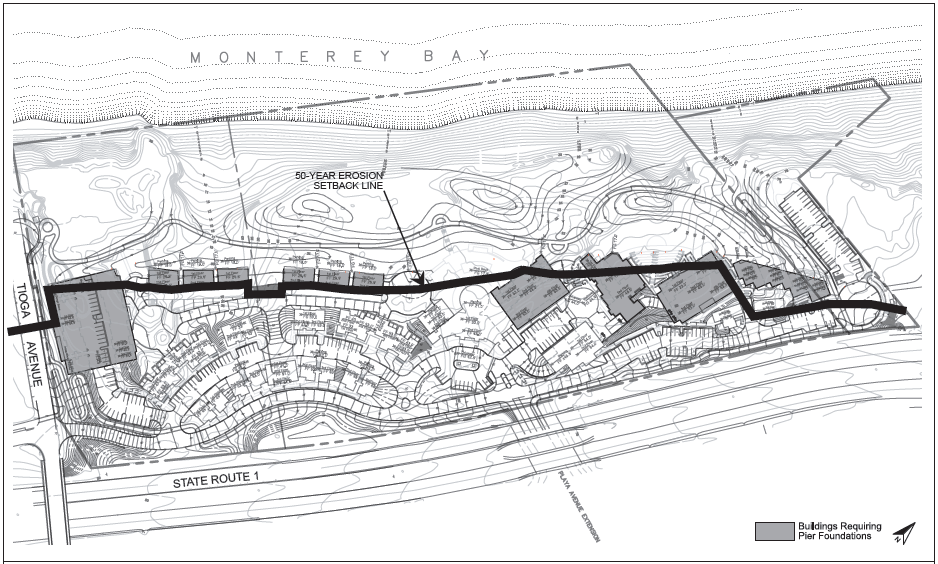
| 09:42, 4 April 2013 | 50YearSetback.jpg (file) |  |
295 KB | Alexs | 1 | |
| 15:02, 26 February 2021 | 97226display.jpg (file) |  |
23 KB | IsaacN | 1 | |
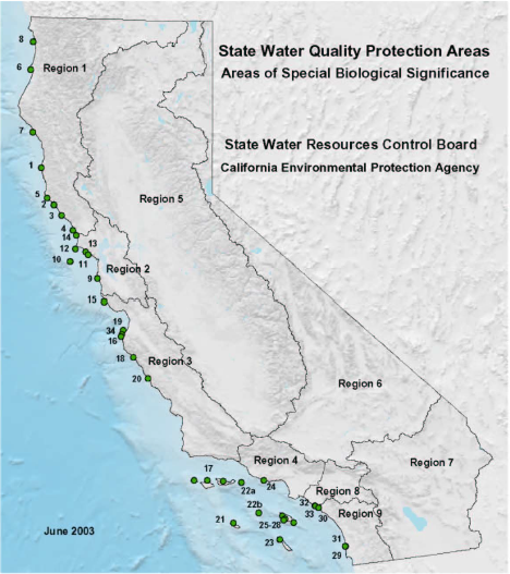
| 06:34, 12 April 2012 | ASBS.png (file) |  |
327 KB | Cheriec | 1 | |
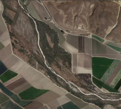
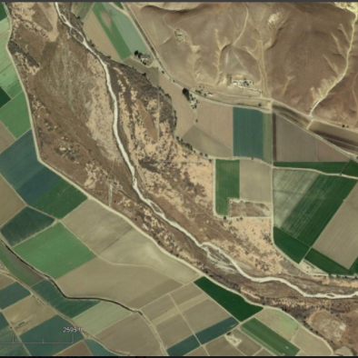
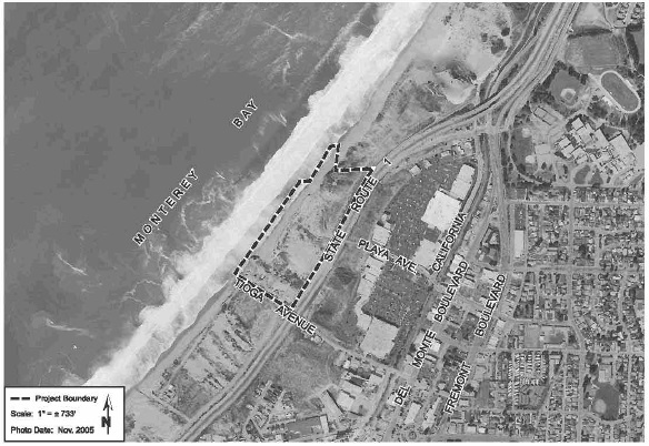
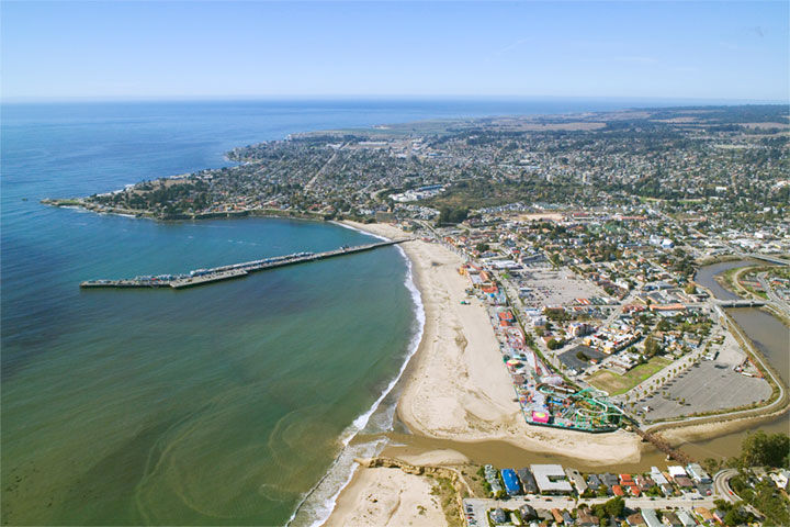
| 23:16, 3 April 2013 | Aerial2.jpg (file) |  |
108 KB | Alexs | Image 1. Aerial photo of site location. | 1 |
| 11:27, 9 April 2013 | Aerial view - Santa Cruz CA.jpg (file) |  |
97 KB | Aimeet | 1 | |
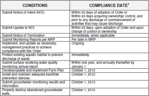
| 09:09, 5 April 2012 | AgWaiverReqs1.JPG (file) |  |
64 KB | Christinad | Table 1. Time schedule for compliance for all dischargers (Tier 1,2,&3). Taken from the final 2012 Conditional Waiver of Waste Requirements for Discharges from Irrigated Lands (Order No. R3-2012-0011). | 1 |
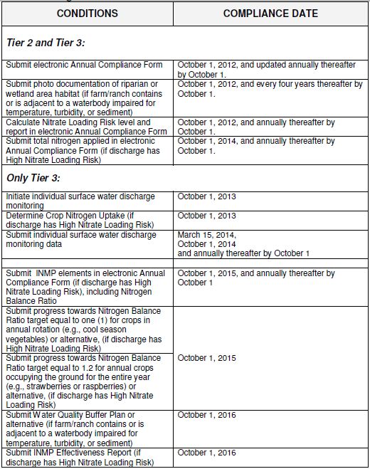
| 09:25, 5 April 2012 | AgWaiverReqs2.JPG (file) |  |
105 KB | Christinad | 1 | |
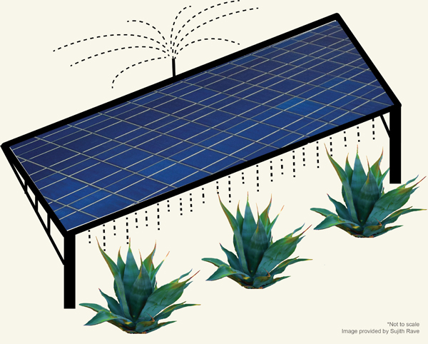
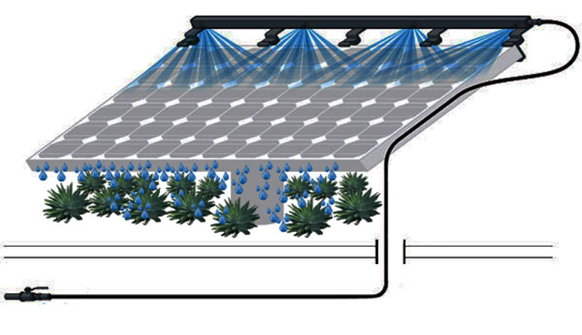
| 12:23, 6 April 2017 | Agave Solar.jpg (file) |  |
189 KB | Cynthiag | 1 | |
| 12:29, 6 April 2017 | Agave Solar2.jpg (file) |  |
43 KB | Cynthiag | 1 | |
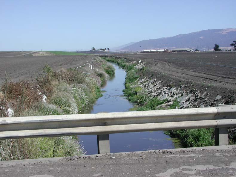
| 11:30, 8 April 2011 | Agwaiver.jpg (file) |  |
74 KB | Rosea | Picture Reclamation Ditch looking upstream from San Jon Rd.(Photo: Don Kozlowski, June 2002). Copied from [http://ccows.csumb.edu/pubs/reports/CCoWS_DPR_FinalReport_040331c.pdf CCoWS DPR Final Report]. | 4 |
| 12:27, 3 April 2011 | Agwaiver.png (file) |  |
135 KB | Rosea | 2 | |
| 19:23, 26 March 2019 | Alb.jpg (file) |  |
102 KB | AndrewC | 1 | |
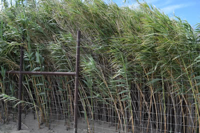
| 09:47, 2 April 2019 | Arundo-donax-sm.jpg (file) |  |
43 KB | StefanieK | Arundo donax along the Salinas River. Photo from https://www.rcdmonterey.org/salinas-river-arundo-and-tamarisk-control | 1 |
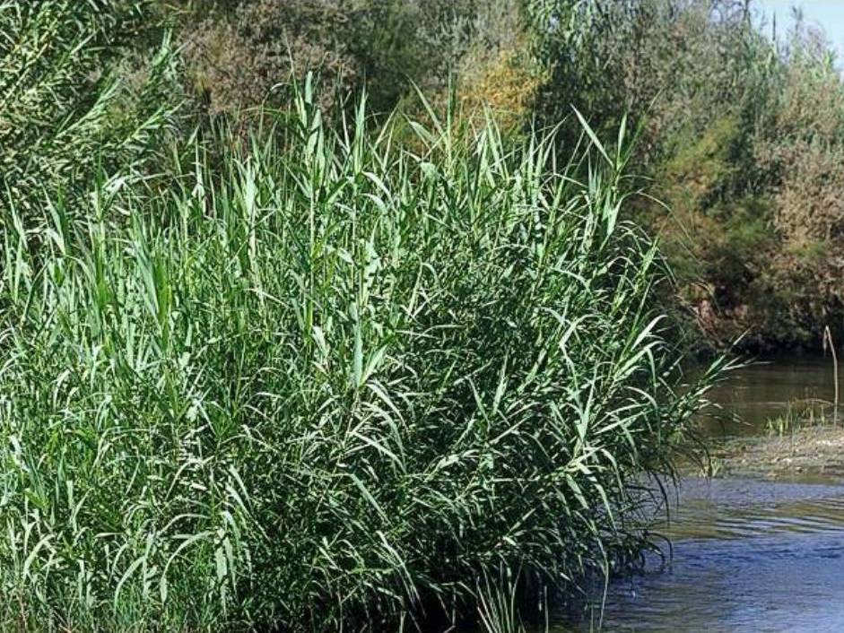
| 11:37, 3 April 2018 | Arundo-donax.jpg (file) |  |
180 KB | ArevMarkarian | http://www.cal-ipc.org/plants/profile/arundo-donax-profile/ | 1 |
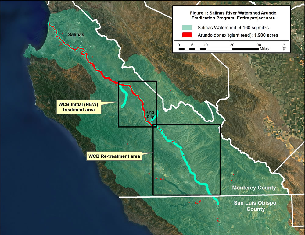
| 11:33, 3 April 2018 | Arundo-infestation-within-the-salinas-river-watershed.jpg (file) |  |
192 KB | ArevMarkarian | https://www.rcdmonterey.org/salinas-river-arundo-and-tamarisk-control | 1 |
| 13:35, 12 April 2012 | Asbs19.png (file) |  |
91 KB | Cheriec | 1 | |
| 22:49, 24 February 2021 | BHA.jpg (file) |  |
125 KB | EmmaD | Backcountry Hunters and Anglers | 1 |
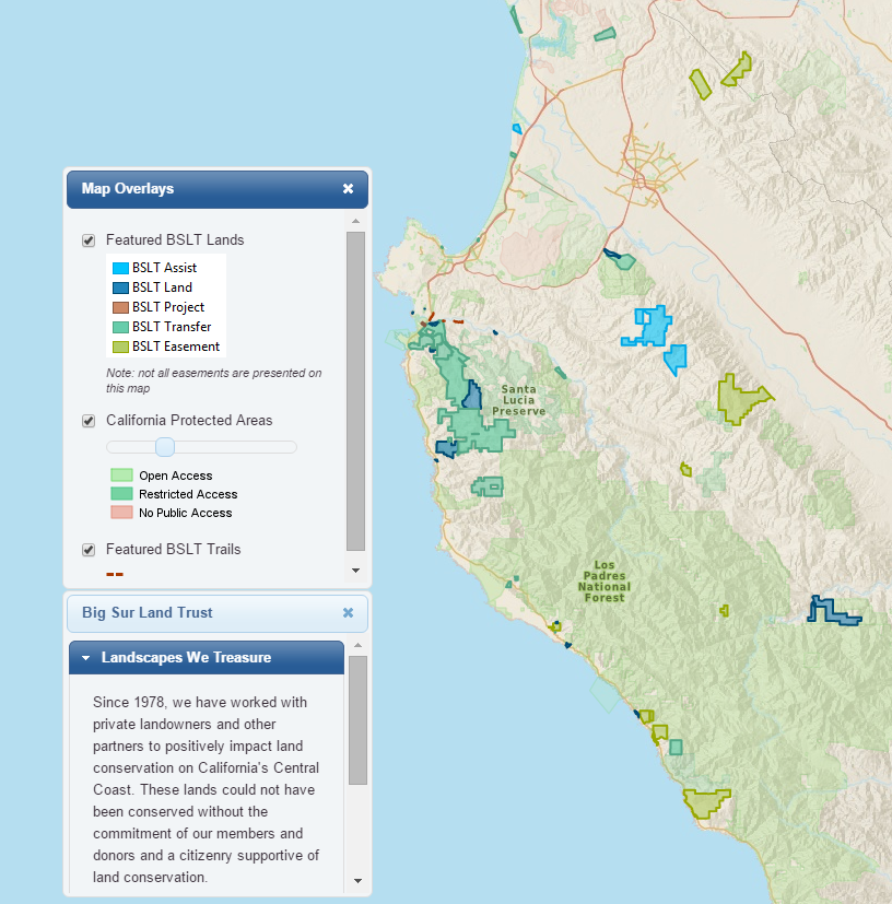
| 14:00, 2 April 2016 | BSLT.PNG (file) |  |
619 KB | Leahm | 2 | |
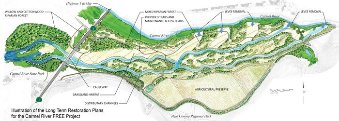
| 13:23, 5 April 2016 | BSLT CarmelRiverFREE.JPG (file) |  |
56 KB | Juliaf | Reverted to version as of 20:15, 5 April 2016 | 5 |
| 13:27, 5 April 2016 | BSLT CarmelRiverFREE.PDF (file) | 280 KB | Juliaf | Image sourced from [http://www.bigsurlandtrust.org/blog/carmel-river-free-37.htm Big Sur Land Trust blog] | 1 | |
| 12:55, 14 April 2016 | BSLT Logo.PNG (file) | 14 KB | Leahm | Reverted to version as of 19:53, 14 April 2016 | 5 | |
| 21:57, 6 April 2020 | BSLT Pathways Map.jpg (file) |  |
779 KB | MattM | 2 | |
| 14:38, 25 February 2021 | Basemap.jpg (file) |  |
400 KB | ShawnM | 1 | |
| 15:16, 8 March 2009 | BasinComp Burn Severity.zip (file) | 4.79 MB | Erins | 1 | ||
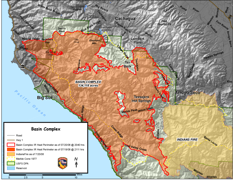
| 15:30, 6 April 2017 | Basincomplexfire.jpg (file) |  |
424 KB | Mattr | 2 | |
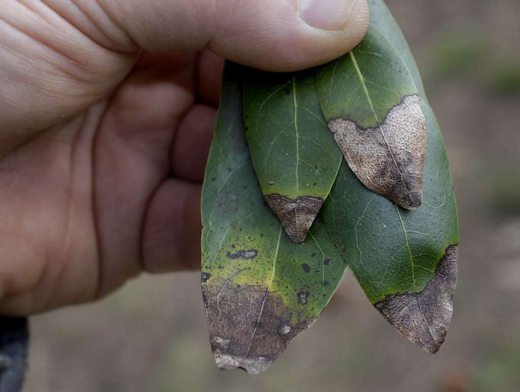
| 12:07, 30 March 2017 | Bay Laurel SOD.jpg (file) |  |
52 KB | Cynthiag | Bay laurel with SOD. | 1 |
First page |
Previous page |
 Next page |
Last page |