File list
From CCoWS Wiki
This special page shows all uploaded files.
| Name | Thumbnail | Size | User | Description | Versions | |
|---|---|---|---|---|---|---|
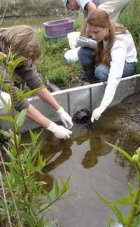
| 16:37, 23 January 2009 | Miles+kelleen 200w.jpg (file) |  |
39 KB | Fred | 1 | |
| 19:30, 1 February 2009 | Carmel Burn.png (file) |  |
105 KB | Erins | 1 | |
| 22:35, 1 February 2009 | Carmel BaseMap +Elev.pdf (file) | 1.49 MB | Fred | 1 | ||
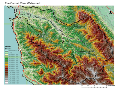
| 07:22, 2 February 2009 | Carmel BaseMap +Elev 400w.png (file) |  |
235 KB | Fred | 1 | |
| 08:06, 2 February 2009 | Carmel Burn.pdf (file) | 483 KB | Erins | 1 | ||
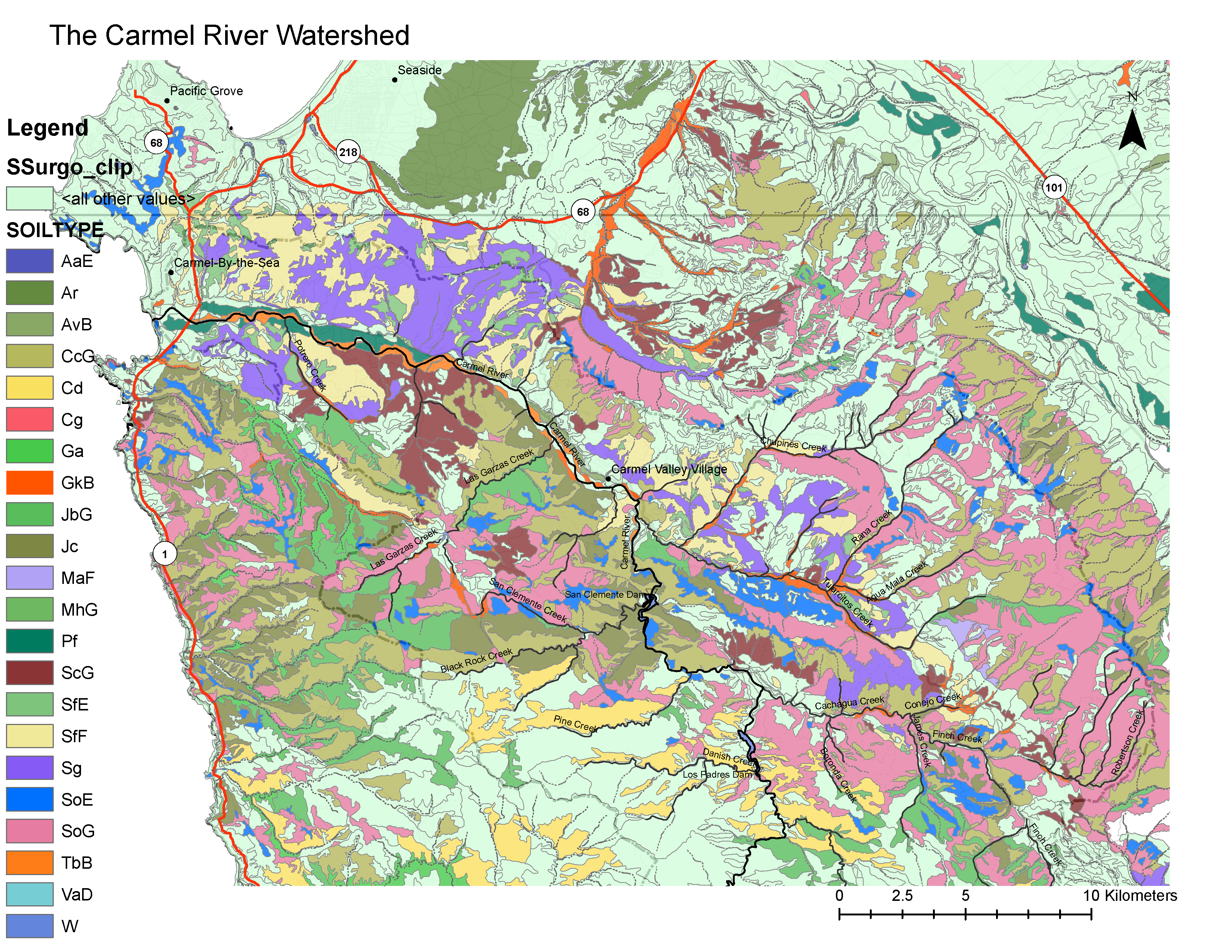
| 13:57, 2 February 2009 | Carmel Soils.pdf (file) | 1.08 MB | Pamk | 2 | ||
| 08:24, 3 February 2009 | Soil type5.png (file) |  |
1 KB | Pamk | 1 | |
| 08:27, 3 February 2009 | Soil type3.png (file) |  |
2 KB | Pamk | 1 | |
| 13:04, 4 February 2009 | Carmel Watershed PrecipitationMap.pdf (file) | 519 KB | Violettap | 1 | ||
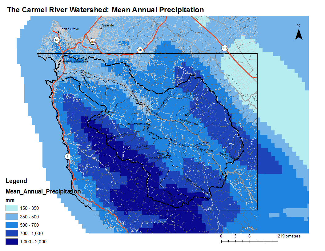
| 13:11, 4 February 2009 | Carmel Watershed Precipitation.png (file) |  |
156 KB | Violettap | 1 | |
| 19:57, 4 February 2009 | Soil erosion QUAN LRES.pdf (file) | 1.9 MB | Steveq | 1 | ||
| 20:00, 4 February 2009 | Soil erosion index.pdf (file) | 1.9 MB | Steveq | 1 | ||
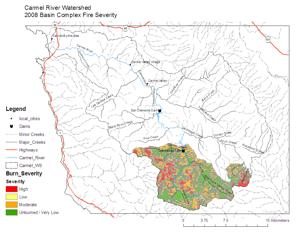
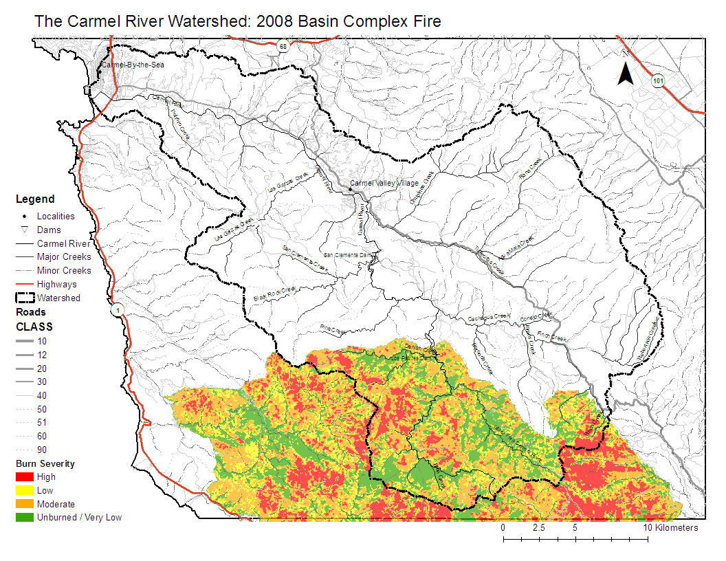
| 21:32, 4 February 2009 | 2008 Burn Severity.png (file) |  |
178 KB | Erins | 2 | |
| 21:33, 4 February 2009 | 2008 Burn Severity.pdf (file) | 612 KB | Erins | 2 | ||
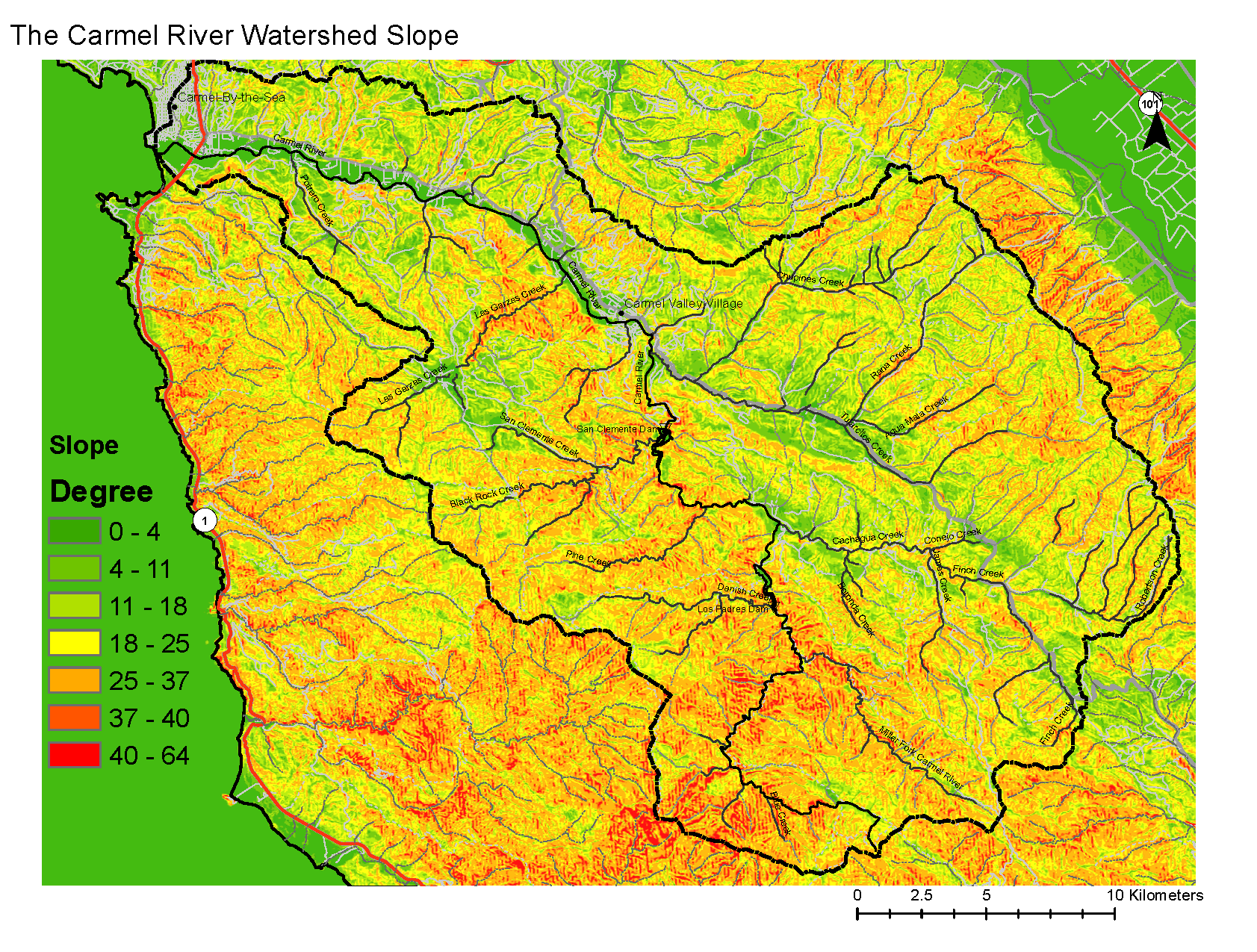
| 18:19, 5 February 2009 | Carmel Slope.pdf (file) | 959 KB | Cooperf | 1 | ||
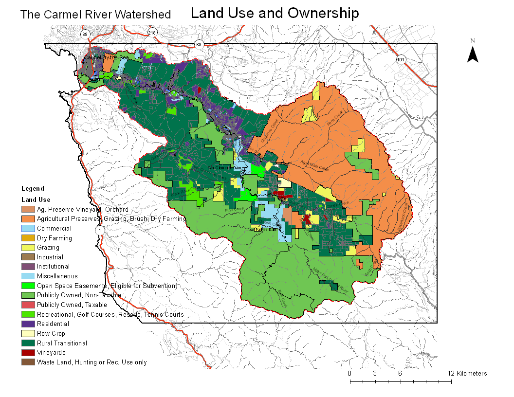
| 22:27, 5 February 2009 | Carmel LandUse Map.pdf (file) | 914 KB | Bartk | Map of Land Use and Ownership in Carmel River Watershed | 1 | |
| 22:43, 5 February 2009 | Carmel LandUse Map.png (file) |  |
146 KB | Bartk | 1 | |
| 23:50, 5 February 2009 | Carmel Slope.png (file) |  |
1.95 MB | Fred | 1 | |
| 23:55, 5 February 2009 | Carmel Soils.png (file) |  |
1.22 MB | Fred | 1 | |
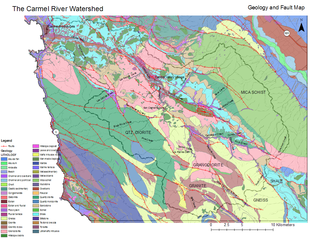
| 21:02, 6 February 2009 | Geo.Fault.Map.pdf (file) | 812 KB | Randyh | 2 | ||
| 21:04, 6 February 2009 | Geol.Fault.Map.png (file) |  |
306 KB | Randyh | 2 | |
| 10:08, 11 February 2009 | TestUploadLargeFile.JPG (file) |  |
3.86 MB | Fred | Just testing that we can now upload files >2MB | 1 |
| 16:25, 11 February 2009 | TarsierRasterKauaiRainbow.jpg (file) |  |
66 KB | Fred | 1 | |
| 19:32, 11 February 2009 | TarsierRasterKauaiASC.zip (file) | 241 KB | Fred | 1 | ||
| 20:06, 11 February 2009 | Kauai 3sec ArcGrid.zip (file) | 309 KB | Fred | 1 | ||
| 20:07, 11 February 2009 | Kauai 3sec GeoTIFF.zip (file) | 294 KB | Fred | 1 | ||
| 20:07, 11 February 2009 | Kauai 3sec BIL.zip (file) | 238 KB | Fred | 1 | ||
| 20:08, 11 February 2009 | Kauai 3sec GridFloat.zip (file) | 285 KB | Fred | 1 | ||
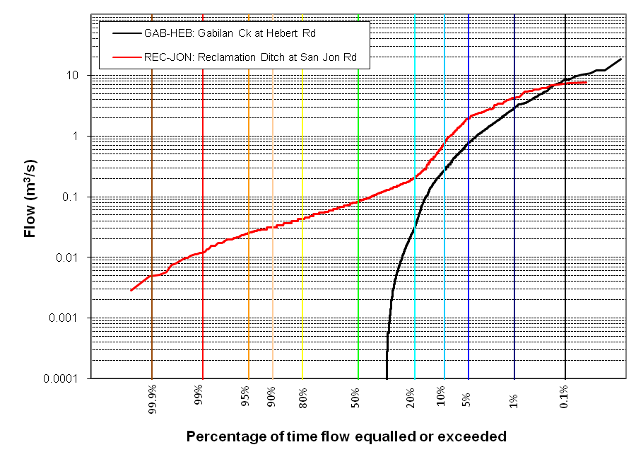
| 15:05, 20 February 2009 | GabilanWatershed FlowDurationAnalysis.png (file) |  |
41 KB | Fred | Created in Excel using USGS data by Fred Watson as an example to ENVS 560 class. | 1 |
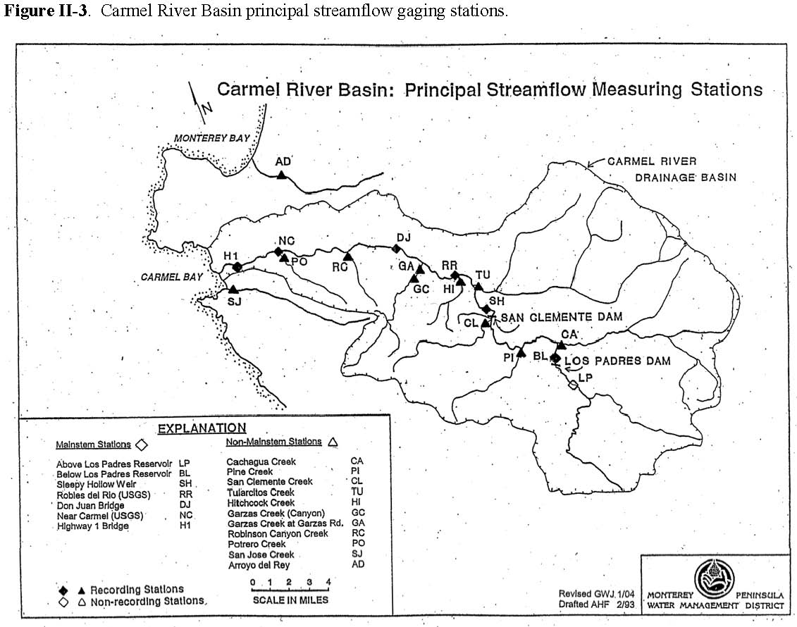
| 12:33, 22 February 2009 | Carmel MPWMD Gages Map FromUnknownReport.jpg (file) |  |
118 KB | Fred | 1 | |
| 12:48, 22 February 2009 | TarsierRenderKauaiBasic.jpg (file) |  |
46 KB | Fred | 1 | |
| 09:49, 24 February 2009 | Flowduration 30297 image001.gif (file) |  |
12 KB | Cooperf | 1 | |
| 10:16, 24 February 2009 | Flowduration 30297 image001.png (file) |  |
5 KB | Cooperf | 1 | |
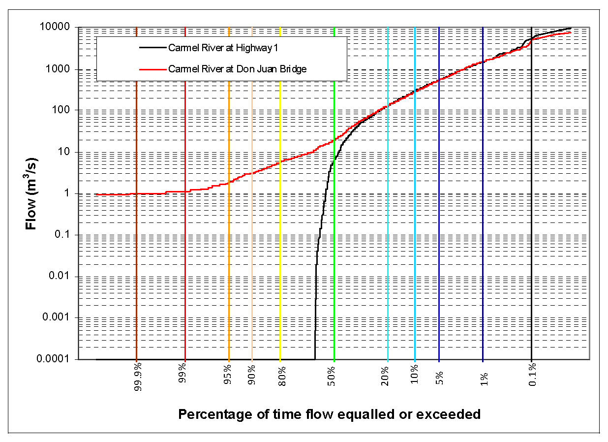
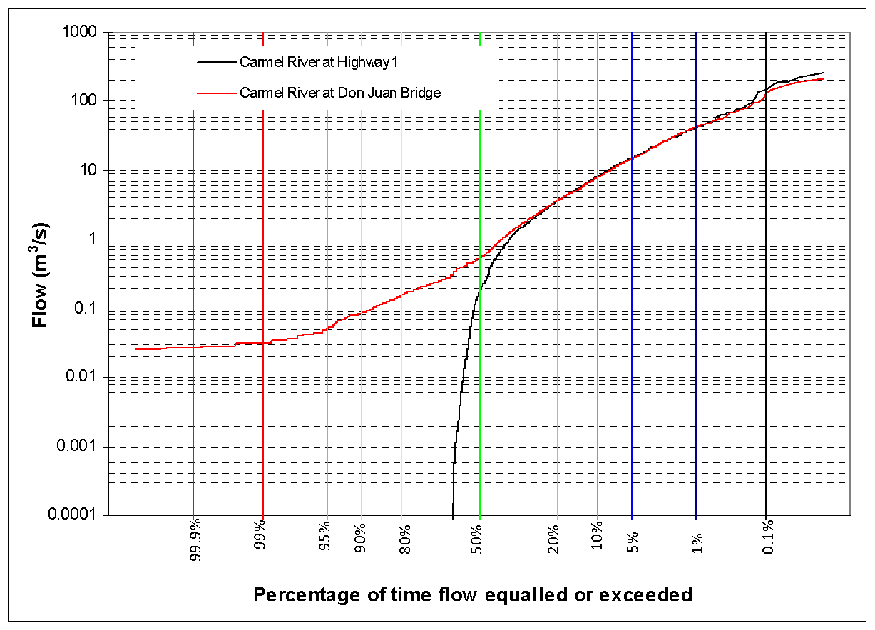
| 11:03, 24 February 2009 | PineCreek Flow Duration Curve.pdf (file) | 64 KB | Erins | 2 | ||
| 12:30, 24 February 2009 | FDC sq.png (file) |  |
25 KB | Steveq | 1 | |
| 14:27, 24 February 2009 | Image008.png (file) |  |
43 KB | Pamk | 1 | |
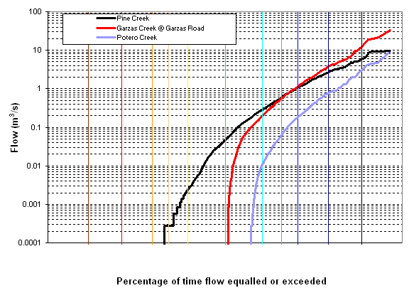
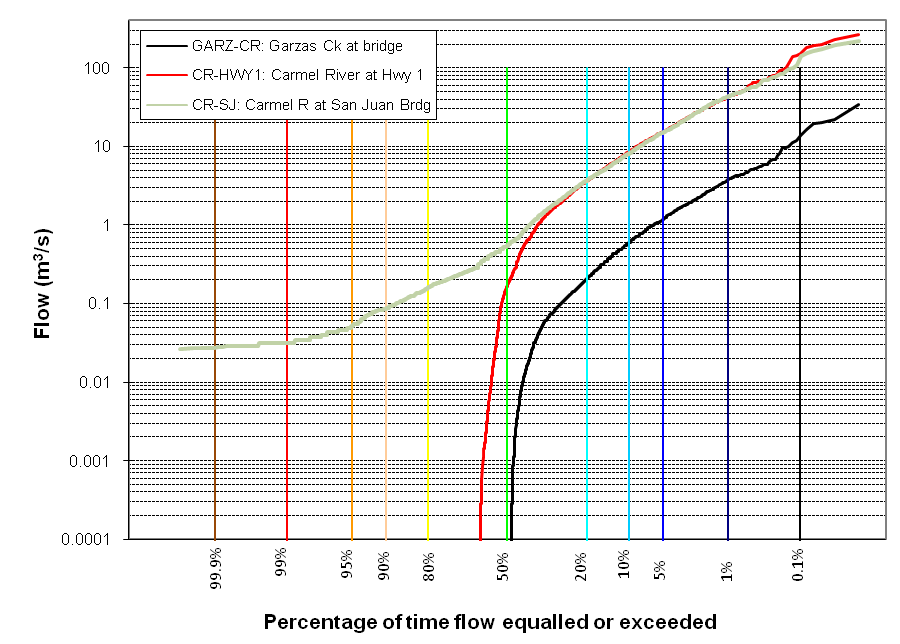
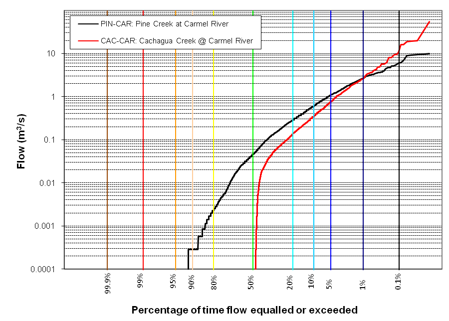
| 19:27, 24 February 2009 | PI CA Crks Flow Duration Analysis.png (file) |  |
41 KB | Erins | 1 | |
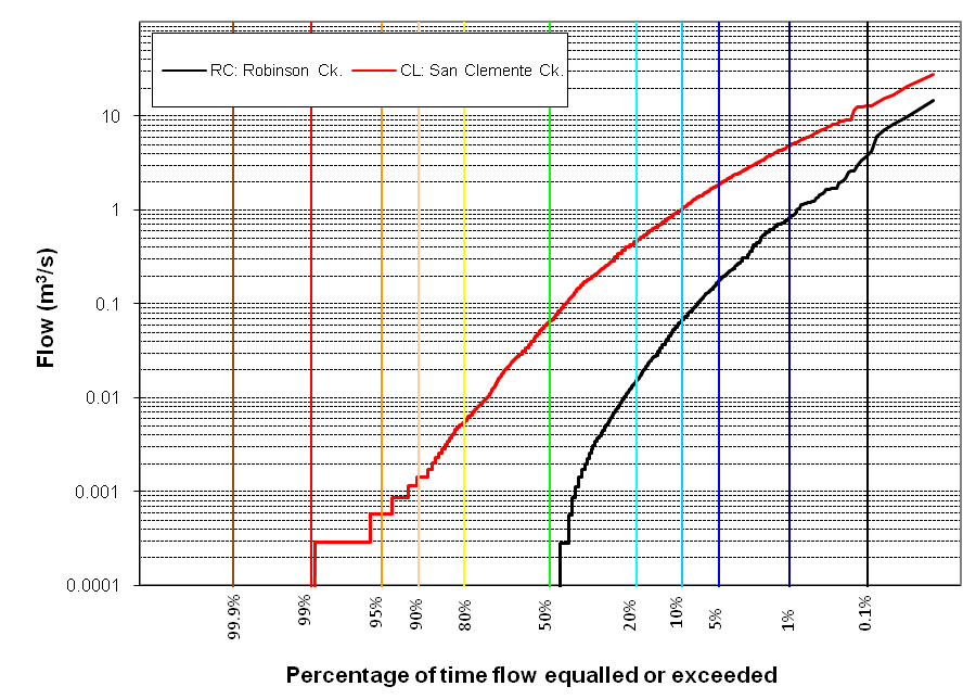
| 13:44, 25 February 2009 | FlowDurationCurveRCSC.png (file) |  |
41 KB | Randyh | 1 | |
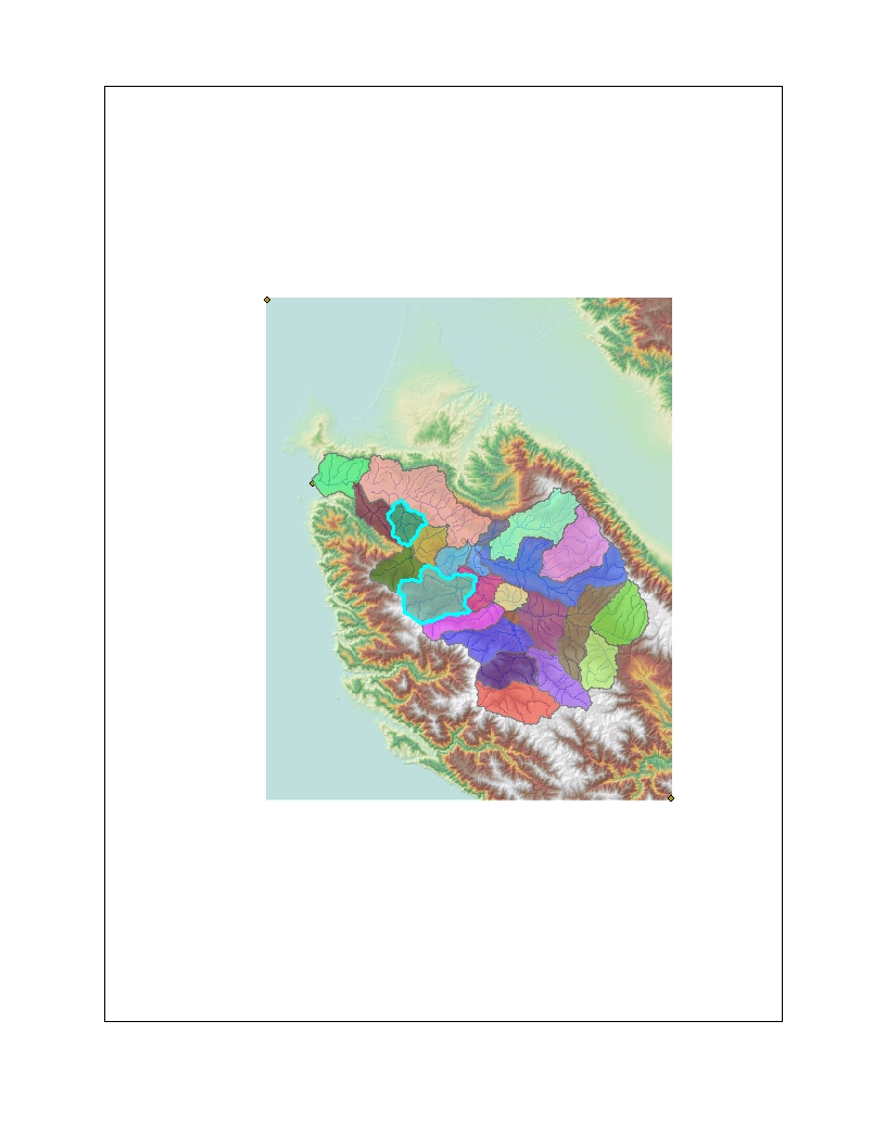
| 13:55, 25 February 2009 | Rob.SC.map.jpg (file) |  |
170 KB | Randyh | 1 | |
| 20:49, 3 March 2009 | Test.xlsx (file) | 8 KB | Fred | 1 | ||
| 00:00, 4 March 2009 | CDEC Precip PNR PoncainoRidge.xlsx (file) | 1.06 MB | Fred | 1 | ||
| 12:53, 5 March 2009 | FDC QUAN corrected.png (file) |  |
23 KB | Steveq | 1 | |
| 15:16, 8 March 2009 | BasinComp Burn Severity.zip (file) | 4.79 MB | Erins | 1 | ||
| 14:58, 22 March 2009 | CleanerXL HandyOutputProfiles.clb.zip (file) | 15 KB | Fred | Some handy output profiles for Cleaner XL used by the EcoViz Technical Team. | 1 | |
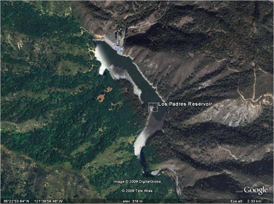
| 17:36, 30 January 2010 | Los Padres.png (file) |  |
16 KB | Emilyp | 2 | |
| 17:51, 30 January 2010 | Los Padres 2008.png (file) |  |
104 KB | Emilyp | 1 | |
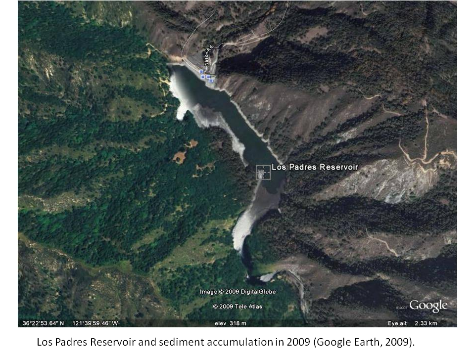
| 14:24, 31 January 2010 | Los Padres 2009.png (file) |  |
1.37 MB | Emilyp | 1 | |
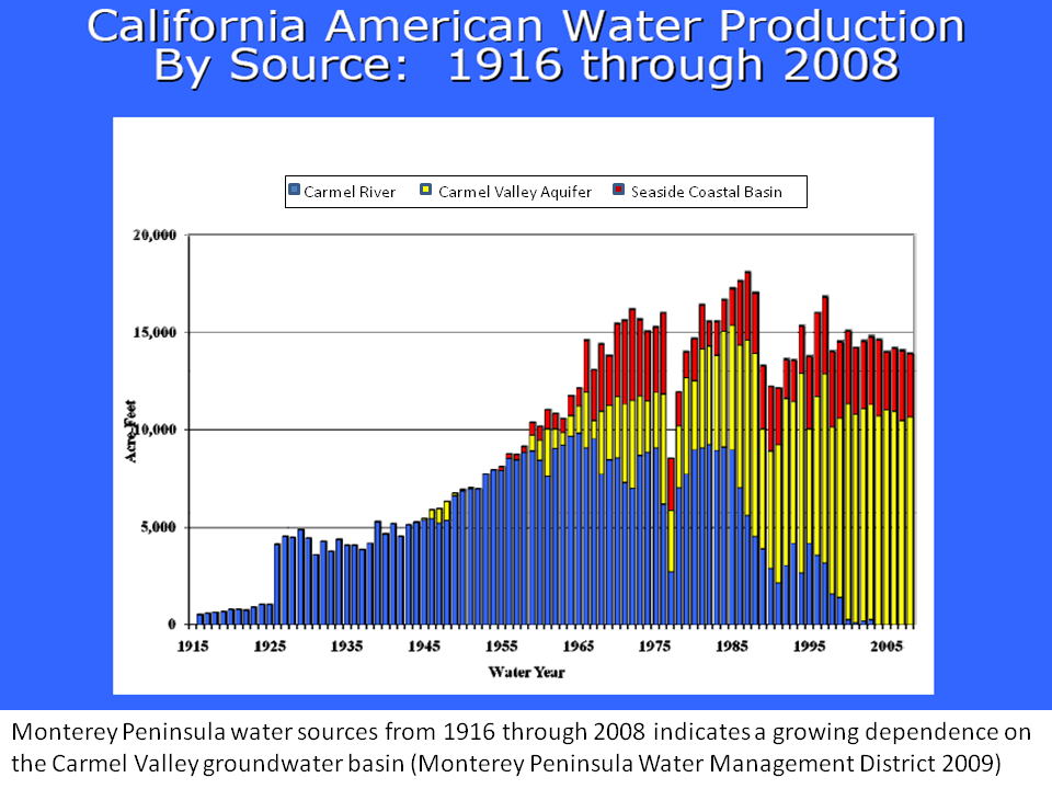
| 15:02, 31 January 2010 | MPWMD water production graph.png (file) |  |
137 KB | Emilyp | 1 | |
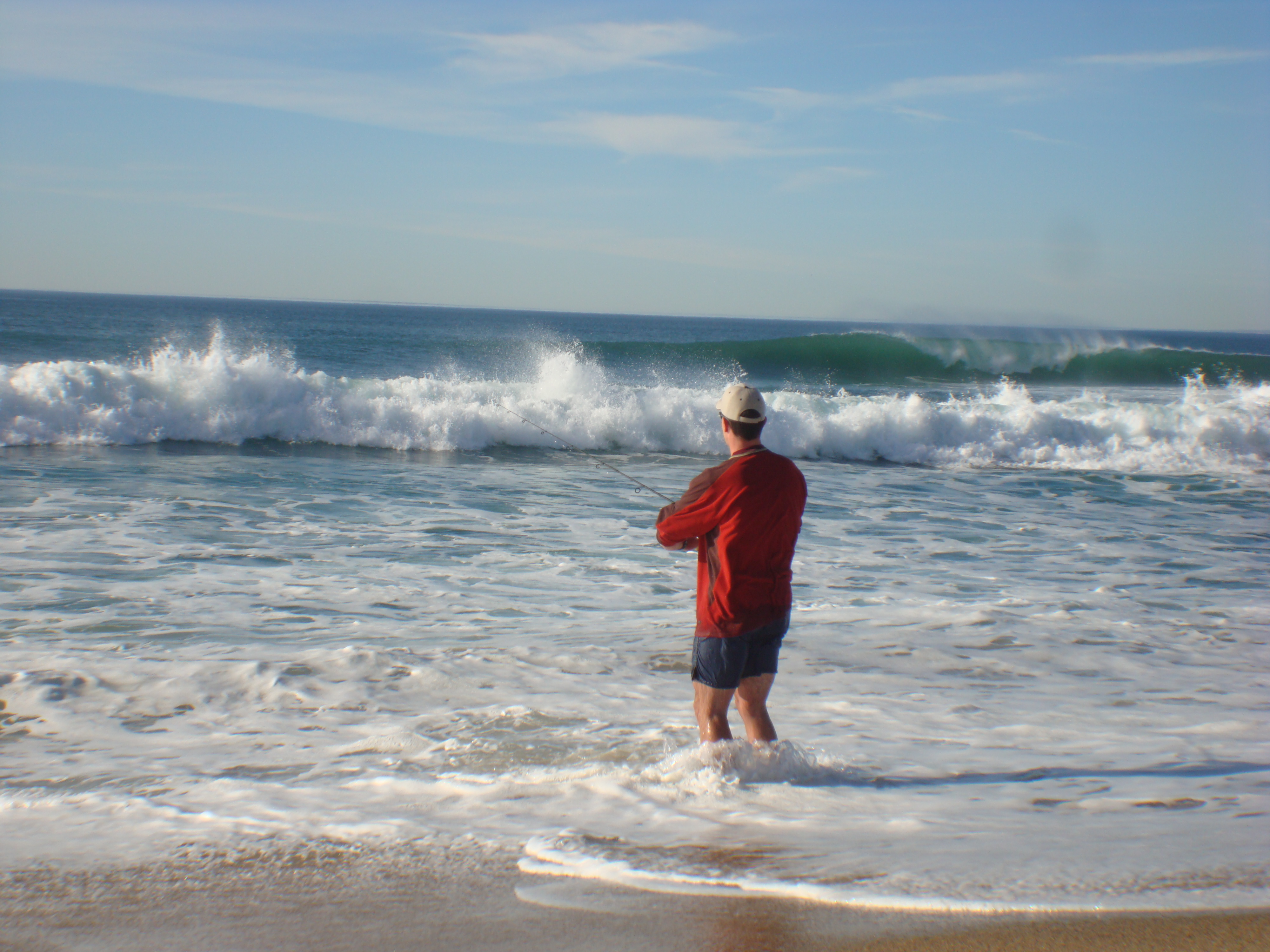
| 10:00, 4 February 2010 | PICT0108.JPG (file) |  |
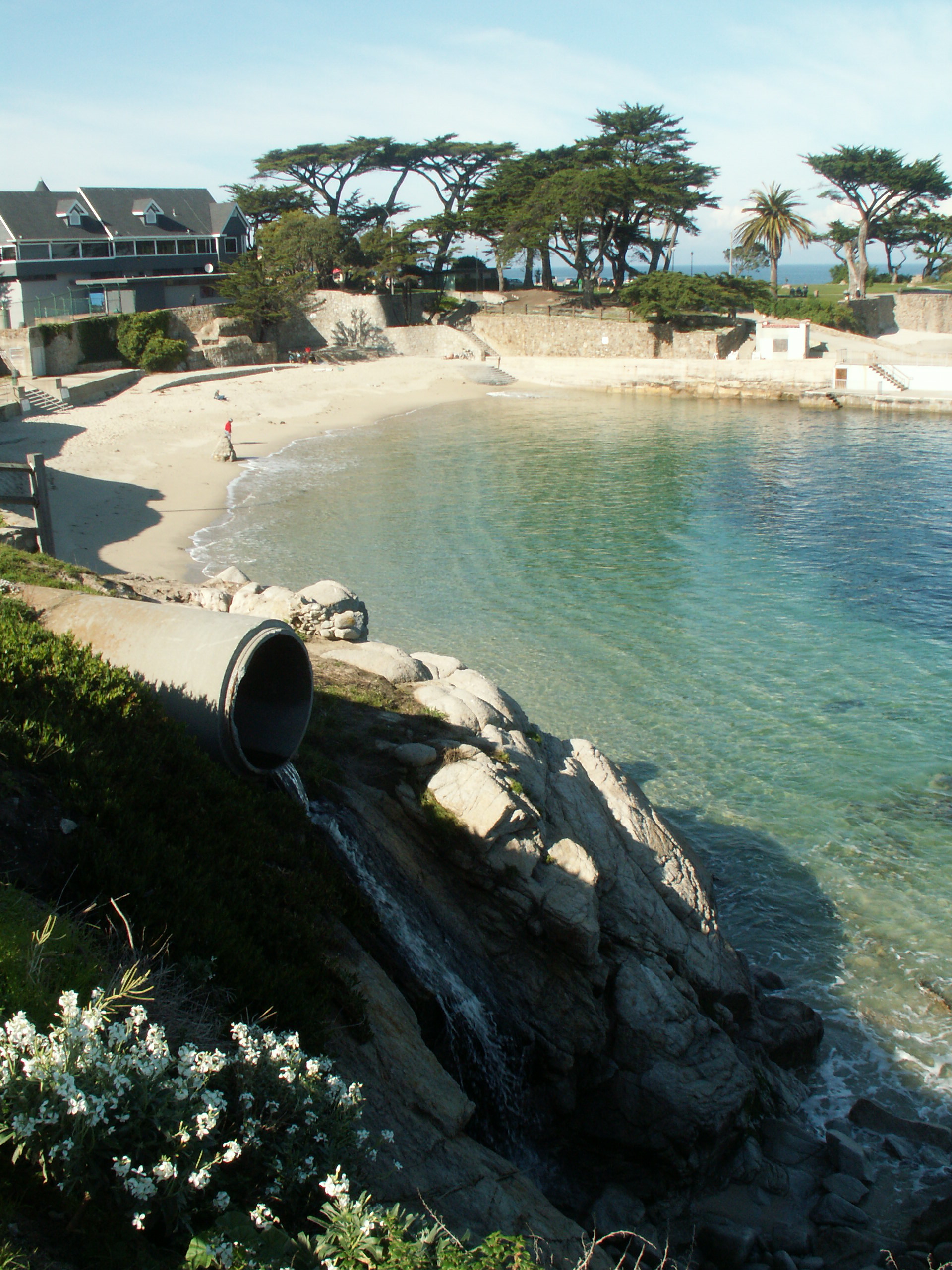
1.66 MB | Tyb | A storm water discharge point source at Lover's Point in Pacific Grove ASBS | 1 |
| 10:22, 4 February 2010 | Image-PICT0108.JPG (file) |  |
1.66 MB | Tyb | A storm water discharge point source at Lover's Point in Pacific Grove ASBS | 1 |
First page |
Previous page |
Next page |
Last page |