Difference between revisions of "Urban stormwater management in the City of Pacific Grove"
From CCoWS Wiki
m |
m |
||
| Line 13: | Line 13: | ||
[http://en.wikipedia.org/wiki/Pacific_Grove,_California The City of Pacific Grove, California] | [http://en.wikipedia.org/wiki/Pacific_Grove,_California The City of Pacific Grove, California] | ||
| − | + | ||
| + | [[Image:PacificGrove_LandUse.png|thumb|200px|right|City of Pacific Grove boundary and landuse types.<ref name="ENVS660">]] | ||
[[Image:greenwood1.png|thumb|200px|right|Impervious landcover on the Monterey Peninsula highlighting the Greenwood Park Watershed. Map by: Kirk Post]] | [[Image:greenwood1.png|thumb|200px|right|Impervious landcover on the Monterey Peninsula highlighting the Greenwood Park Watershed. Map by: Kirk Post]] | ||
Revision as of 12:57, 1 April 2012
A watershed-related issue examined by the ENVS 560/L Watershed Systems class at CSUMB.

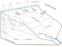
The City of Pacific Grove is located on the NW portion of the Monterey Peninsula. The city contains multiple watershed including the Greenwood Park Watershed which is highly urbanized producing large volumes of stormflow runoff which is discharged into the Monterey Bay ASBS. Approximately 43% of the watershed is covered by impervious surfaces and maintains an average slope of 8% which can result in minimal percolation of seasonal precipitation. Map by: Kirk Post
Contents
Summary
Location
The City of Pacific Grove, California
[[Image:PacificGrove_LandUse.png|thumb|200px|right|City of Pacific Grove boundary and landuse types.Cite error: Closing </ref> missing for <ref> tag
Timeline
Water Quality Monitoring and Science
Data Collection Programs
Organizations and NGOs
- National Water Quality Inventory
Remediation
- Monitoring of stormwater quality within the City of Pacific Grove is performed by multiple entities including:
- Citizen Watershed Monitoring Network organizes annual First Flush
- Urban Watch, and Snapshot monitoring activities for the Monterey region that document stormwater quality conditions for the first storm of the season
- Monterey Bay Sanctuary Citizen Watershed Monitoring Network (Citizen)[1]
Management Strategies
- Monterey Regional Stormwater Management Program (MRSWMP)
- Monterey Bay Sanctuary Citizen Watershed Monitoring Network(MBSCWMN)[2]
- Monterey Peninsula, Carmel Bay, and South Monterey Bay Integrated Regional Water Management Regional Acceptance Process Materials[3]
- Model Urban Runoff Program: A How-To guide for Developing Urban Runoff Programs for Small Municipalities. July 1998 (revised February 2002, by the California Coastal Commission)[6]
- Urban Forest Management Plan. By: RBF consulting add link[7]
- itree (2011)[8]
- Monterey Bay National Marine Sanctuary (MBNMS)[9]
- Proposition 84 ASBS Grant[10]
- First Flush Event Monitoring by the Sanctuary Citizen Watershed Monitoring Network (Began 2000)[11]
- Year 5 Annual Report for the Monterey Regional Storm Water Management Program (MRSWMP)
- Annual Reports 1-5. ADD LINK HERE
- Request For Proposals: Design, Environmental Review and Permitting of a Stormwater Treatment System at Greenwood Park[12]
- Report and data on Pacific Grove Stormwater Outfalls[13]
- Greenwood Park Monitoring[14]
- Low Impact Development (LID) technologies implemented as Best Management Practices BMPs throughout the watershed. Add LINK HERE
Metadata
References
- ↑ http://montereybay.noaa.gov/monitoringnetwork/about_us.html
- ↑ Monterey Bay Sanctuary Citizen Watershed Monitoring Network http://montereybay.noaa.gov/monitoringnetwork/pdf/ff2011.pdf
- ↑ Monterey Peninsula, Carmel Bay, and South Monterey Bay Integrated Regional Water Management Regional Acceptance Process Materials http://www.mpwmd.dst.ca.us/Mbay_IRWM/RAP.pdf
- ↑ Memorandum of Agreement for the Monterey Regional Storm Water Pollution Prevention Program http://www.ci.pg.ca.us/pubworks/mrswmp/MRSWMP_a.pdf
- ↑ Monterey Regional Stormwater Management Program http://www.montereysea.org/index.php
- ↑ Monterey Bay Sanctuary Citizen Watershed Monitoring Network http://www.co.monterey.ca.us/msea/Literature/Documents/MURP.pdf
- ↑ Urban Forest Management Plan. By: RBF consulting add link http://www.ci.pg.ca.us/pubworks/4.Pacific%20Grove%20UFMP_Draft%20Outline.pdf
- ↑ http://www.ci.pg.ca.us/pubworks/iTree.pdf
- ↑ http://montereybay.noaa.gov/
- ↑ http://www.waterboards.ca.gov/water_issues/programs/grants_loans/asbs/docs/news0611.pdf
- ↑ http://sanctuarysimon.org/monterey/sections/waterQuality/project_info.php?projectID=100141&sec=wq
- ↑ http://www.ci.pg.ca.us/RFP%20Wetland_GreenwoodPark.pdf
- ↑ http://ccows.csumb.edu/pubs/proj_pubs/2011/ENVS660_PGStormwater/index.htm
- ↑ Watson, F., Krone-Davis, P., and Smith, J. 2012 in prep. Streamflow gaging at Greenwood Park, Pacific Grove, California: January-April 2012. Report prepared for Monterey Bay Sanctuary Foundation and the City of Pacific Grove. The Watershed Institute, California State University Monterey Bay, Publication No. WI-2012-3. Available from: http://ccows.csumb.edu/pubs/
- ↑ CSUMB Class ENVS 660: Pugh K, Arenas R, Cubanski P, Lanctot M, Purdy A, Bassett R, Smith J, Hession S, Stoner K, Ashbach R, Alberola G, Jacuzzi N, Watson F. 2011. Stormwater outfall watershed delineation, land cover characteristics, and recommended priorities for monitoring and mitigation in the City of Pacific Grove, California. The Watershed Institute, California State Monterey Bay, Publication No. WI-2011-02, 74 pages. http://ccows.csumb.edu/pubs/reports/CSUMB_ENVS660_ClassReport_PGStormwater_120306.pdf
Links
- Urban stormwater management in the Monterey Bay region
- Urban Discharges to Areas of Special Biological Significance on Monterey Peninsula
Disclaimer
This page may contain student work completed as part of assigned coursework. It may not be accurate. It does not necessary reflect the opinion or policy of CSUMB, its staff, or students.