|
Data Type |
Description |
Browser Quick View |
Google Earth Quick View
(Right click to save and open in Google Earth)
|
|
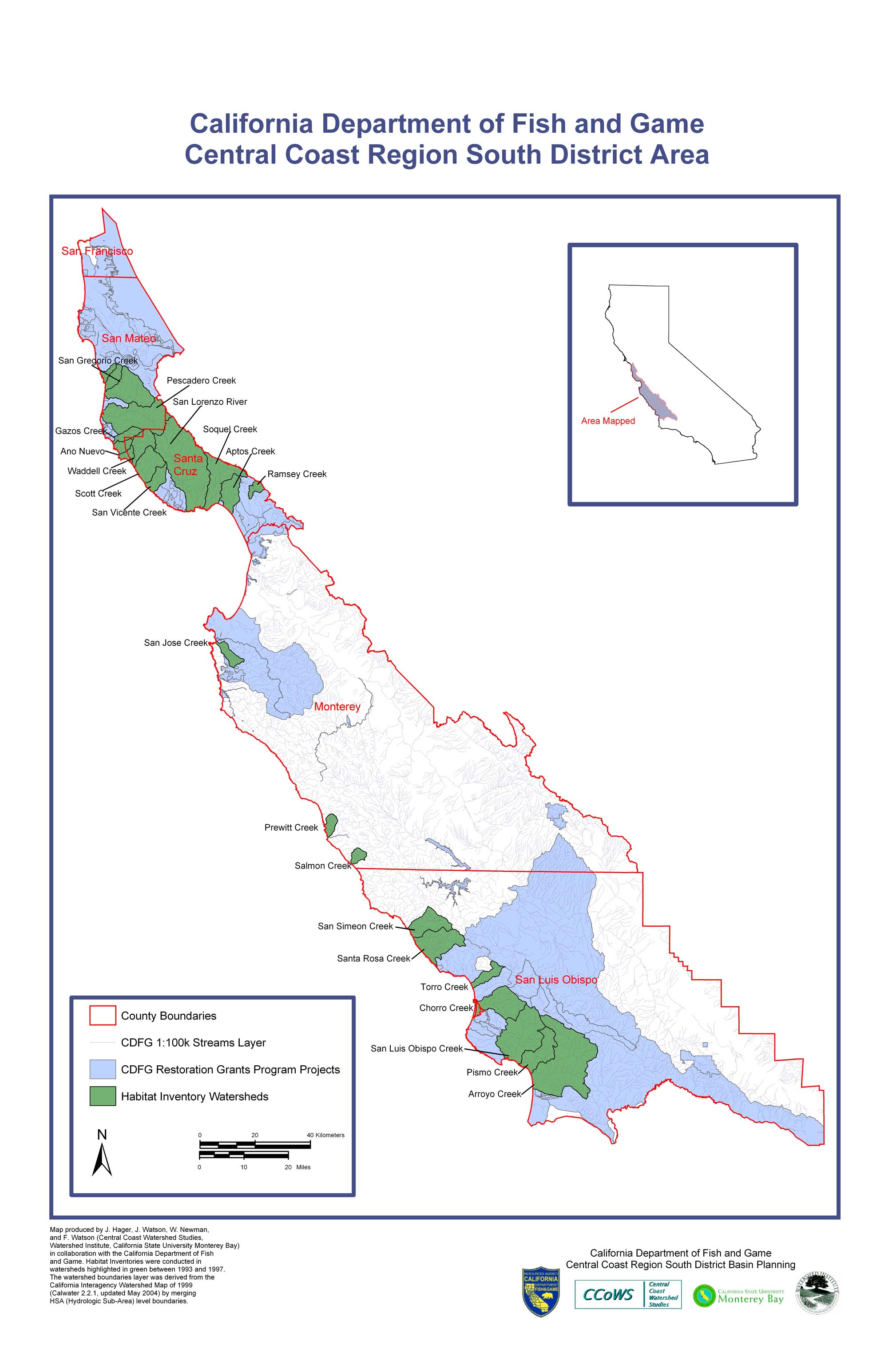
Central Coast Region South District Area
|
jpeg |
Map produced by J. Hager, W. Newman and F. Watson
(Central Coast Watershed Studies, Watershed Institute,
California State University Monterey Bay) in collaboration
with the California Department of Fish and Game.
Habitat Inventories were conducted in watersheds
highlighted in green between 1993 and 1997. The
watershed boundaries layer was derived from the
California Interagency Watershed Map of 1999
(Calwater 2.2.1, updated May 2004) by merging
HSA (Hydrologic Sub-Area) level boundaries.
|
|

|
|
Download (675kb)
Right Click to Save |
| Developement in Central Coast Region South District Area |
jpeg |
Map produced by J. Hager, J. Watson, J. Casagrande,
W. Newman, and F. Watson (Central Coast Watershed Studies,
Watershed Institute, California State University Monterey Bay)
in collaboration with the California Department of Fish
and Game. Development Projections (2000 Census).
Habitat Inventories were conducted in
watersheds highlighted in green between 1993 and 1997.
The watershed boundaries layer was derived from the
California Interagency Watershed Map of 1999
(Calwater 2.2.1, updated May 2004) by merging
HSA (Hydrologic Sub-Area) level boundaries.
|
|
|
|
Download (494kb)
Right Click to Save |
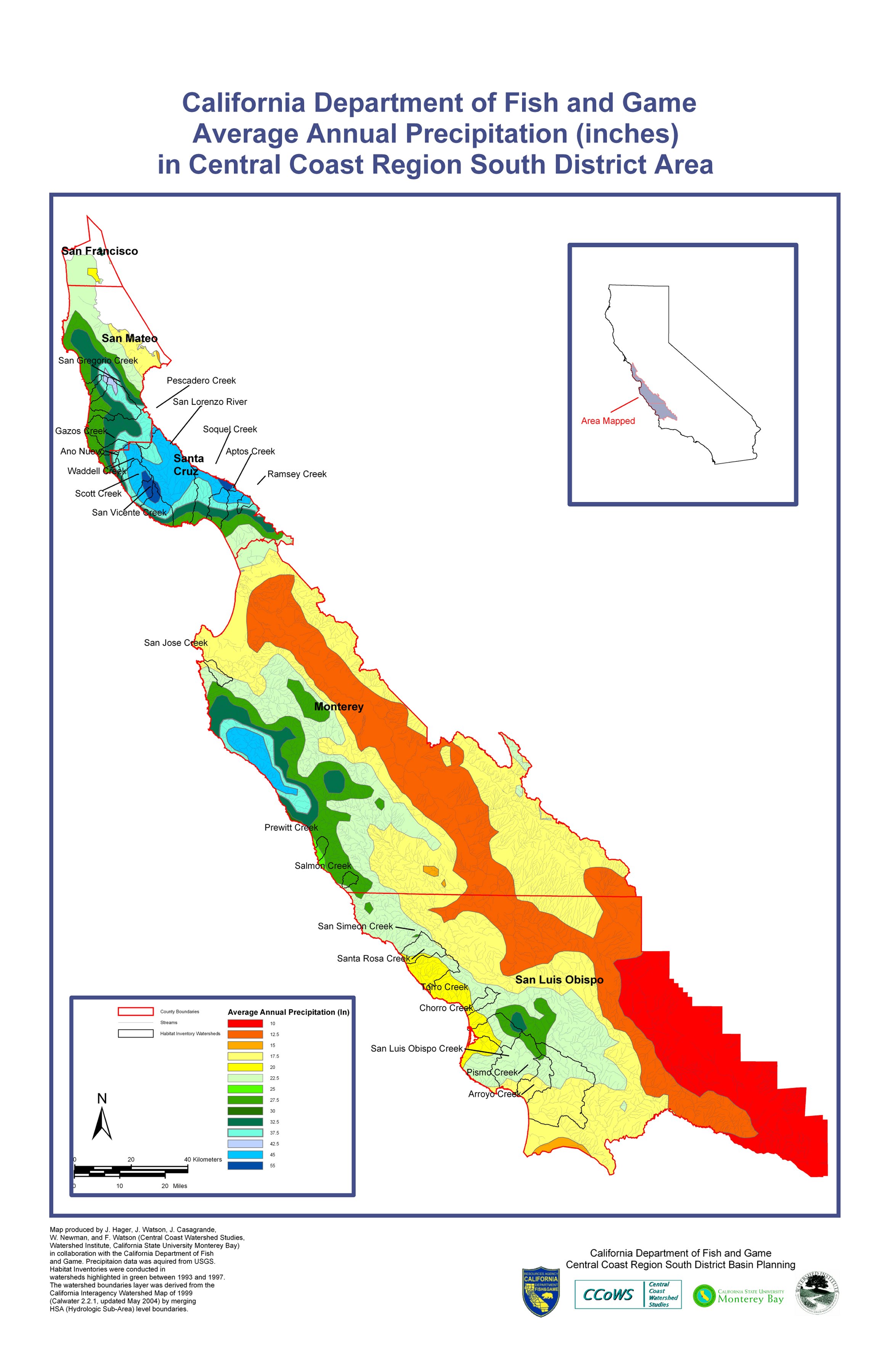
Average Annual Precipitation (Inces) in Central Coast Region South District Area
|
jpeg |
Map produced by J. Hager, J. Watson, J. Casagrande,
W. Newman, and F. Watson (Central Coast Watershed Studies,
Watershed Institute, California State University Monterey Bay)
in collaboration with the California Department of Fish
and Game. Development Projections (2000 Census).
Habitat Inventories were conducted in
watersheds highlighted in green between 1993 and 1997.
The watershed boundaries layer was derived from the
California Interagency Watershed Map of 1999
(Calwater 2.2.1, updated May 2004) by merging
HSA (Hydrologic Sub-Area) level boundaries.
|
|
|
|
|
| Landslide Suceptability in Central Coast Region South District Area |
jpeg |
Map produced by J. Hager, J. Watson, J. Casagrande,
W. Newman, and F. Watson (Central Coast Watershed Studies,
Watershed Institute, California State University Monterey Bay)
in collaboration with the California Department of Fish
and Game. Development Projections (2000 Census).
Habitat Inventories were conducted in
watersheds highlighted in green between 1993 and 1997.
The watershed boundaries layer was derived from the
California Interagency Watershed Map of 1999
(Calwater 2.2.1, updated May 2004) by merging
HSA (Hydrologic Sub-Area) level boundaries.
|
|
|
|
|
| Land Zoning in Central Coast Region South District Area |
jpeg |
Map produced by J. Hager, J. Watson, J. Casagrande,
W. Newman, and F. Watson (Central Coast Watershed Studies,
Watershed Institute, California State University Monterey Bay)
in collaboration with the California Department of Fish
and Game. Development Projections (2000 Census).
Habitat Inventories were conducted in
watersheds highlighted in green between 1993 and 1997.
The watershed boundaries layer was derived from the
California Interagency Watershed Map of 1999
(Calwater 2.2.1, updated May 2004) by merging
HSA (Hydrologic Sub-Area) level boundaries.
|
|
|
|
|