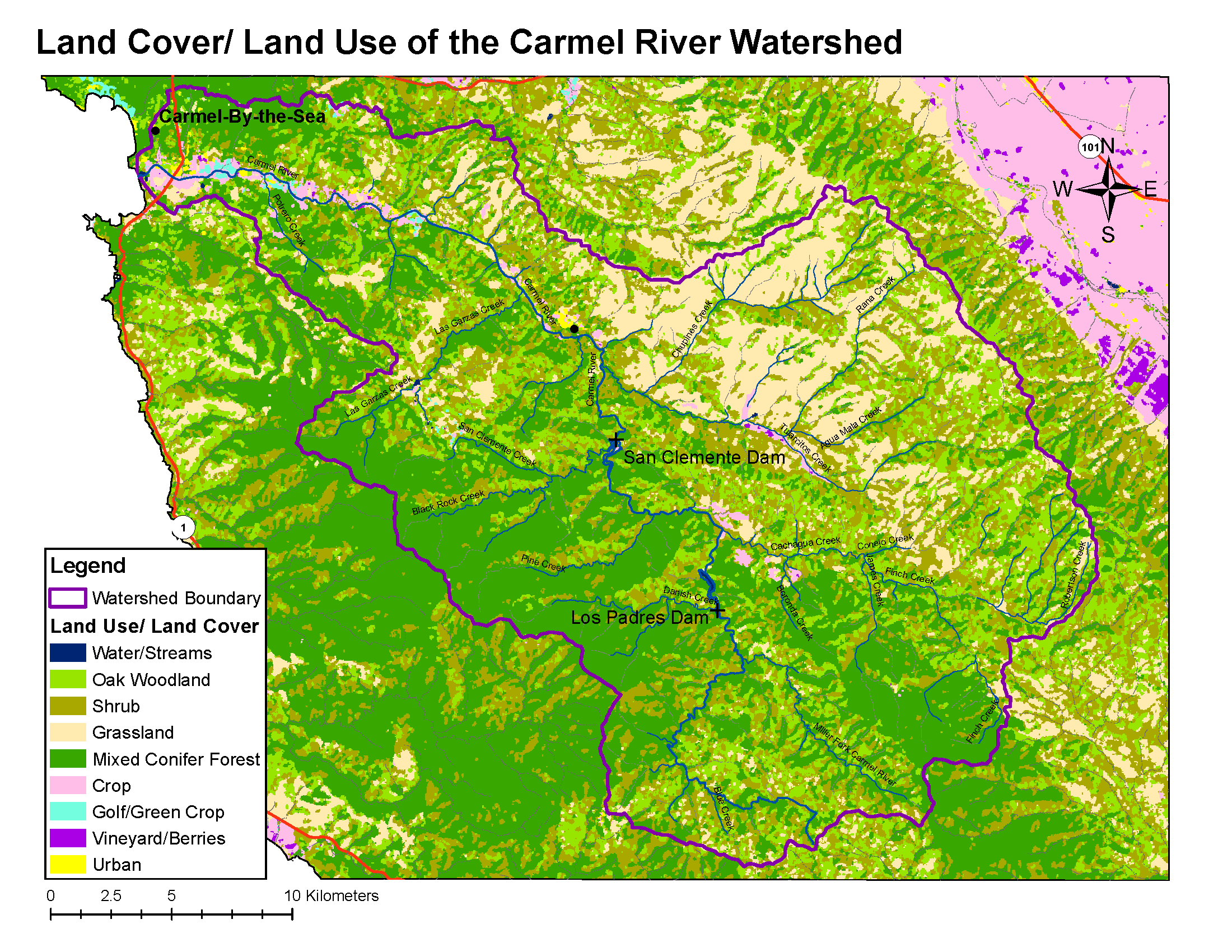
Carmel River Watershed: Map of Land Cover
From CCoWS Wiki

Metadata
- Original source of data: CSUMB Central Coast Watershed Studied Team (CCoWS)
- Map produced by: David Nishijima
- Projected Coordinate System: NAD_1983_UTM_Zone_10N
- Projection: Transverse_Mercatornal
- Geographic Coordinate System: GCS_North_American_1983
- Datum: D_North_American_1983
Processing Steps
- Retrieved land use/cover information from CCoWS website
- Added maps to base map
- Formatted legend, title, compass and scale