File list
From CCoWS Wiki
This special page shows all uploaded files.
| Name | Thumbnail | Size | User | Description | Versions | |
|---|---|---|---|---|---|---|
| 11:35, 26 September 2021 | ETMC.jpg (file) |  |
10 KB | MikaelaB | 1 | |
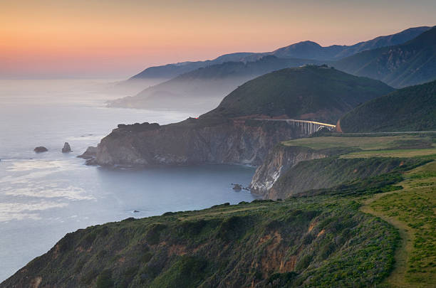
| 13:43, 18 March 2021 | BigSur.jpg (file) |  |
35 KB | IsaacN | Photo of the Big Sur Coastline. Photo from https://www.gettyimages.com/photos/big-sur?phrase=big%20sur&sort=mostpopular | 1 |
| 13:12, 18 March 2021 | California.png (file) |  |
2.18 MB | ConnieM | 5 | |
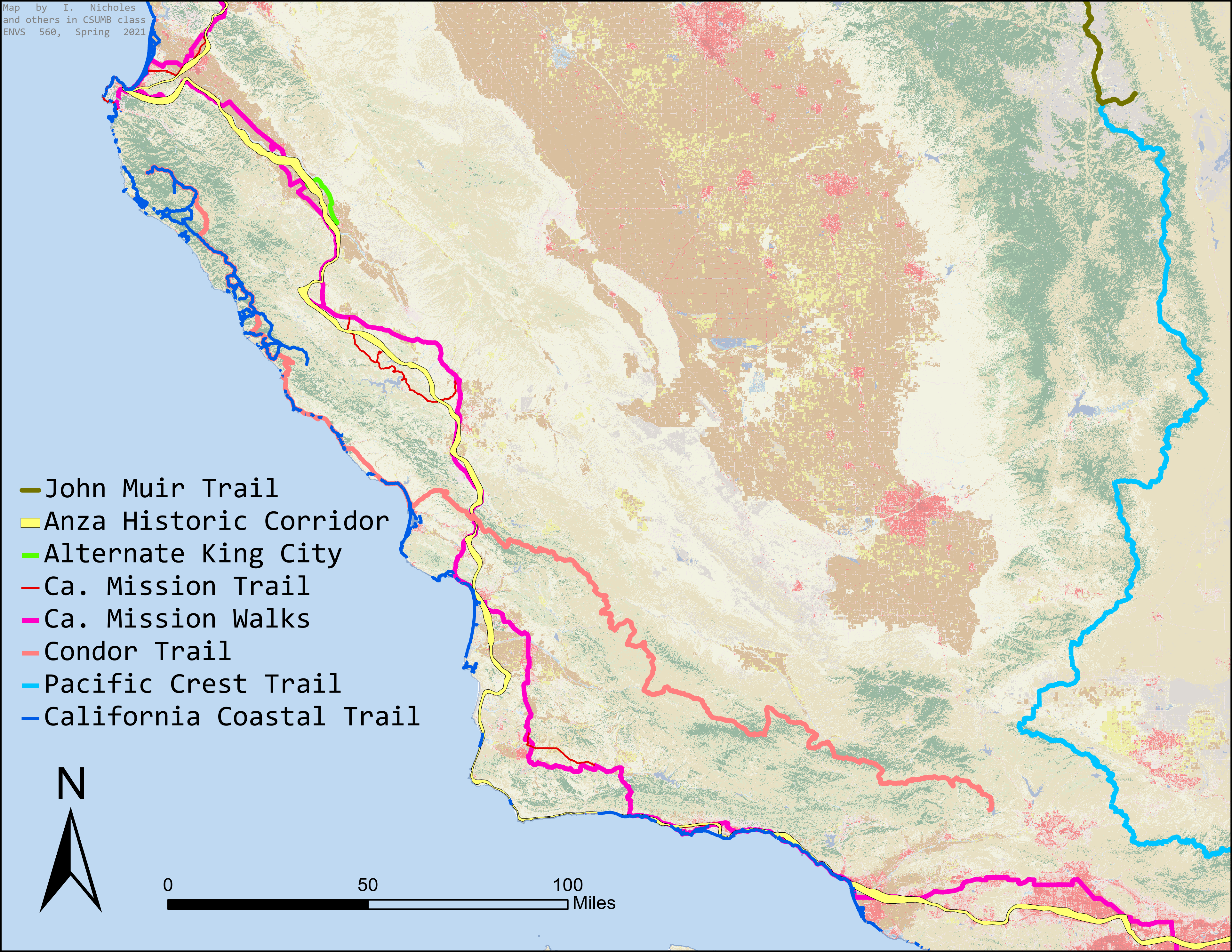
| 13:08, 18 March 2021 | CentralCalTrails.jpeg (file) |  |
3.9 MB | IsaacN | Significant Trails within Central California Area crossing through the proposed area belonging to The Range of the Condor National Heritage Area. | 1 |
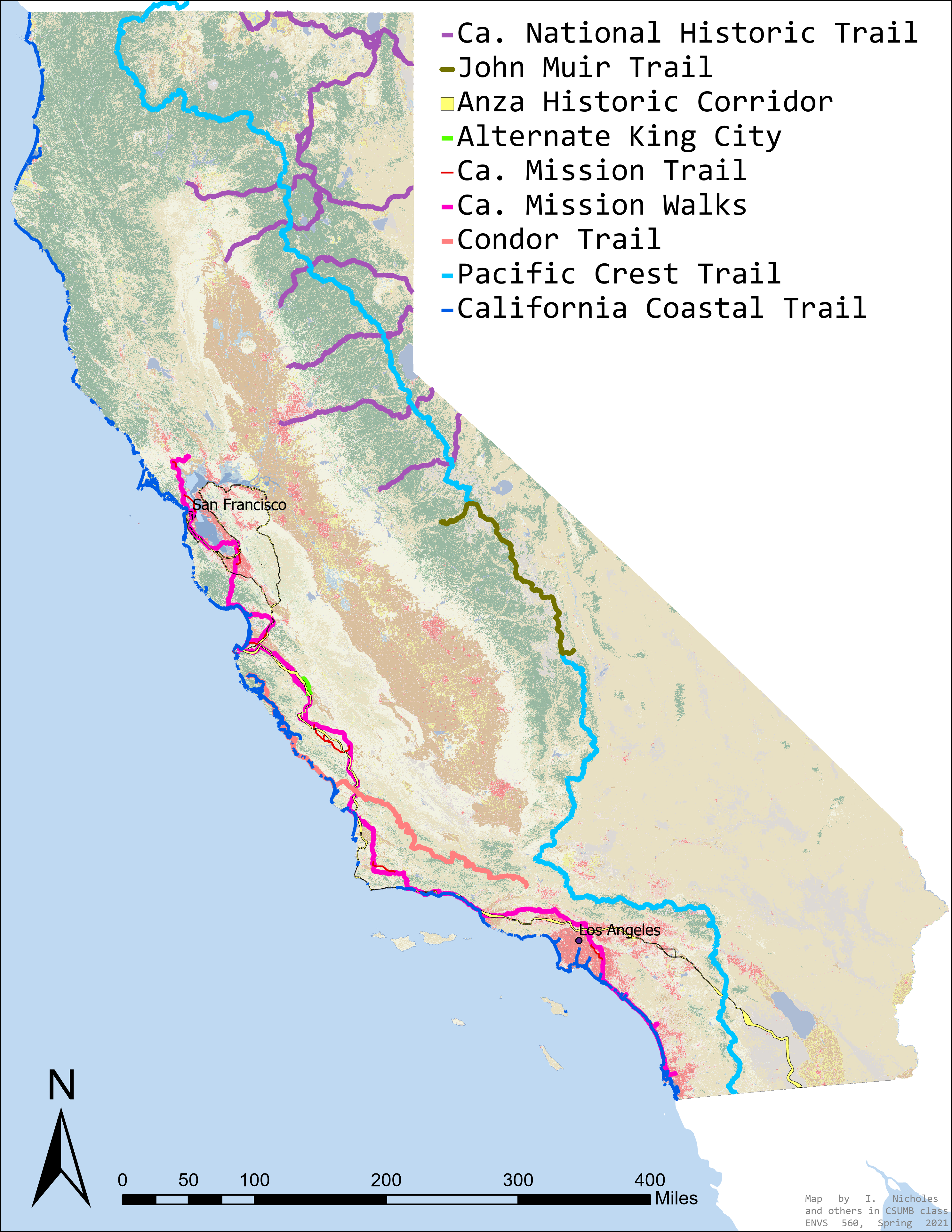
| 13:06, 18 March 2021 | CaliforniaTrails.jpg (file) |  |
2.97 MB | IsaacN | Significant Trails of California crossing through the proposed area belonging to The Range of the Condor National Heritage Area. | 1 |
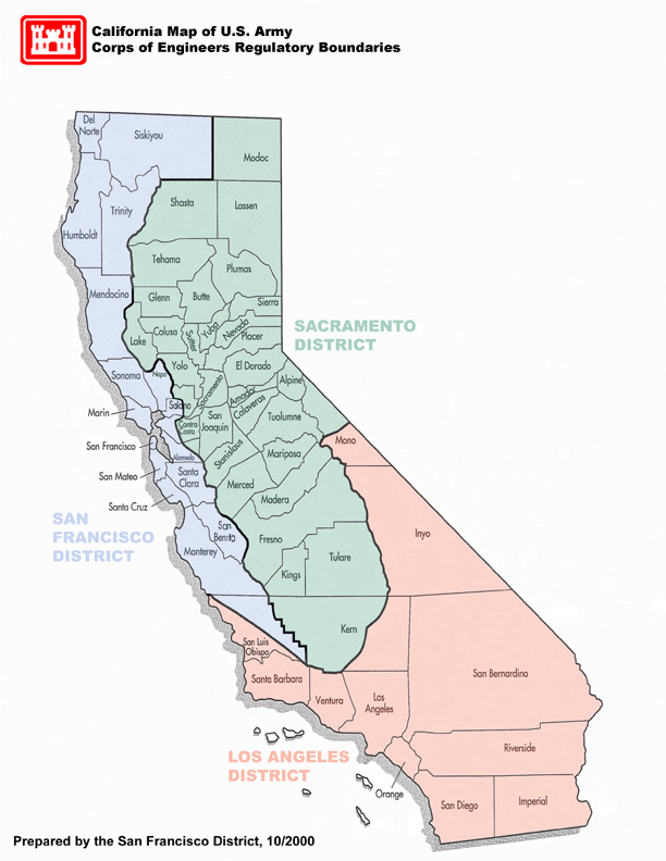
| 13:00, 18 March 2021 | USACE district boundary.jpg (file) |  |
209 KB | BrookeF | 1 | |
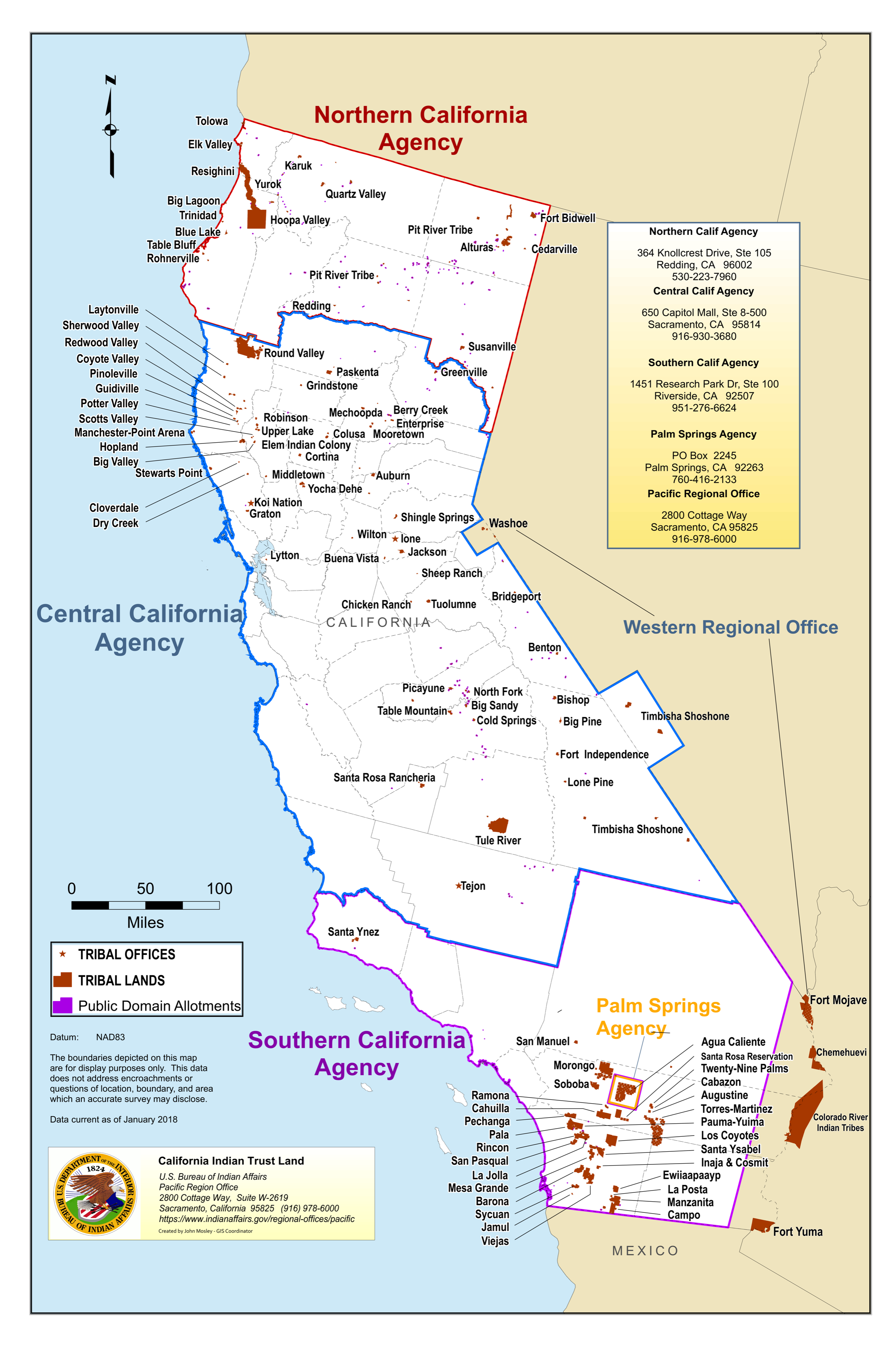
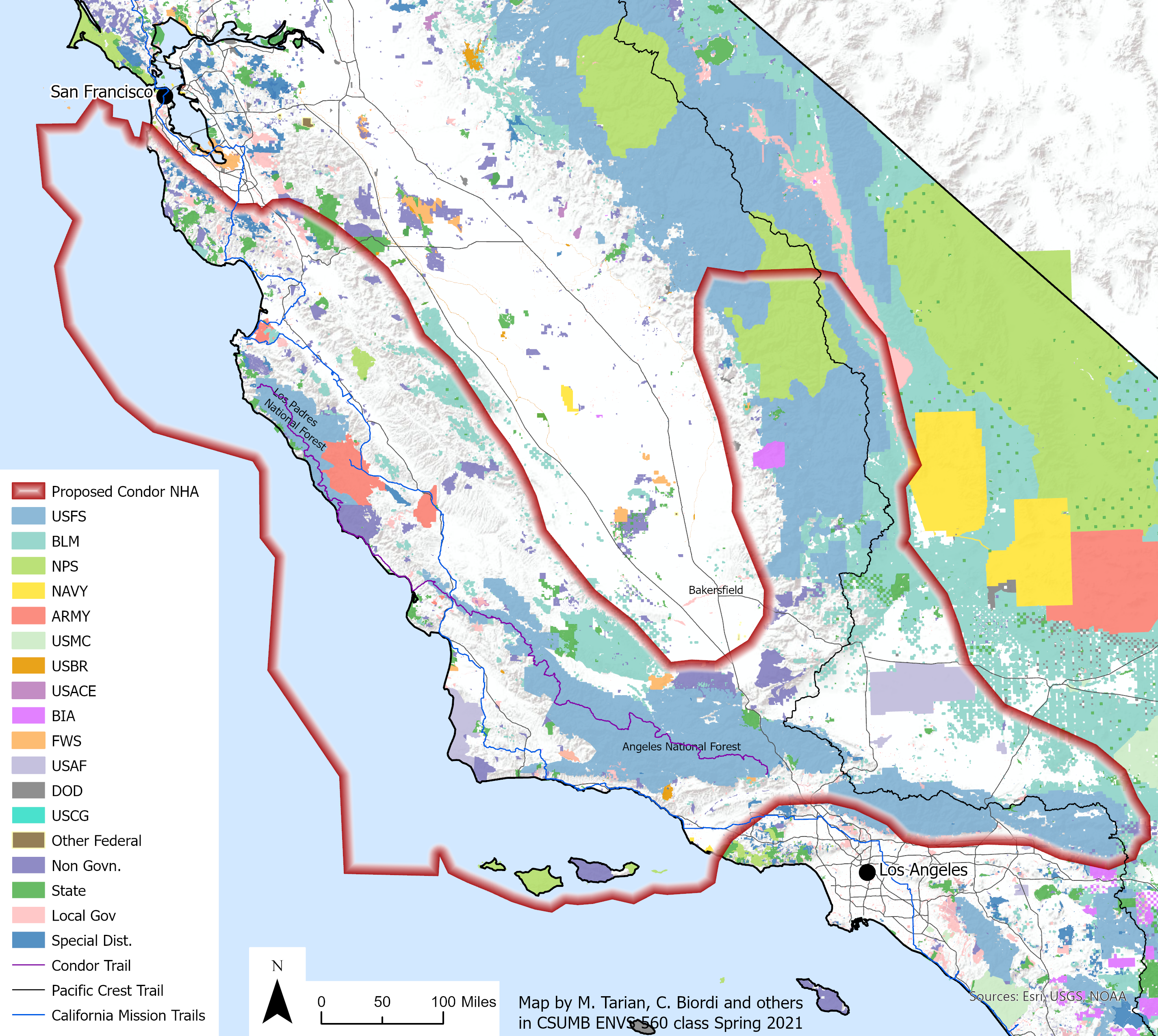
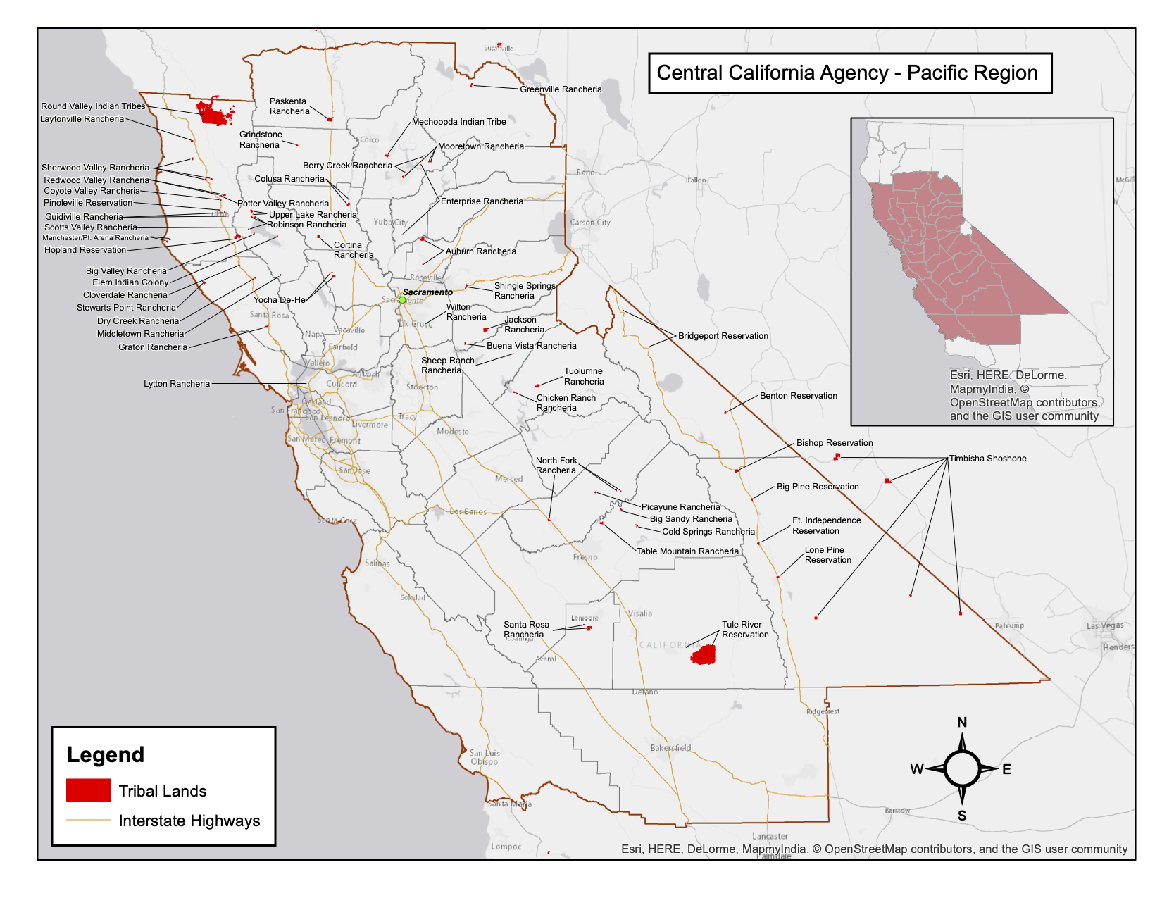
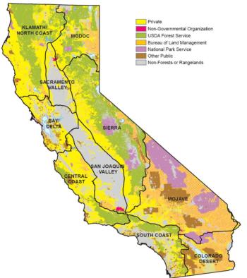
| 12:59, 18 March 2021 | California Agency Jurisdictional Map.png (file) |  |
9.18 MB | ConnieM | 1 | |
| 16:00, 16 March 2021 | 210308 CNHA SMA.png (file) |  |
4.44 MB | MichelleT | Reverted to version as of 22:58, 16 March 2021 | 13 |
| 15:12, 16 March 2021 | USBR Logo.png (file) | 21 KB | AdrianG | Logo for the US Bureau of Reclamation | 1 | |
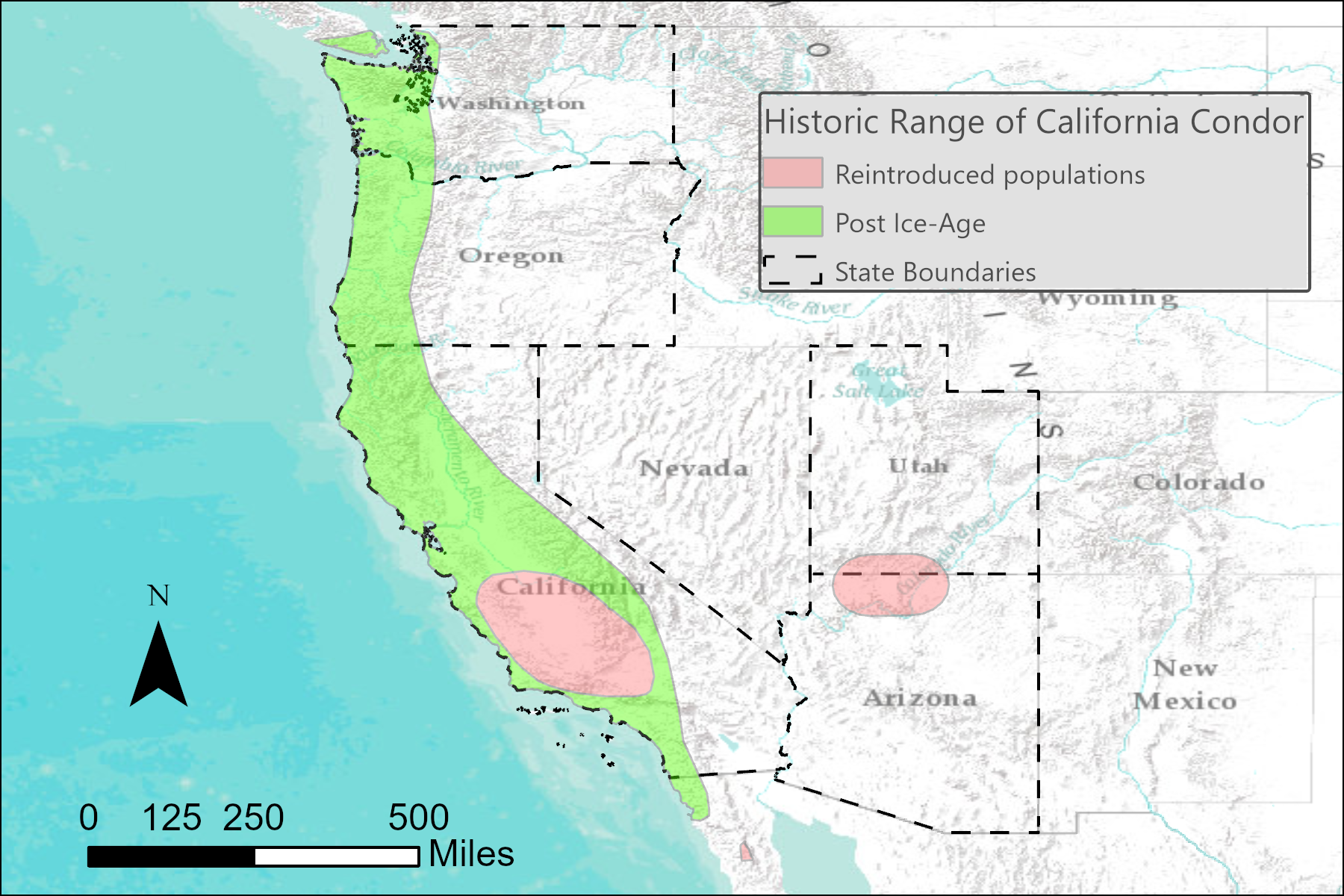
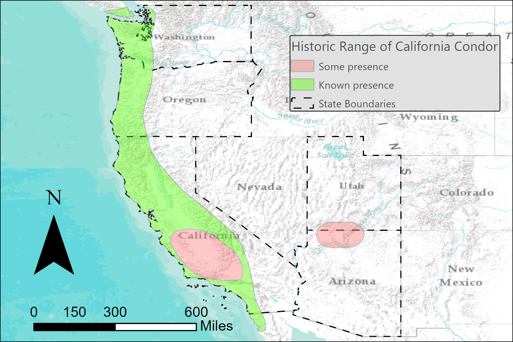
| 13:44, 16 March 2021 | Post iceage condor2.png (file) |  |
1.55 MB | AdrianG | California condor range reduction post ice-age, pre-European colonization of the North America. As well as, reintroduced populations. | 1 |
| 16:29, 9 March 2021 | VentanaWildlifeSociety.png (file) |  |
27 KB | AubrieH | Logo for the Ventana Wildlife Society. | 1 |
| 17:25, 8 March 2021 | Post iceage condor.png (file) |  |
1.56 MB | AdrianG | Condor population after Ice-Age, and reintroduced populations | 1 |
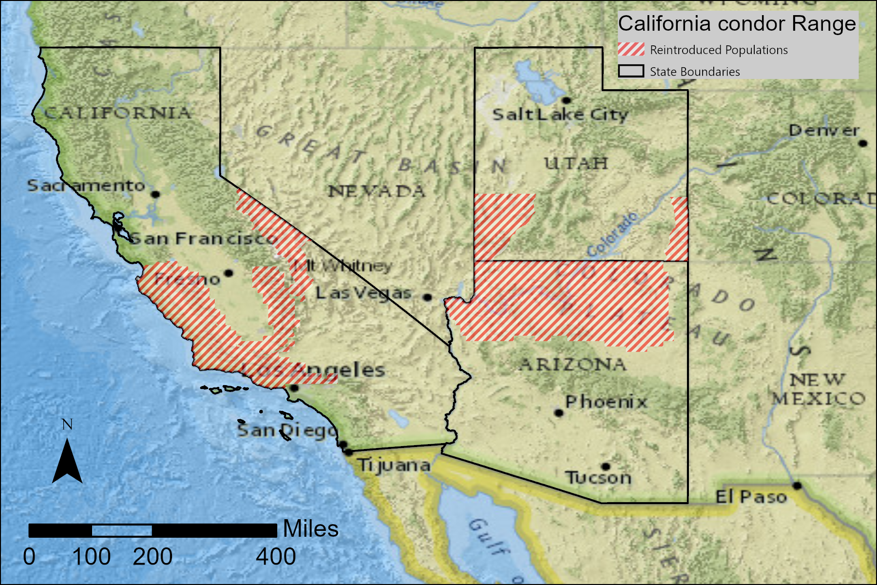
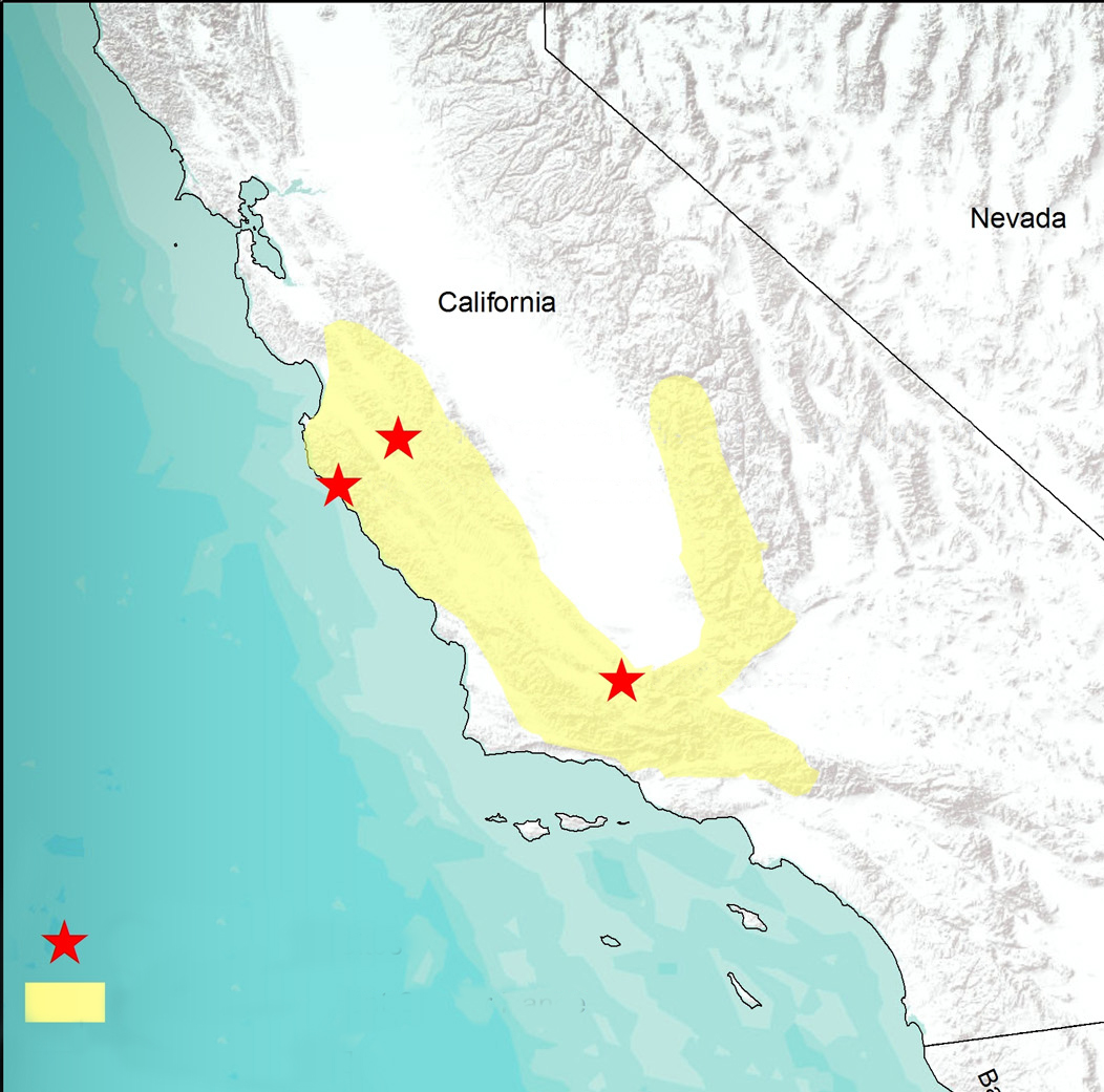
| 17:13, 8 March 2021 | Current condor range.png (file) |  |
2.7 MB | AdrianG | Current condor range as of 2019. Shapefile source: USFWS | 1 |
| 11:29, 6 March 2021 | Central California Agency Jurisdictional Map.png (file) |  |
865 KB | ConnieM | 1 | |
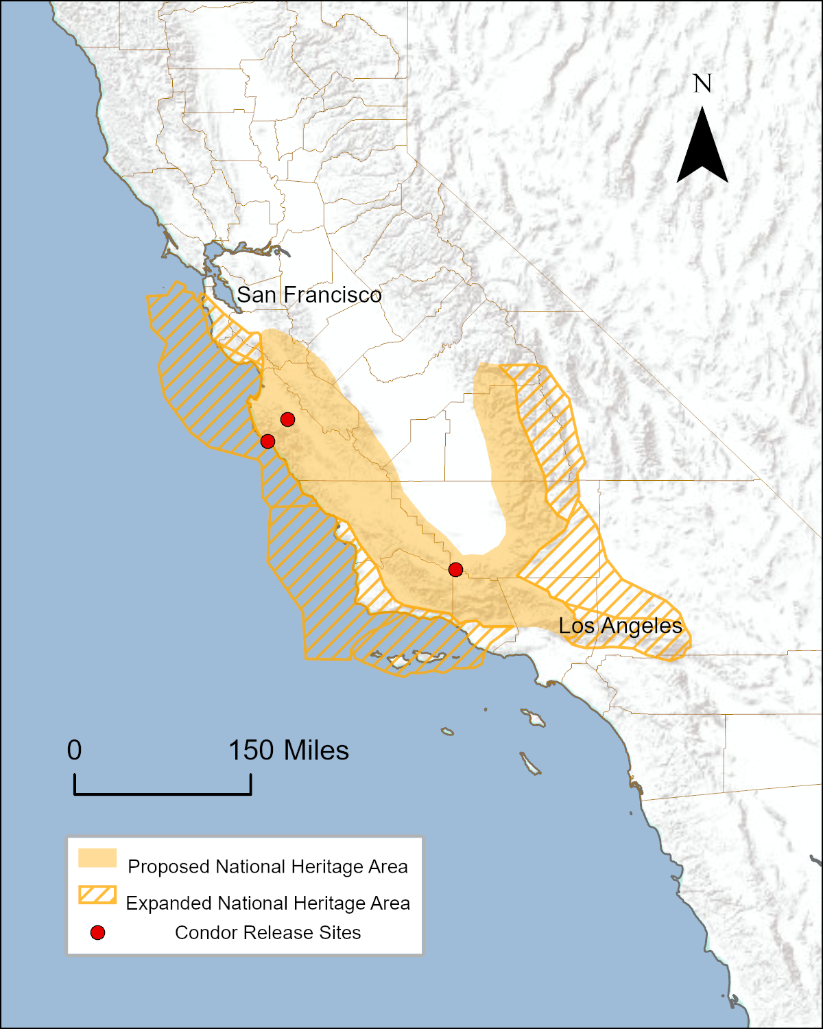
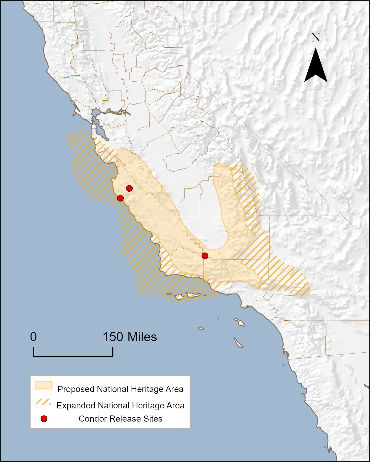
| 20:27, 5 March 2021 | NHAProposal.png (file) |  |
1,007 KB | AubrieH | Proposed area for the Range of the Condor National Heritage Area based on California Condor range and habitat. | 1 |
| 17:56, 5 March 2021 | CondorNHA SMA.png (file) |  |
157 KB | CaliforniaB | 1 | |
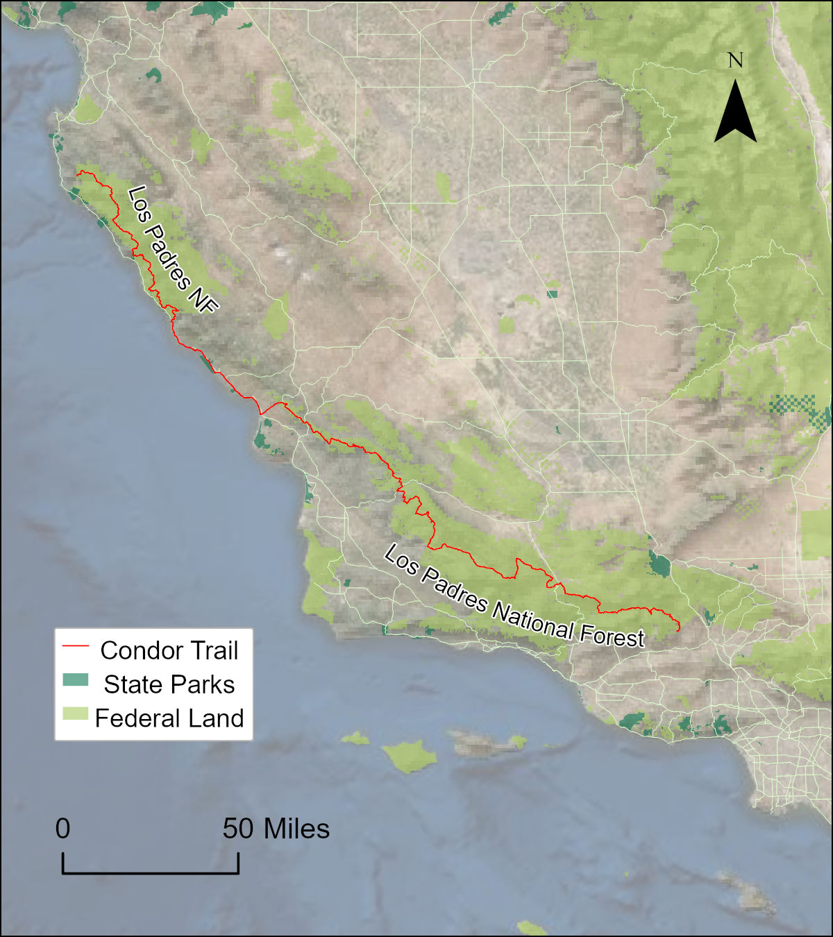
| 18:14, 4 March 2021 | CondorTrail.pdf (file) | 954 KB | AubrieH | A map of the Condor Trail through the Los Padres National Forest. | 1 | |
| 17:59, 4 March 2021 | CondorTrail.png (file) |  |
1.11 MB | AubrieH | Map of the Condor Trail through Los Padres National Forest. | 1 |
| 14:40, 4 March 2021 | Historical Range of California condor.png (file) |  |
1.56 MB | AdrianG | Historic range | 1 |
| 11:47, 4 March 2021 | US-FWS-logo.png (file) | 23 KB | LissaG | 1 | ||
| 21:02, 3 March 2021 | Condor Trail.png (file) |  |
1.55 MB | AubrieH | Map of the Condor Trail through Los Padres National Forest. | 1 |
| 20:42, 3 March 2021 | Condor Trail.pdf (file) | 1.2 MB | AubrieH | Map of the Condor Trail through the Los Padres National Forest. | 1 | |
| 20:40, 3 March 2021 | Condor Trail.jpg (file) |  |
242 KB | AubrieH | Map of the Condor Trail through the Los Padres National Forest. | 1 |
| 19:25, 3 March 2021 | NHA Proposal.pdf (file) | 620 KB | AubrieH | Condor National Heritage Area including release sites for the California Condor. | 1 | |
| 19:00, 3 March 2021 | Condor NHA.png (file) |  |
448 KB | AubrieH | Proposed Range of the Condor National Heritage Area. | 1 |
| 22:29, 2 March 2021 | California condor FWS photo.jpg (file) |  |
618 KB | AdrianG | 1 | |
| 22:23, 2 March 2021 | California condor FWS thumb.jpg (file) |  |
8 KB | AdrianG | CC_11_flying high | 1 |
| 13:44, 2 March 2021 | Juaneno 400x400.gif (file) |  |
268 KB | ConnieM | 1 | |
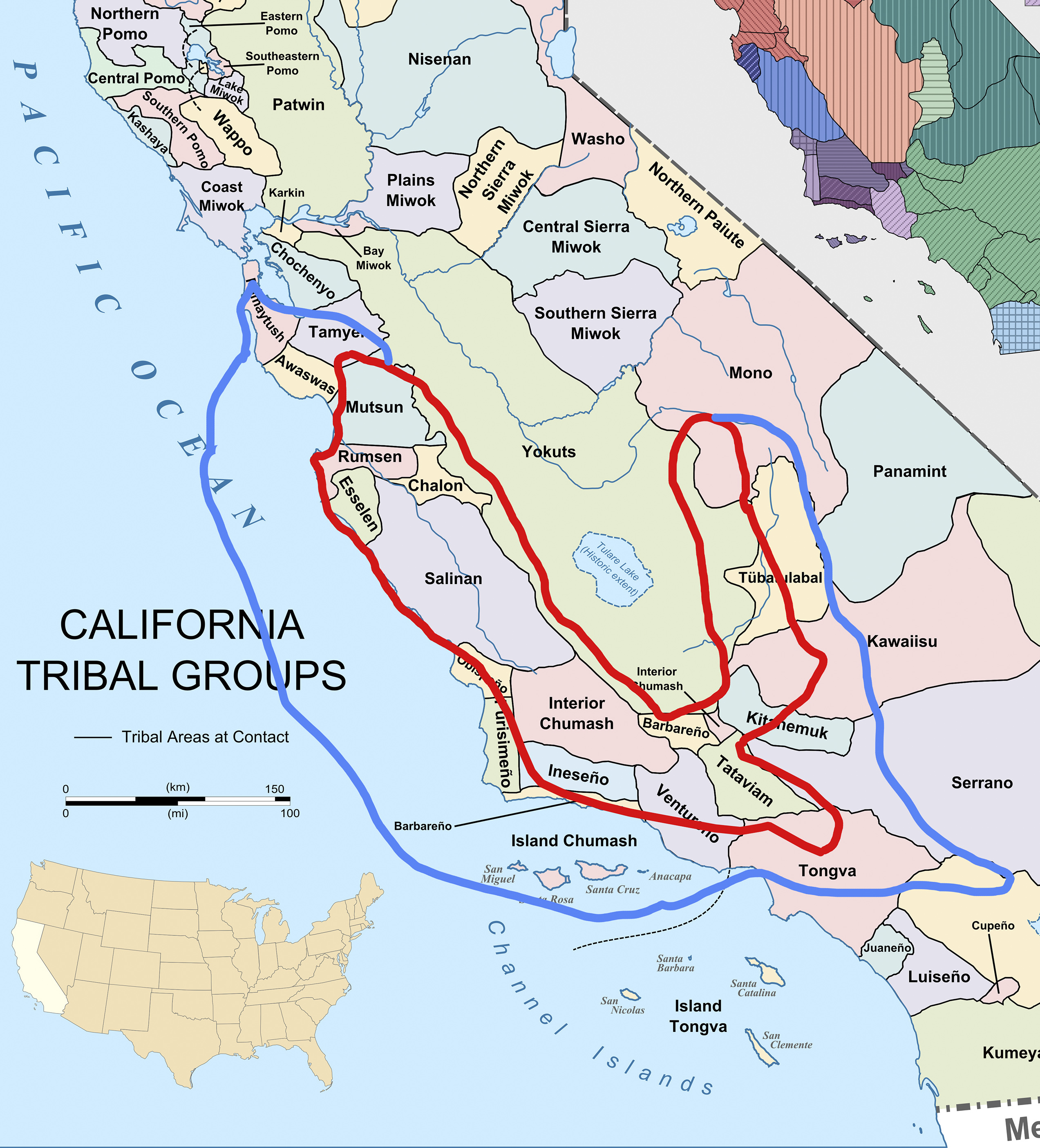
| 13:31, 2 March 2021 | Tribes expanded focused.jpg (file) |  |
1.68 MB | ConnieM | 1 | |
| 18:51, 26 February 2021 | NOAA logo.png (file) | 109 KB | LissaG | 1 | ||
| 15:02, 26 February 2021 | 97226display.jpg (file) |  |
23 KB | IsaacN | 1 | |
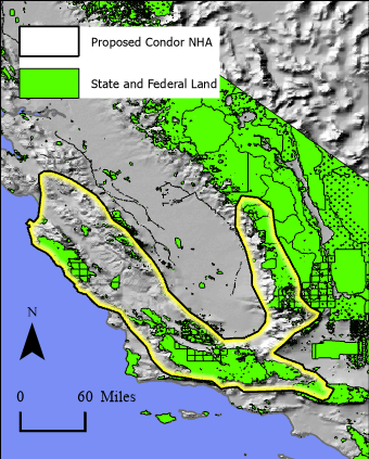
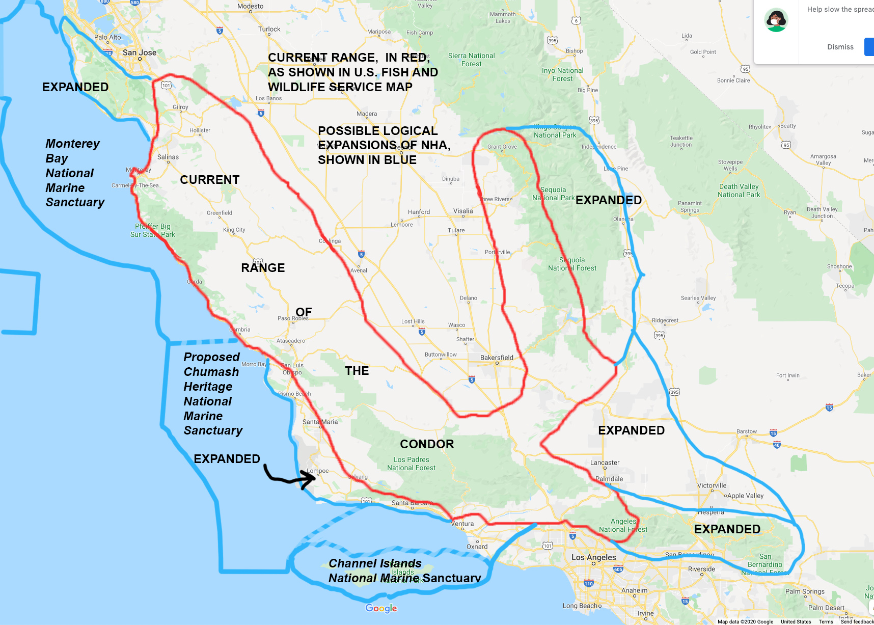
| 14:46, 25 February 2021 | ExpansionWithSanctuaries.jpg (file) |  |
750 KB | ShawnM | Proposed Range of the Condor National Heritage Area planning map - 2/23/21 Source: Don Gruber | 1 |
| 14:38, 25 February 2021 | Basemap.jpg (file) |  |
400 KB | ShawnM | 1 | |
| 22:49, 24 February 2021 | BHA.jpg (file) |  |
125 KB | EmmaD | Backcountry Hunters and Anglers | 1 |
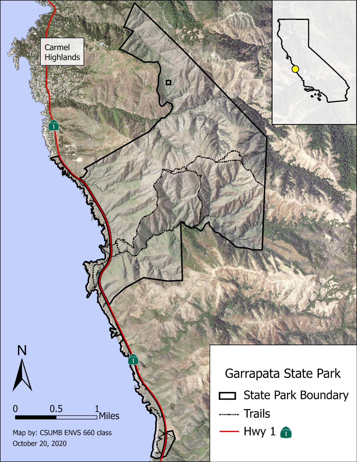
| 19:33, 24 October 2020 | GSP LocationMap.png (file) |  |
4.78 MB | MikaelaB | 1 | |
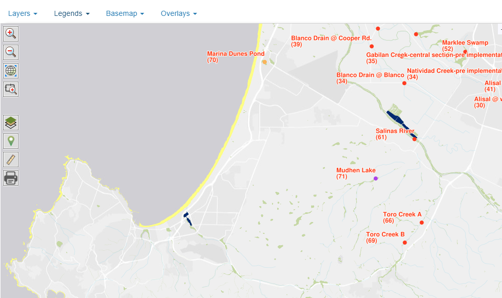
| 13:50, 9 April 2020 | Combined.jpg (file) |  |
470 KB | JamieS | 1 | |
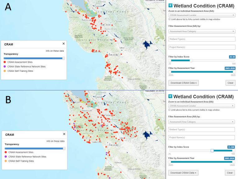
| 20:35, 8 April 2020 | Wikicram.jpg (file) |  |
253 KB | JamieS | 2 | |
| 14:27, 8 April 2020 | WatershedsMBNMS.png (file) |  |
317 KB | LauraF | 1 | |
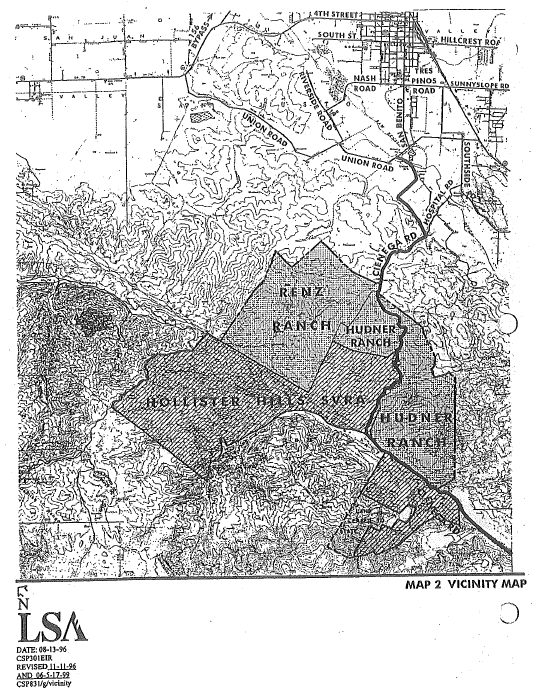
| 12:25, 8 April 2020 | HHSVRA-HR.PNG (file) |  |
168 KB | EricW | Hollister hills SVRA Hunder Renz acquisitions | 1 |
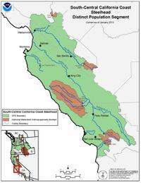
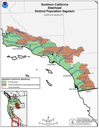
| 12:13, 8 April 2020 | SouthCentralCaliforniaCoastSteelhead.jpg (file) |  |
14 KB | BryanVO | 1 | |
| 12:05, 8 April 2020 | CentralCaliforniaCoastSteelhead.jpg (file) |  |
15 KB | BryanVO | 1 | |
| 11:54, 8 April 2020 | SouthcentralCalcoast steelhead.jpg (file) |  |
14 KB | BryanVO | 1 | |
| 09:42, 8 April 2020 | SouthernCalCoastSteelhead noaa.png (file) |  |
1.09 MB | BryanVO | 1 | |
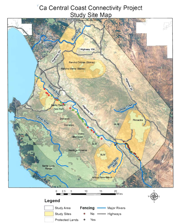
| 21:45, 7 April 2020 | HuberEtAl2014 Page41.png (file) |  |
2.2 MB | JanettePJ | 1 | |
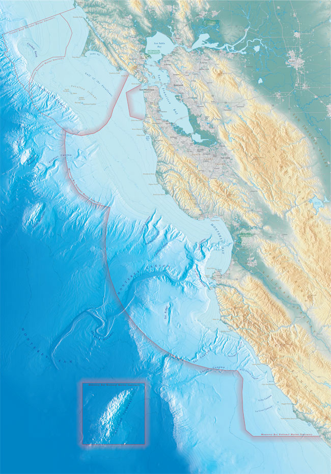
| 13:04, 7 April 2020 | Mbnms lg.jpg (file) |  |
169 KB | RyanS | MBNMS boundaries map | 1 |
| 23:29, 6 April 2020 | Mud.jpg (file) |  |
501 KB | JamieS | 1 | |
| 21:57, 6 April 2020 | BSLT Pathways Map.jpg (file) |  |
779 KB | MattM | 2 | |
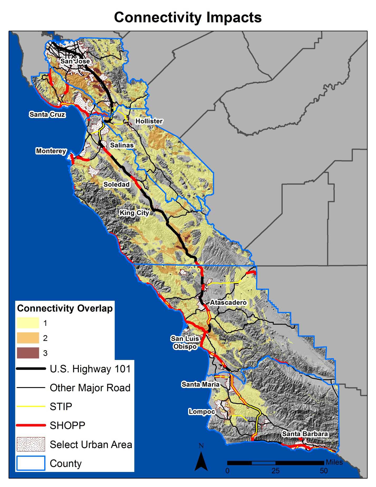
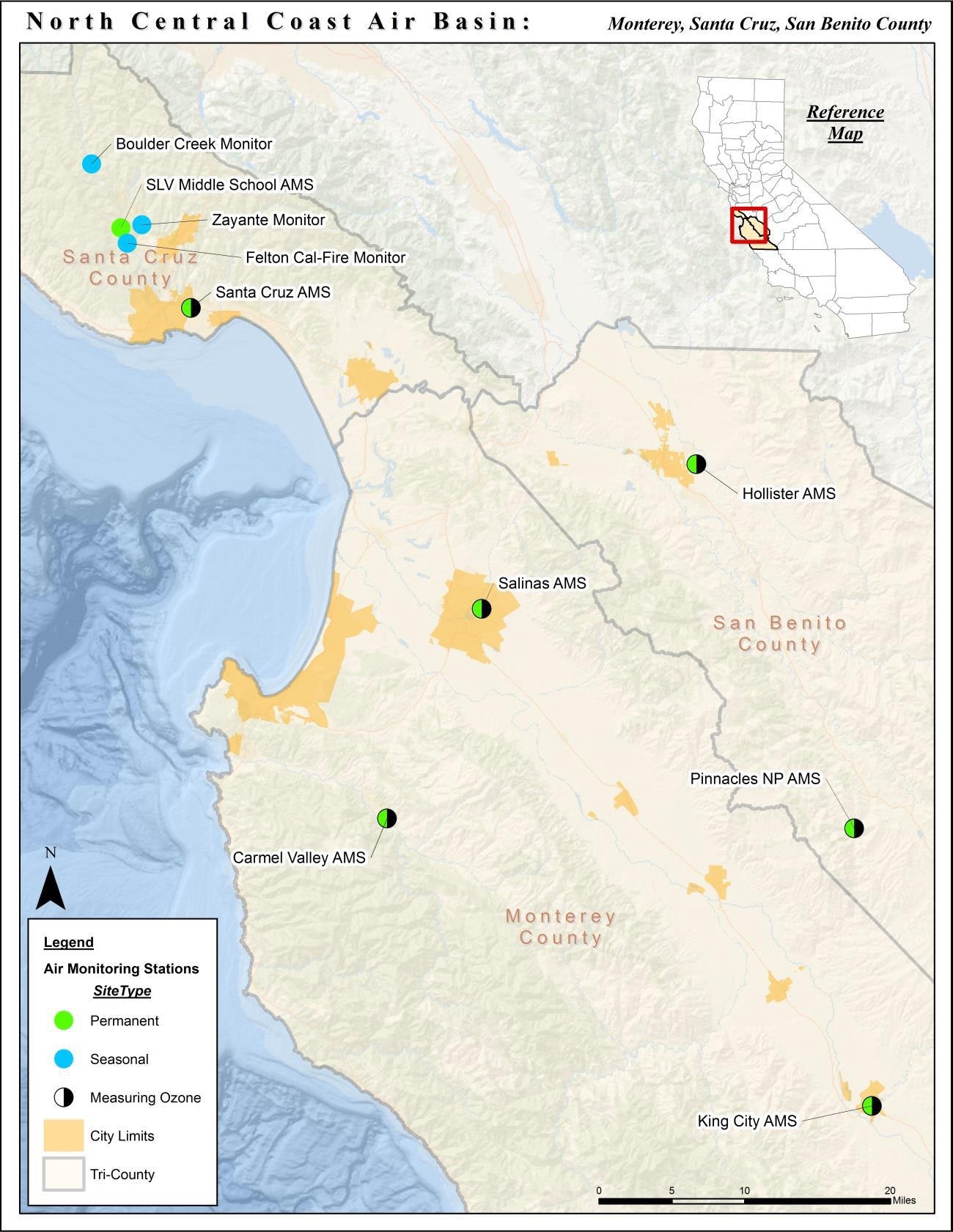
| 21:50, 6 April 2020 | Nccab.jpg (file) |  |
311 KB | EricW | north central coast air basin map | 1 |
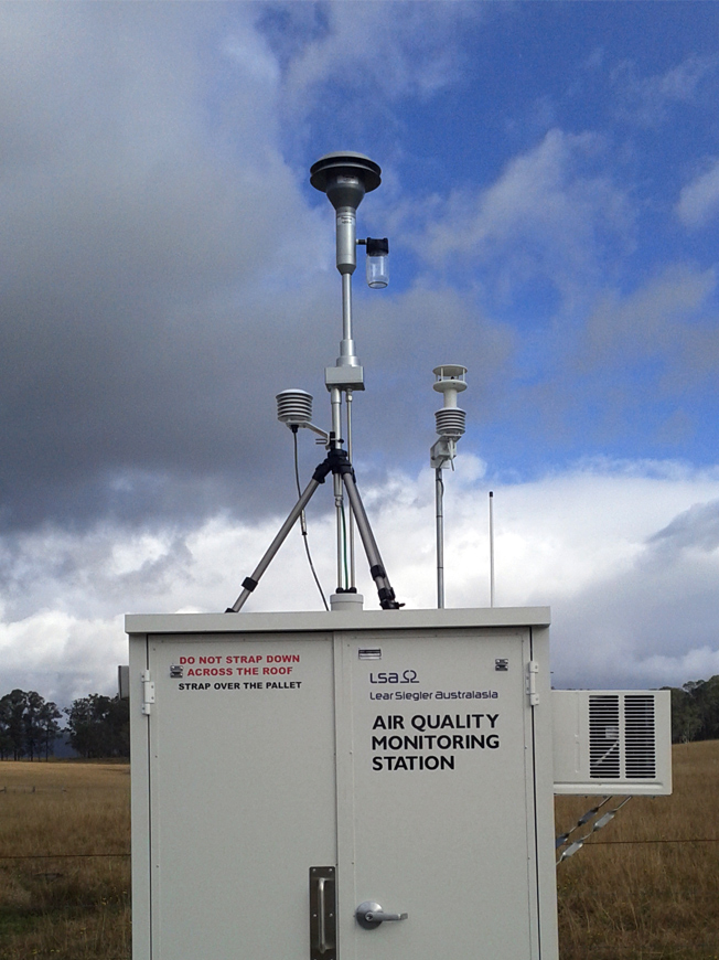
| 21:33, 6 April 2020 | Bayarea monitoring station.jpg (file) |  |
294 KB | EricW | Air Monitoring station in the bay area | 1 |
| 21:31, 6 April 2020 | InterLakeTunnel.JPG (file) |  |
23 KB | TedR | 1 |
First page |
Previous page |
Next page |
Last page |