File list
From CCoWS Wiki
This special page shows all uploaded files.
| Name | Thumbnail | Size | User | Description | Versions | |
|---|---|---|---|---|---|---|
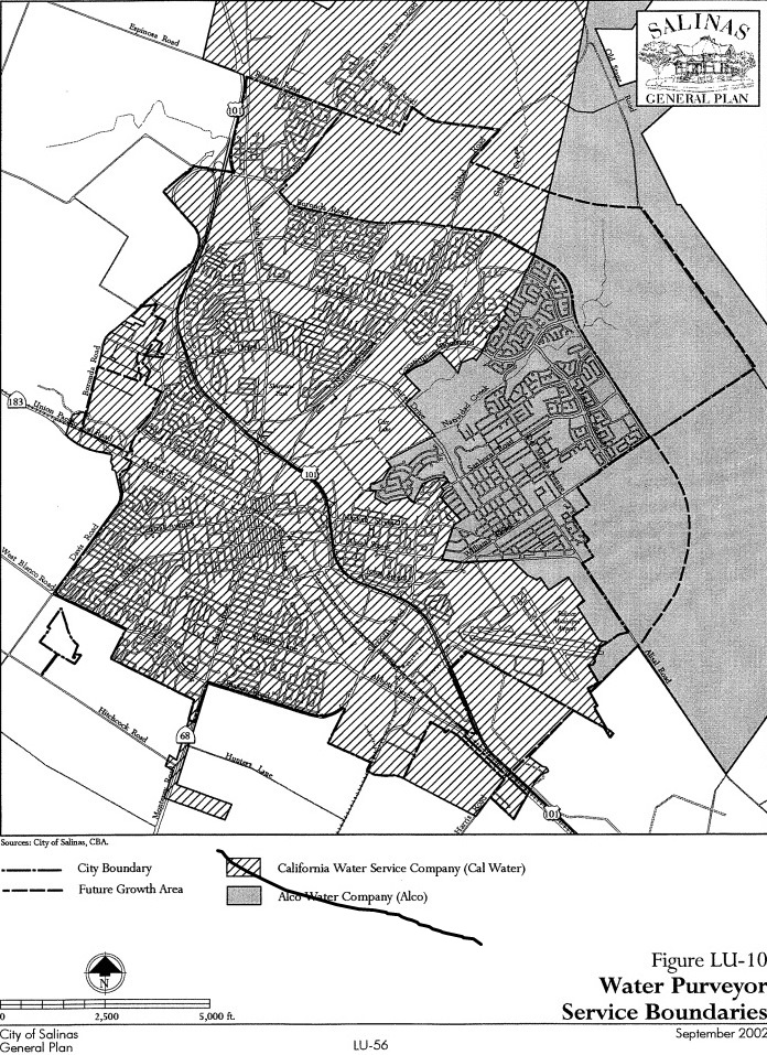
| 12:34, 14 April 2016 | SalinasWaterServiceBoundaries.jpg (file) |  |
367 KB | Gabem | 1 | |
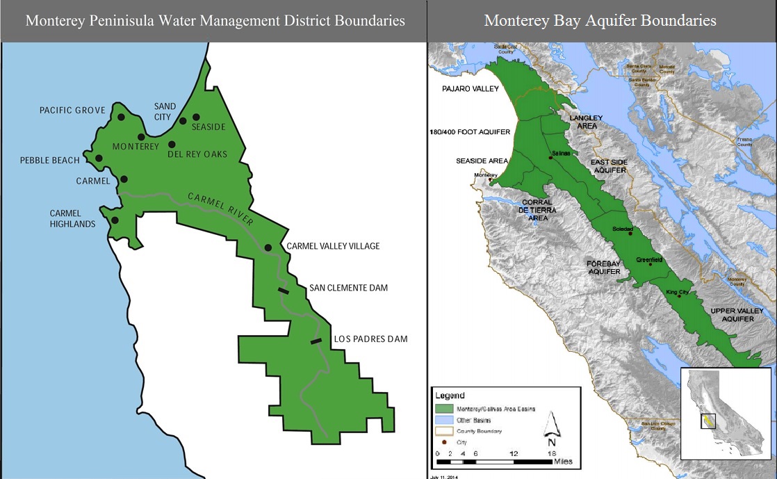
| 12:06, 14 April 2016 | MPWMD and Aquifer Boundary.jpg (file) |  |
213 KB | Gabem | Monterey Bay Water District and aquifer boundaries. | 1 |
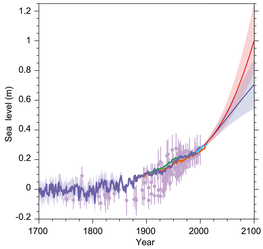
| 20:37, 3 April 2016 | IPCC Sea Level 2013.jpg (file) |  |
255 KB | Gabem | 1 | |
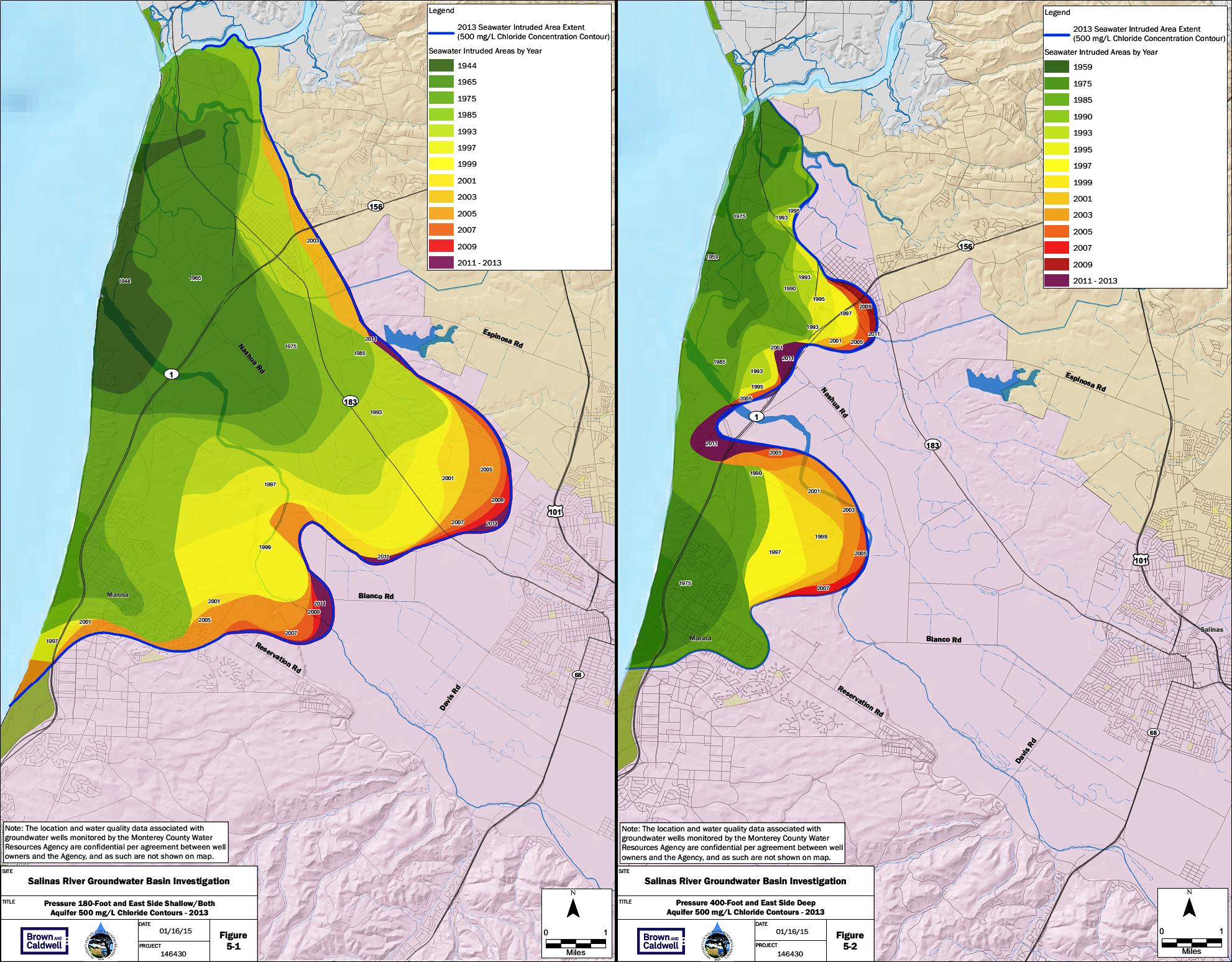
| 15:56, 29 March 2016 | 1944to2013-intrusion.jpg (file) |  |
518 KB | Gabem | Summarizes the rates of seawater instrusion from 1944 to 2013 for the 180-foot (left) and 400-foot (right) aquifer in the Salinas Valley, as measured from the historical extents. Chloride concentration is used as an indicator of seawater intruded into... | 1 |
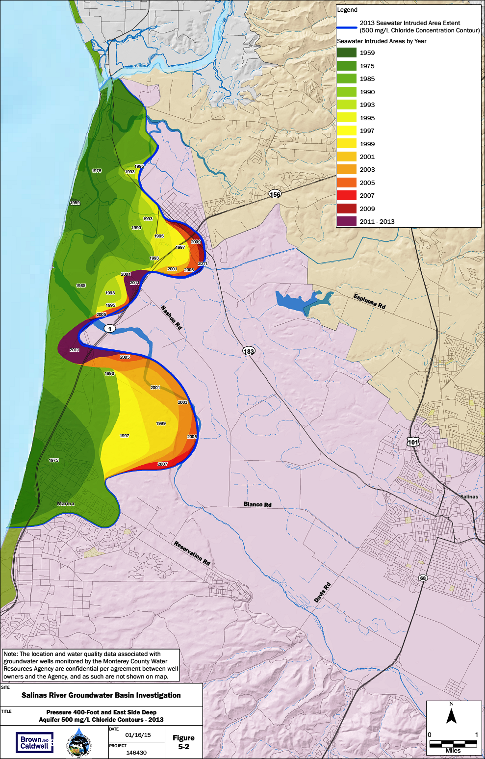
| 15:35, 29 March 2016 | 400ft-intrusion.png (file) |  |
1.18 MB | Gabem | Summarizes the rates of seawater instrusion from 1944 to 2013 for the 400-foot aquifer in the Salinas Valley, as measured from the historical extents. Chloride concentration is used as an indicator of seawater intruded into aquifers because chloride b... | 1 |
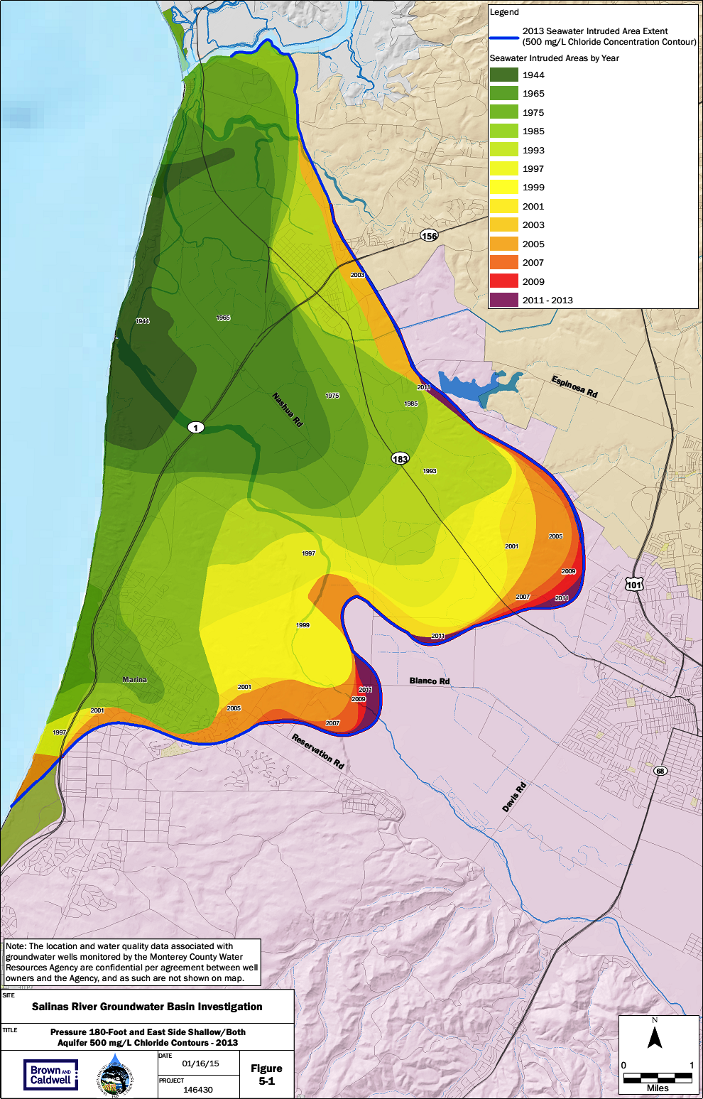
| 15:29, 29 March 2016 | 180ft-intrusion.png (file) |  |
1.14 MB | Gabem | Summarizes the rates of seawater instrusion from 1944 to 2013 for the 180-foot aquifer in the Salinas Valley, as measured from the historical extents. Chloride concentration is used as an indicator of seawater intruded into aquifers because chloride b... | 1 |