Difference between revisions of "Carneros Watershed: Precipitation 2"
From CCoWS Wiki
(New page: thumb * PDF file - for printing * PNG file ...) |
(→Alternative Version) |
||
| (9 intermediate revisions by one user not shown) | |||
| Line 1: | Line 1: | ||
| − | [[Image: | + | [[Image:CarnerosWatershed Precipitation2.png|200px|thumb]] |
| − | * [[Media:CarnerosWatershed | + | * [[Media:CarnerosWatershed Precipitation2.pdf|PDF file - for printing]] |
| − | * [[Media: | + | * [[Media:CarnerosWatershed Precipitation2.png|PNG file]] |
== Metadata == | == Metadata == | ||
| Line 8: | Line 8: | ||
* Data anlysis: ArcMap | * Data anlysis: ArcMap | ||
* Map produced by: Adam J. Purdy | * Map produced by: Adam J. Purdy | ||
| − | * Coordinate | + | * Projected Coordinate System: NAD 1983 UTM Zone 10 |
| − | * | + | ** Projection: Transverse Mercator |
| + | * Geographic Coordinate System: NAD 1983 | ||
| + | ** Dataum (North American 1983 | ||
| + | ** Prime Meridian: Greenwich | ||
== Processing Steps == | == Processing Steps == | ||
| − | + | * Convert ASCII grid file to Raster using Conversion Tools | |
| − | + | * Define Projection | |
| − | + | * Crop Raster to Central California Coast using Spatial Analyst Tool | |
| + | * Create contour lines from the raster image using the Spacial Analyst Tool | ||
| + | * Symbolize contour lines by width and choose to label | ||
| + | * Select appropriate color scheme | ||
| + | * Add DEM and hillshade layers for aesthetics | ||
| + | |||
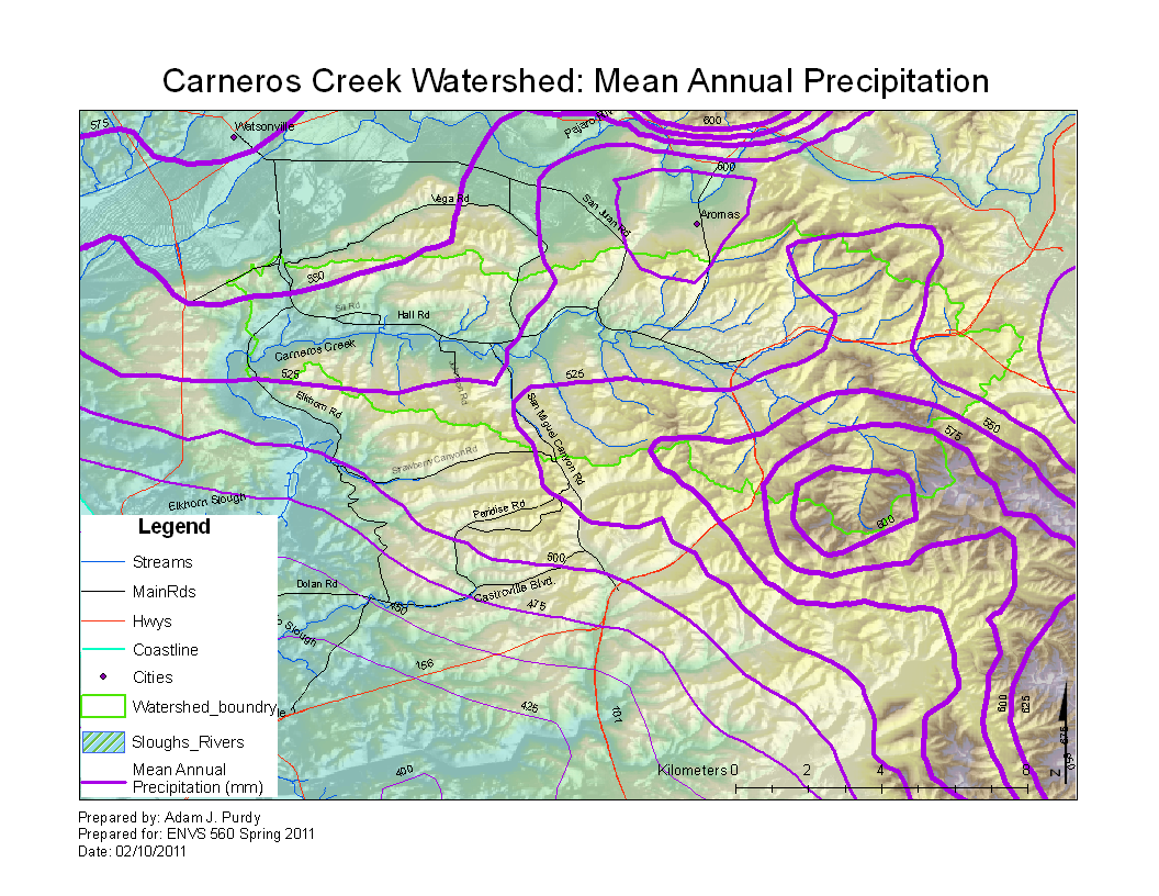
| + | == Alternative Version == | ||
| + | |||
| + | * [[Carneros Watershed: Precipitation 1]] | ||
== Links == | == Links == | ||
* [[Maps of the Carneros Watershed]] | * [[Maps of the Carneros Watershed]] | ||
| + | * [[The Carneros Watershed]] | ||
Latest revision as of 11:51, 11 February 2011

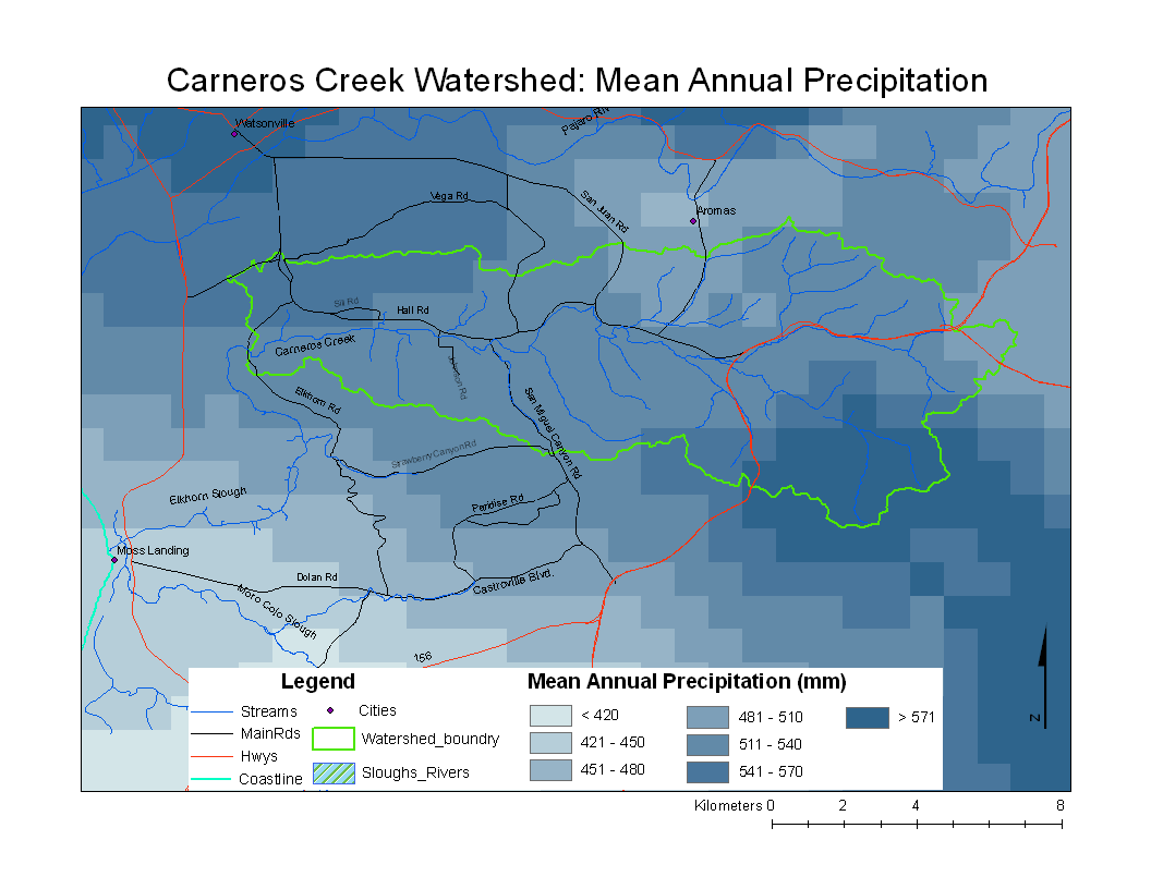
Metadata
- Original source of data: See PRISM
- Data anlysis: ArcMap
- Map produced by: Adam J. Purdy
- Projected Coordinate System: NAD 1983 UTM Zone 10
- Projection: Transverse Mercator
- Geographic Coordinate System: NAD 1983
- Dataum (North American 1983
- Prime Meridian: Greenwich
Processing Steps
- Convert ASCII grid file to Raster using Conversion Tools
- Define Projection
- Crop Raster to Central California Coast using Spatial Analyst Tool
- Create contour lines from the raster image using the Spacial Analyst Tool
- Symbolize contour lines by width and choose to label
- Select appropriate color scheme
- Add DEM and hillshade layers for aesthetics