File list
From CCoWS Wiki
This special page shows all uploaded files.
| Name | Thumbnail | Size | User | Description | Versions | |
|---|---|---|---|---|---|---|
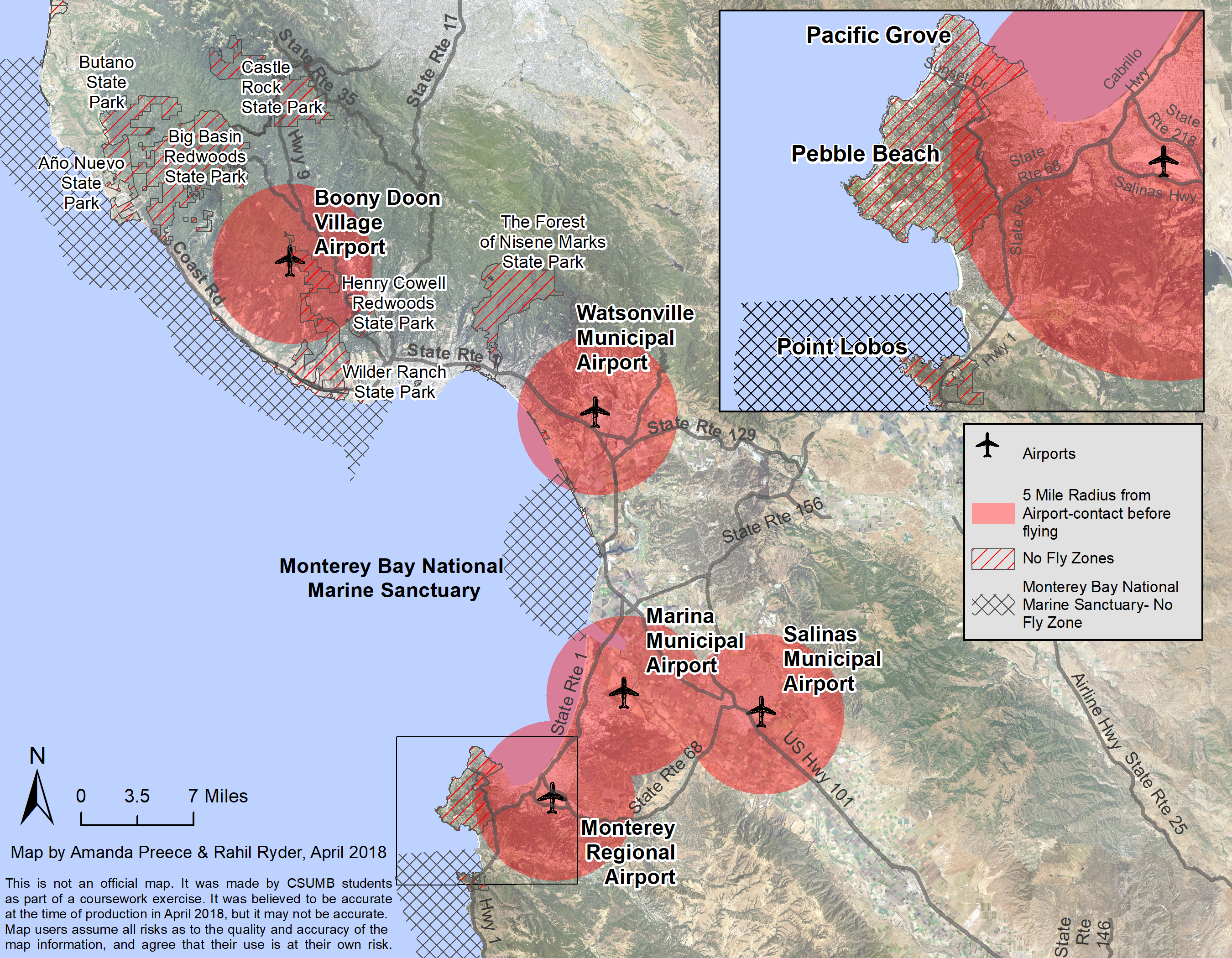
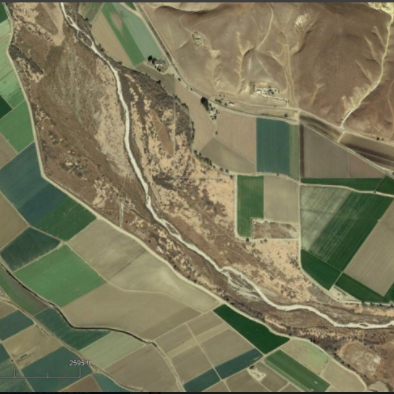
| 22:26, 9 April 2018 | UAV Inset 4.png (file) |  |
6.92 MB | RahilRyder | 1 | |
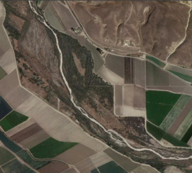
| 22:06, 9 April 2018 | UAV Inset 3.png (file) |  |
6.99 MB | RahilRyder | 1 | |
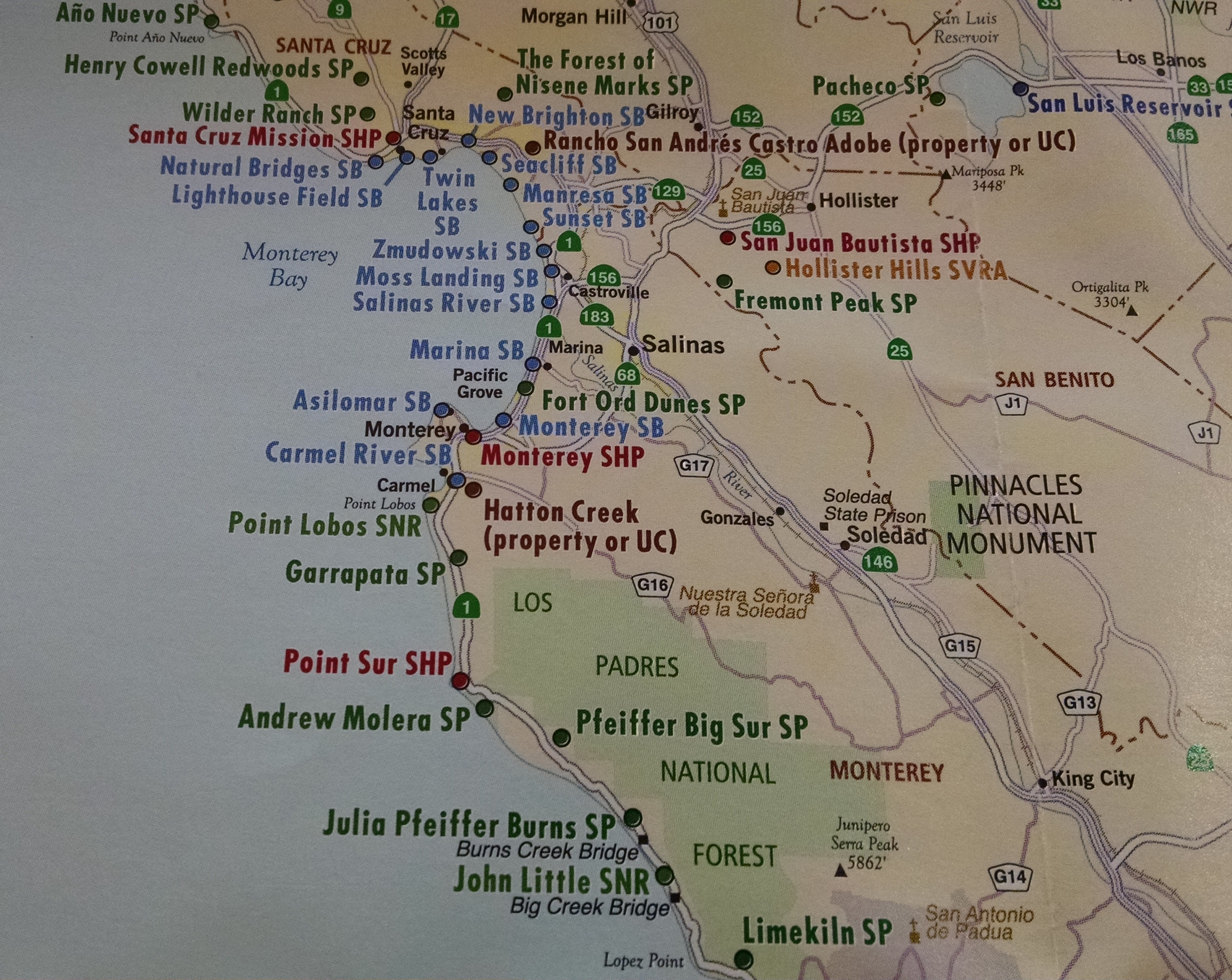
| 13:02, 8 April 2018 | CentralCoast SPs.jpeg (file) |  |
2.68 MB | Amandap | State parks of the central coast | 1 |
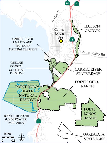
| 10:42, 8 April 2018 | Pointlobos areamap web v5a.jpg (file) |  |
74 KB | Amandap | Carmel area State Parks general plan areas of interest. | 1 |
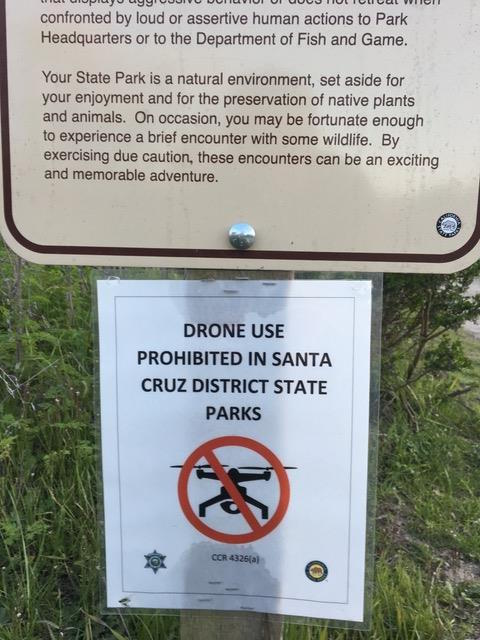
| 18:47, 6 April 2018 | SC no drone.jpeg (file) |  |
66 KB | Amandap | Temporary signs posted in Santa Cruz State Parks for "No Drones" | 1 |
| 18:47, 6 April 2018 | PB no drones.jpeg (file) |  |
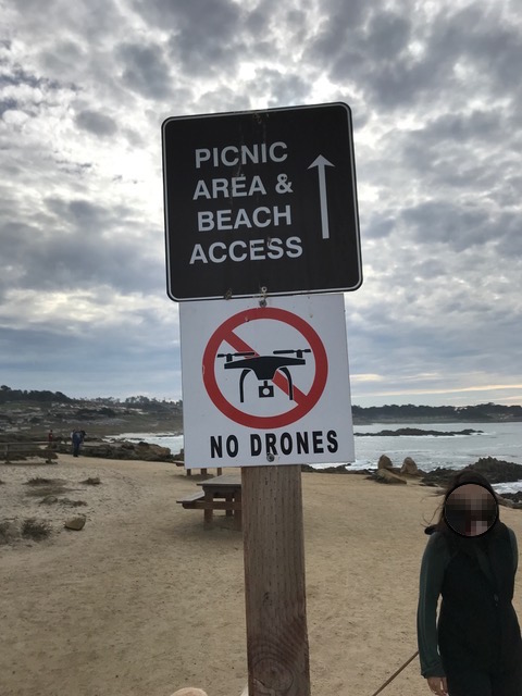
85 KB | Amandap | Signs along the coast in the Pebble Beach community. | 1 |
| 18:37, 6 April 2018 | PG drone permit.jpeg (file) |  |
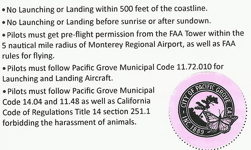
188 KB | Amandap | Text included on the back of a City of Pacific Grove drone permit. | 1 |
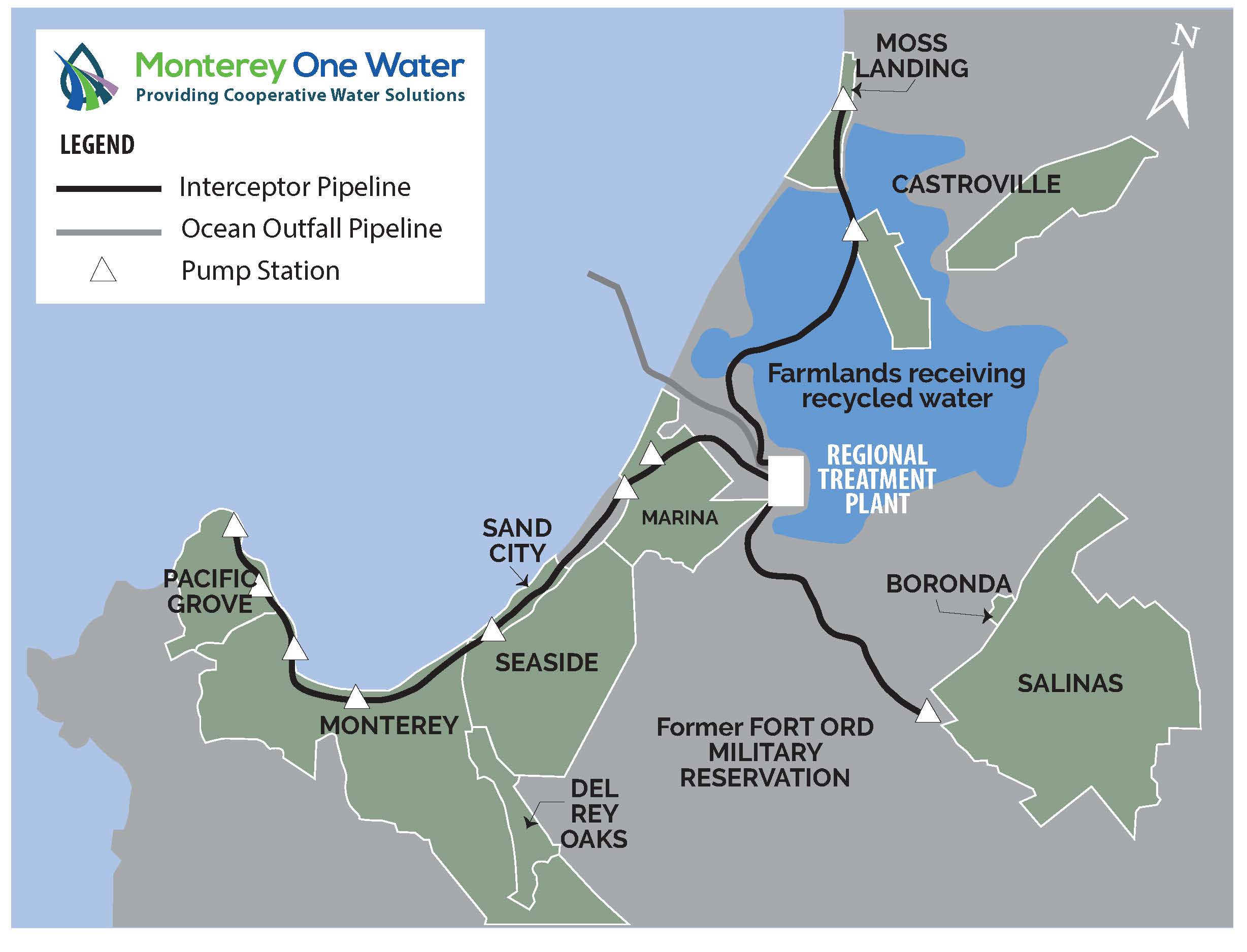
| 13:58, 6 April 2018 | Montereyonewaterservicearea downloaded180406.jpg (file) |  |
227 KB | JesseDoyle | 1 | |
| 13:31, 6 April 2018 | Monterey logo 500.png (file) | 36 KB | JesseDoyle | 1 | ||
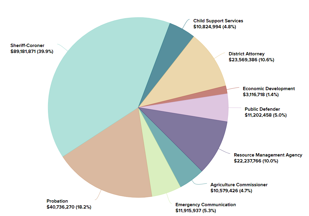
| 12:15, 5 April 2018 | Public Safety Protection 2015 Actual Budget.PNG (file) |  |
66 KB | RahilRyder | 1 | |
| 11:24, 5 April 2018 | 2016.PNG (file) |  |
369 KB | ArevMarkarian | 1 | |
| 11:24, 5 April 2018 | 2015.PNG (file) |  |
316 KB | ArevMarkarian | 1 | |
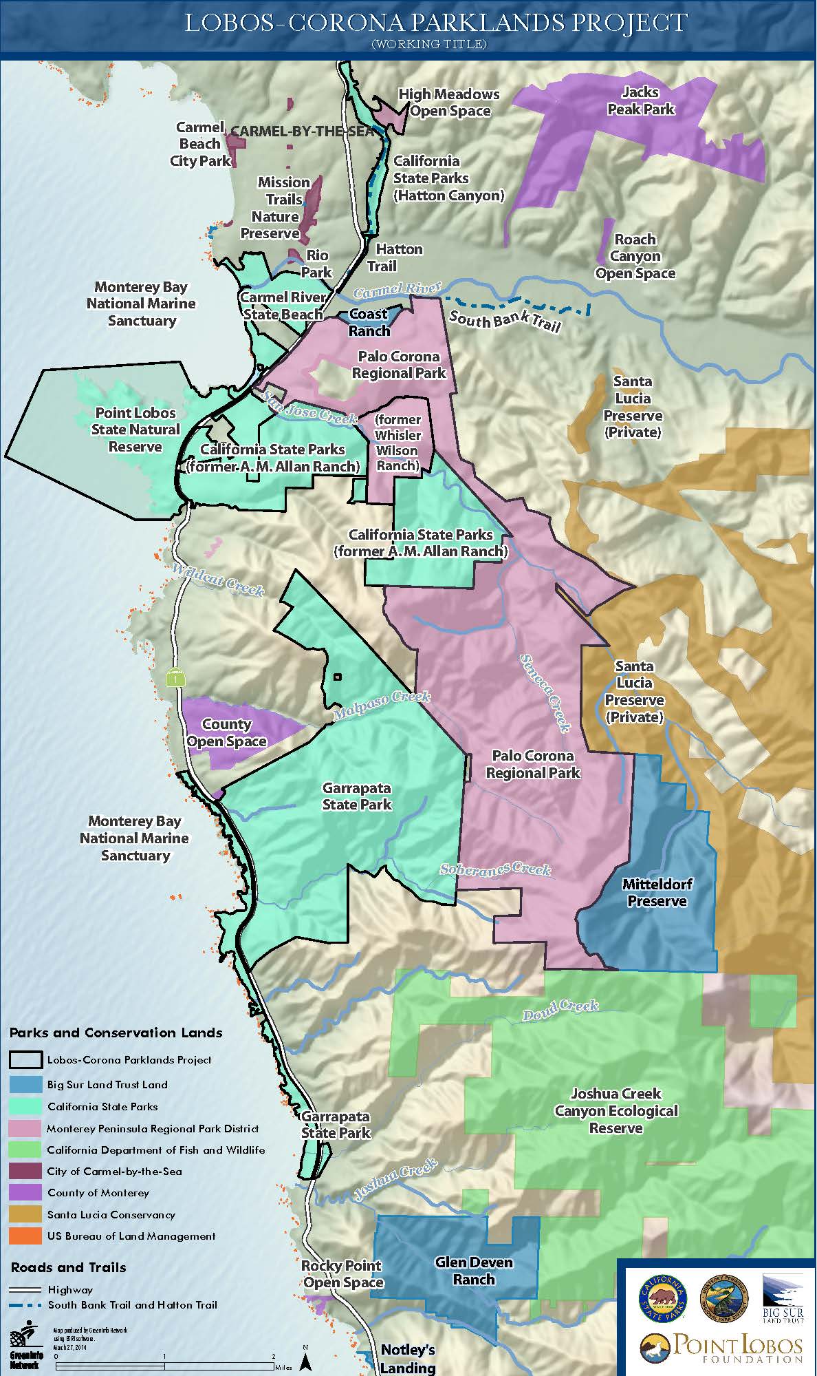
| 10:52, 5 April 2018 | Lobos Corona Parklands Project Map.jpg (file) |  |
295 KB | CorySteinmetz | 1 | |
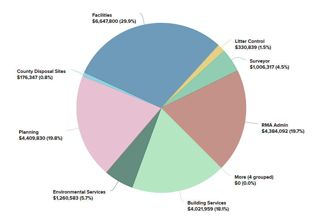
| 10:32, 5 April 2018 | RMA Budget 2015.PNG (file) |  |
58 KB | RahilRyder | 1 | |
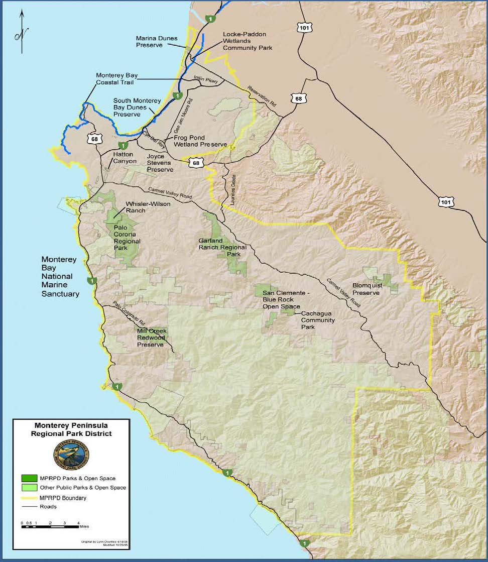
| 22:31, 4 April 2018 | MPRPD Park&WardMap.jpg (file) |  |
361 KB | CorySteinmetz | Map taken from [https://www.mprpd.org/files/fd8969256/LGO_F17W18-Online.pdf] | 1 |
| 20:40, 4 April 2018 | Rcdmcfb.jpg (file) |  |
33 KB | ArevMarkarian | https://www.rcdmonterey.org/ | 1 |
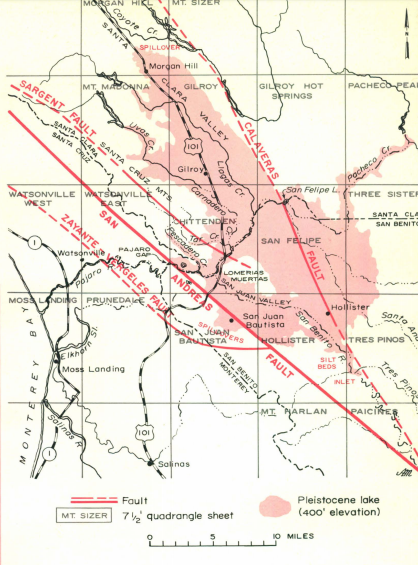
| 14:41, 4 April 2018 | PLEISTOCENE LAKE San Benito.png (file) |  |
365 KB | EmilyWilkinson | 1 | |
| 09:59, 4 April 2018 | MCWRA 2015 Summary Report.pdf (file) | 2.18 MB | JesseDoyle | MCWRA 2015 Groundwater Extraction Report | 1 | |
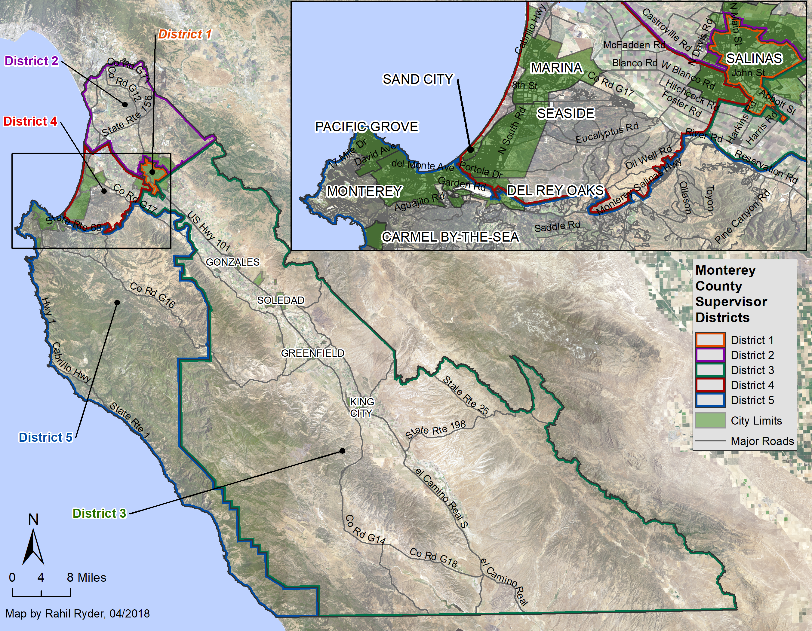
| 02:37, 4 April 2018 | VoterDistrict Street Inset.png (file) |  |
7.83 MB | RahilRyder | 1 | |
| 00:15, 4 April 2018 | MPRPD PropertyMapCropped.jpg (file) |  |
137 KB | CorySteinmetz | MPRPD Property Map from the 2016-2020 Strategic Plan | 1 |
| 23:59, 3 April 2018 | MPRPD Properties.pdf (file) | 184 KB | CorySteinmetz | Property map taken from strategic plan 2016-2020 | 1 | |
| 23:42, 3 April 2018 | MPRPD PropertyMap.pdf (file) | 221 KB | CorySteinmetz | MPRPD Properties | 1 | |
| 18:04, 3 April 2018 | TheNatureConservancy.jpg (file) |  |
136 KB | JesseDoyle | 1 | |
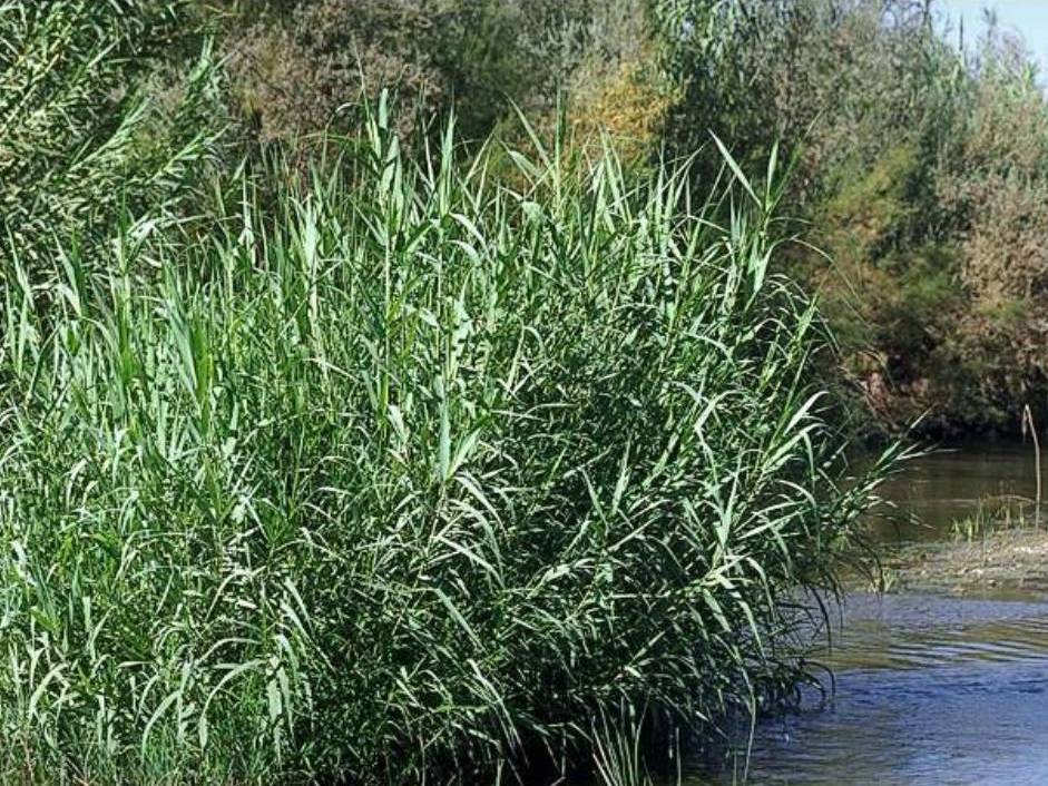
| 11:37, 3 April 2018 | Arundo-donax.jpg (file) |  |
180 KB | ArevMarkarian | http://www.cal-ipc.org/plants/profile/arundo-donax-profile/ | 1 |
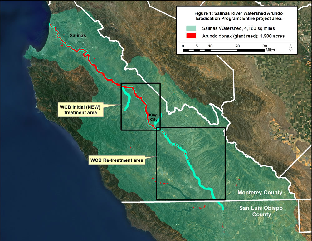
| 11:33, 3 April 2018 | Arundo-infestation-within-the-salinas-river-watershed.jpg (file) |  |
192 KB | ArevMarkarian | https://www.rcdmonterey.org/salinas-river-arundo-and-tamarisk-control | 1 |
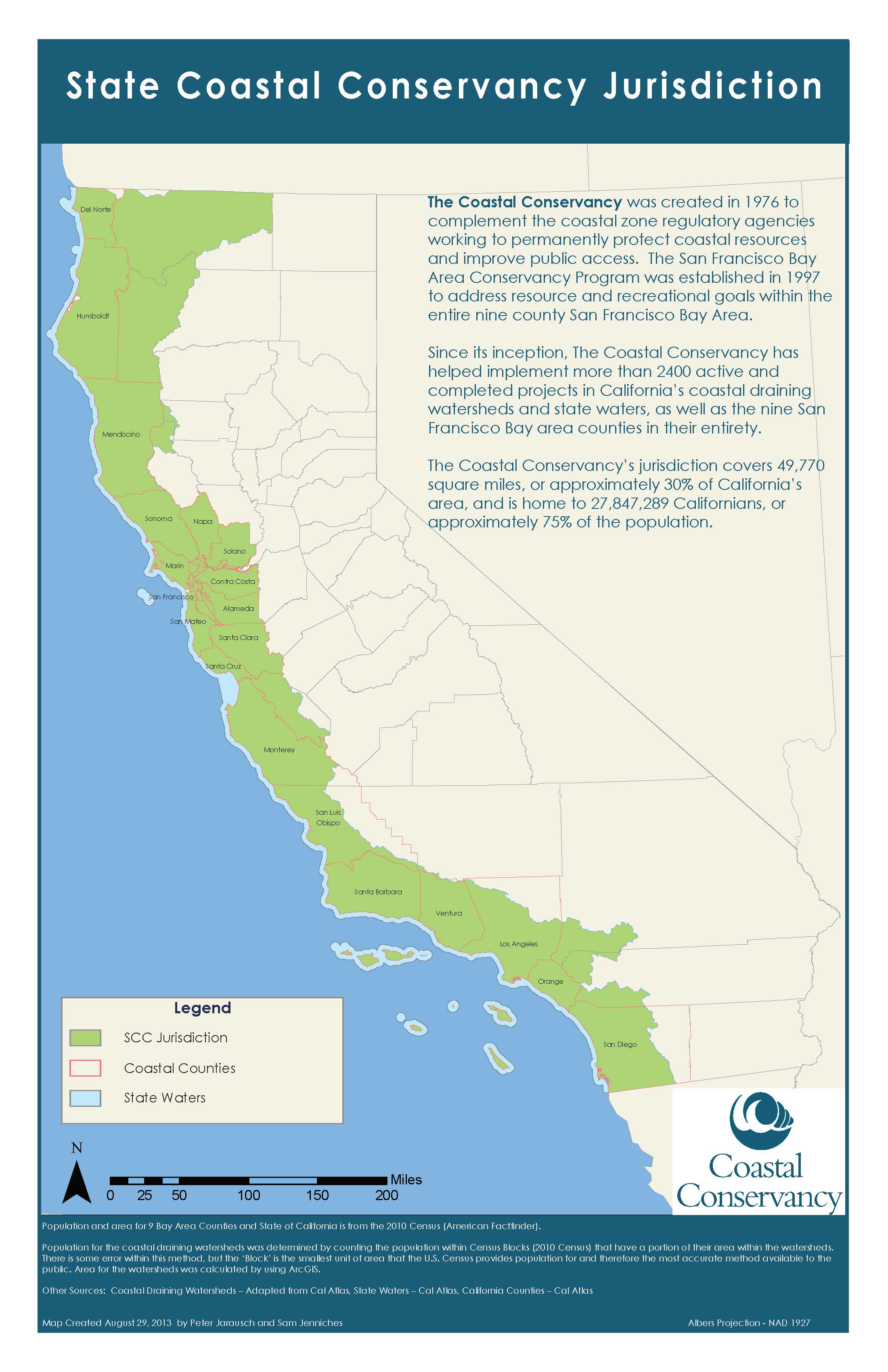
| 16:16, 31 March 2018 | StateCoastalConservancyJurisdiction.jpg (file) |  |
482 KB | JesseDoyle | State Coastal Conservancy Jurisdiction as provided by the Coastal Conservancy Website as of 2018. | 1 |
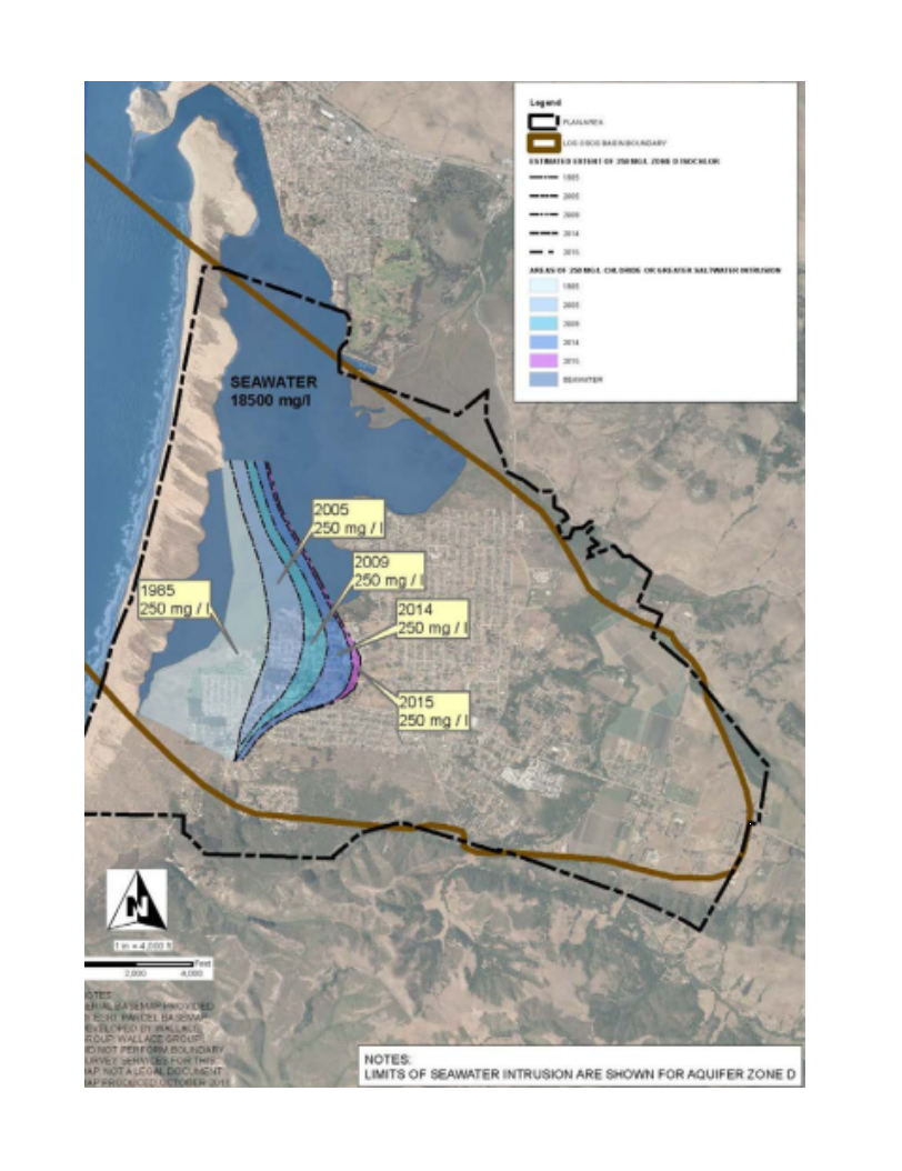
| 09:42, 30 March 2018 | 2017HistoricSeawaterInstrusionMap 400ftAquifer.png (file) |  |
1.48 MB | JesseDoyle | 1 | |
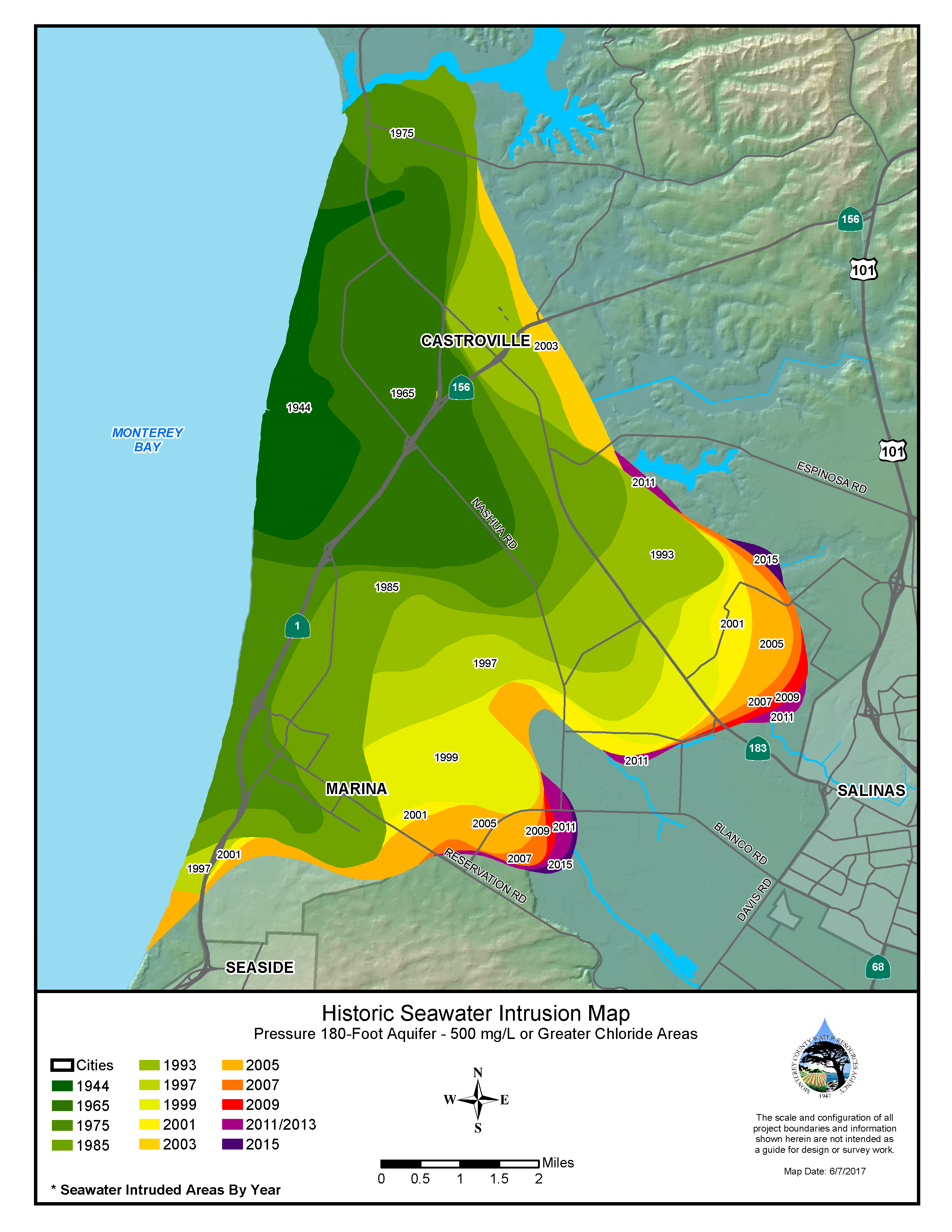
| 09:39, 30 March 2018 | 2017HistoricSeawaterInstrusionMap 180ftAquifer.png (file) |  |
1.77 MB | JesseDoyle | 1 | |
| 09:37, 30 March 2018 | 2017HistoricSeawaterInstrusionMap 180ftAquifer.pdf (file) | 1.89 MB | JesseDoyle | 1 | ||
| 22:31, 29 March 2018 | MCRWA.jpg (file) |  |
24 KB | JesseDoyle | 1 | |
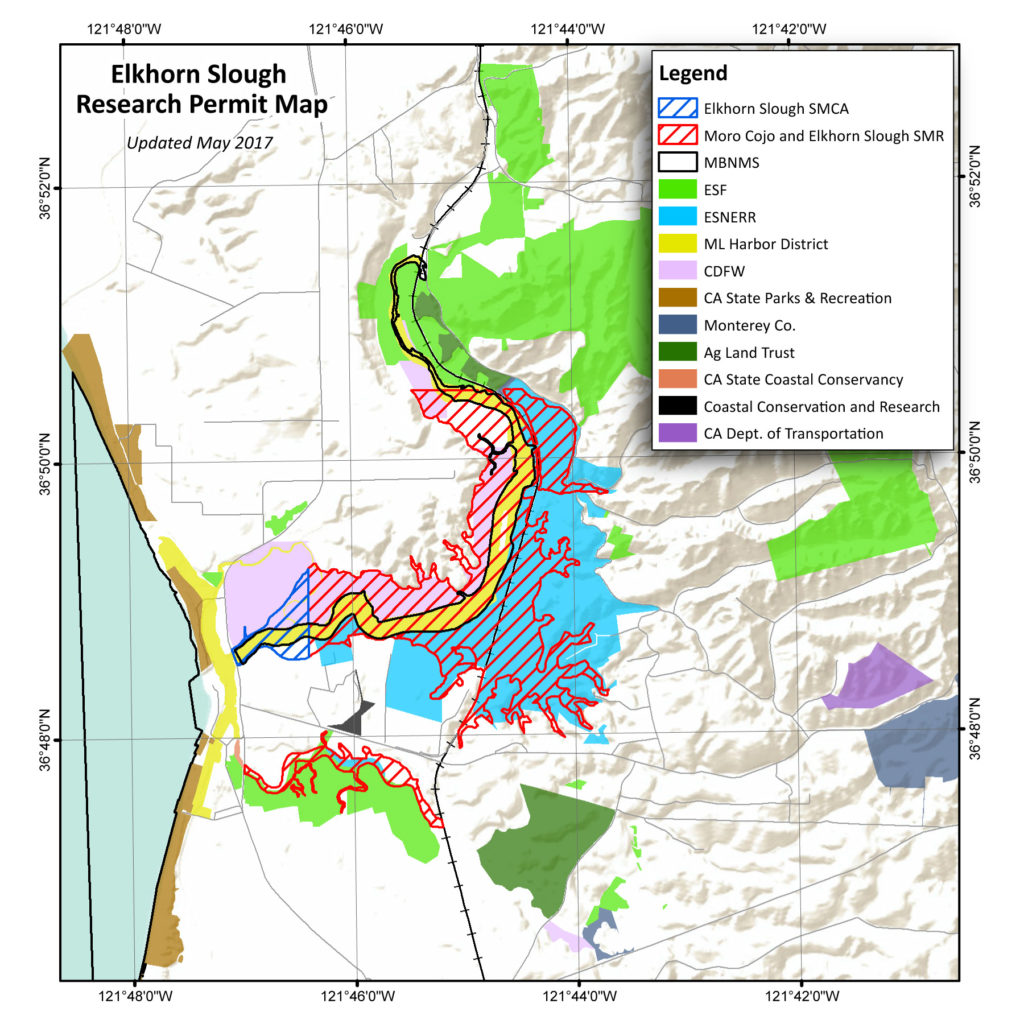
| 20:41, 29 March 2018 | SloughPermitMap.jpg (file) |  |
281 KB | KatHicks | Reserve_permit-map_May2017-1024x1024 | 1 |
| 19:24, 29 March 2018 | EIR.pdf (file) | 5.06 MB | MichaelAndrews | 1 | ||
| 19:21, 29 March 2018 | Eir.pdf (file) | 5.06 MB | MichaelAndrews | 2002 Environmental Impact Report for the City of Salinas | 1 | |
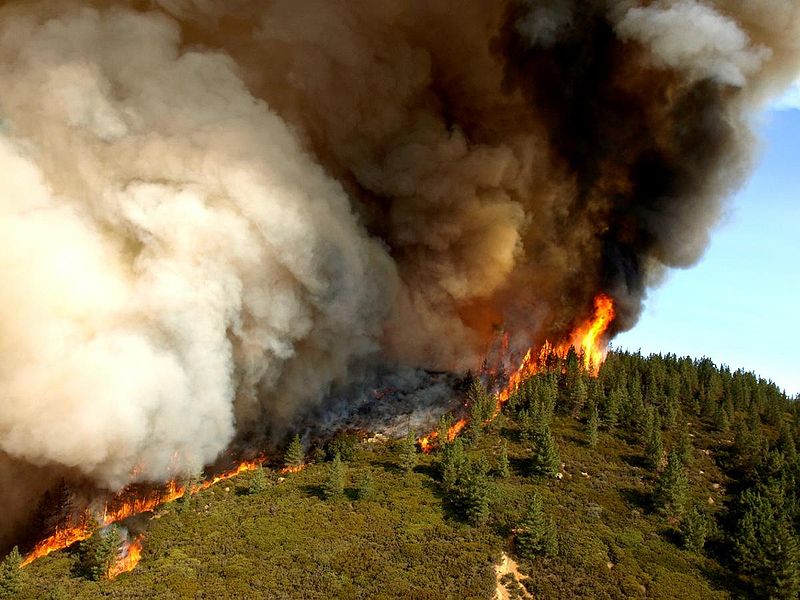
| 17:45, 29 March 2018 | Zacafirewikipedia.jpg (file) |  |
89 KB | JesseDoyle | 1 | |
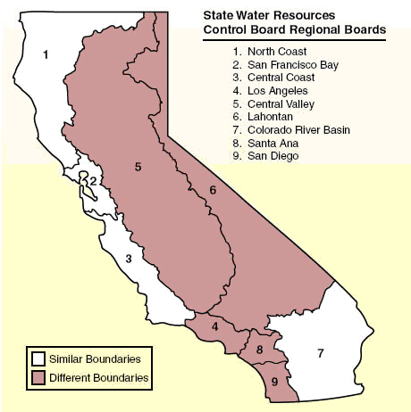
| 13:38, 29 March 2018 | Ccboard.jpg (file) |  |
259 KB | ArevMarkarian | 1 | |
| 13:32, 29 March 2018 | Boards.jpg (file) |  |
122 KB | ArevMarkarian | http://ucnfanews.ucanr.edu/Articles/Feature_Stories/_New__Ag_Waivers_from_two_regional_water_quality_control_boards/ | 1 |
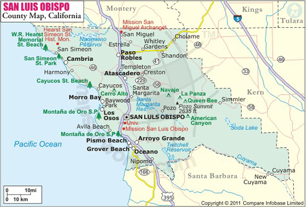
| 13:25, 29 March 2018 | San-luis-obispo-county-map (1).jpg (file) | .jpg) |
215 KB | JesseDoyle | 1 | |
| 08:29, 29 March 2018 | Carmel-River-Steelhead-Logo616x228.png (file) |  |
76 KB | JesseDoyle | 1 | |
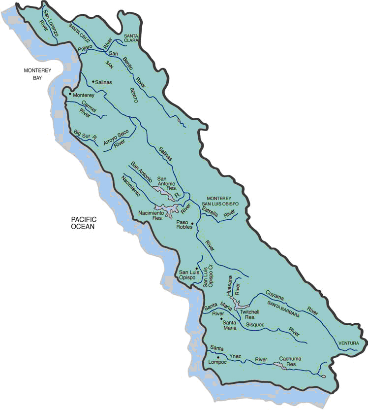
| 14:05, 28 March 2018 | Central Coast.jpg (file) |  |
148 KB | MichaelAndrews | Map depicting the extent of the Central Coast Regional Water Control Board | 1 |
| 15:32, 27 March 2018 | Trout-Unlimited.jpg (file) |  |
41 KB | JesseDoyle | Trout Unlimited logo photo obtained from current TU twitter account as of 180327 | 1 |
| 15:49, 11 April 2017 | MontereyPRegParkD.jpg (file) |  |
237 KB | Cynthiag | 1 | |
| 15:39, 11 April 2017 | Soberanes Incident.jpeg (file) |  |
7.85 MB | Lizzye | Soberanes Fire extent as published in the CalFire Watershed Emergency Response Team Report CA-BEU-003422. Published September 29, 2016. | 1 |
| 14:06, 11 April 2017 | MB-Sanct-Trail-Network-Logo.png (file) | 34 KB | Cynthiag | 1 | ||
| 13:59, 11 April 2017 | CACoastalTrailLogo.jpg (file) |  |
72 KB | Cynthiag | 1 | |
| 13:38, 11 April 2017 | CADeptP&R.png (file) |  |
47 KB | Cynthiag | 1 | |
| 13:29, 11 April 2017 | Carmel Area State Parks Plan.jpg (file) |  |
117 KB | Cynthiag | 1 | |
| 13:12, 11 April 2017 | FORHA Trail.png (file) |  |
761 KB | Cynthiag | 1 | |
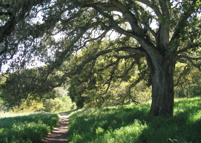
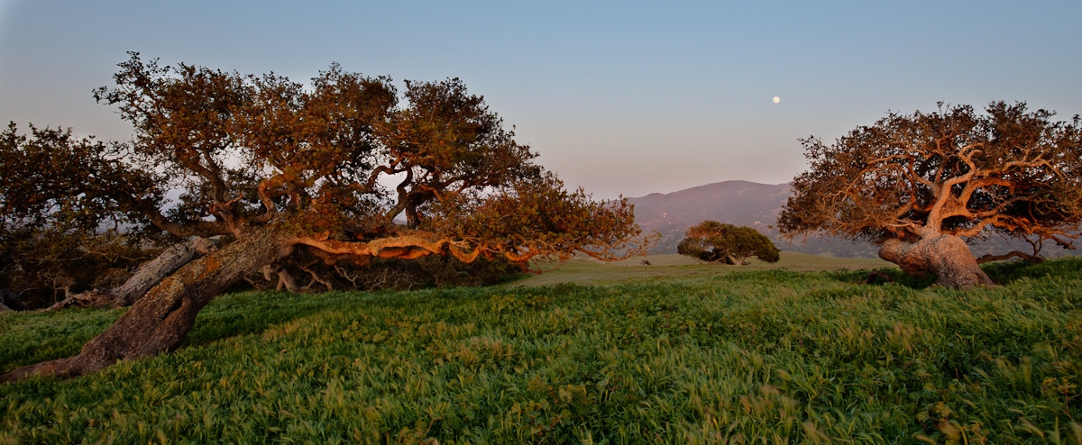
| 12:51, 11 April 2017 | FortOrdOaks.jpg (file) |  |
574 KB | Cynthiag | 1 | |
| 06:30, 11 April 2017 | Lososos.png (file) |  |
1.18 MB | Tiffaneeh | 1 | |
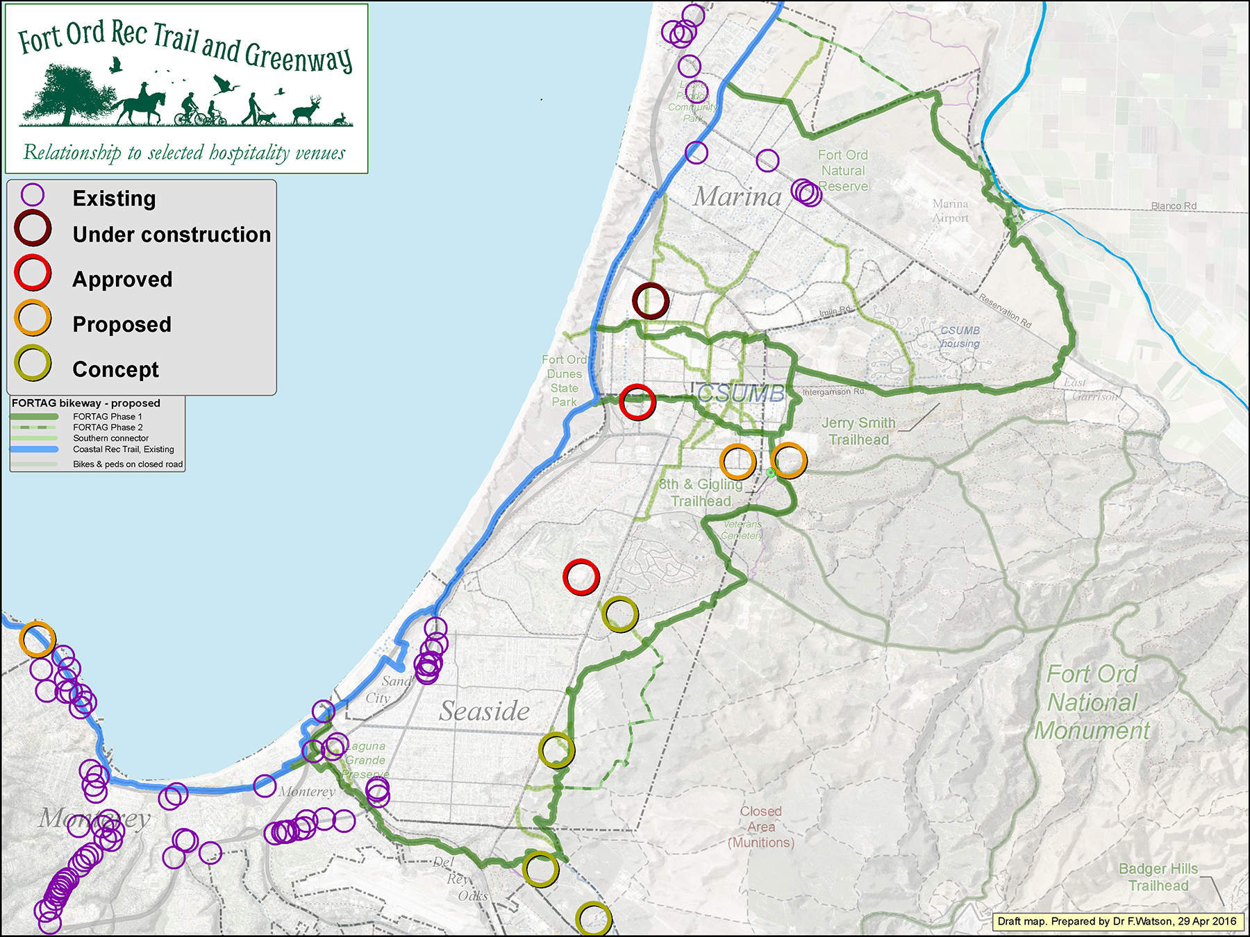
| 00:09, 10 April 2017 | FORTAG Hotels 160429 450dpi.png (file) |  |
3.12 MB | Cynthiag | 1 |
First page |
Previous page |
Next page |
Last page |