Search results
From CCoWS Wiki
Create the page "Image" on this wiki!
- [[Image:DSCN1497.JPG|thumb|Elkhorn Slough National Estuarine Research Reserve]] [[Image:ES protected lands 0309-lr.jpg|thumb|Elkhorn Slough Protected Lands]]5 KB (625 words) - 10:51, 4 April 2019

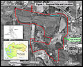
File:TripleMMap Laurel.PDF Location of Triple M Ranch, image courtesy of Laurel Marcus & Associates. Also available from: http://elkhorn(320 KB) - 23:43, 2 February 2011File:TripleMMap Laurel.pdf Location of Triple M Ranch, image courtesy of Laurel Marcus & Associates. Also available from: http://elkhorn(320 KB) - 23:49, 2 February 2011- [[Image: SloughPermitMap.jpg|thumb|500px]]2 KB (215 words) - 20:45, 29 March 2018
- [[Image:Carneros slope.jpg|200px|thumb]] ... unit. This projection change creates some visual distortion in the final image from the shift.1 KB (164 words) - 15:35, 10 February 2011
- [[Image:Pajaro Valley Basemap.jpg|thumb|640px|center|Boundaries of Pajaro Valley co503 B (71 words) - 15:09, 25 March 2014
- [[Image:CarnerosWatershed 100yrFloodplain.png|200px|thumb|100 year FEMA floodplain]1 KB (152 words) - 11:25, 10 February 2011
- [[Image:Moss Landing Harbor.jpg|thumb|460px|Picture of Moss Landing Harbor with Elk1 KB (157 words) - 16:49, 10 February 2011
File:TripleMMap Laurel.jpg Image courtesy of Laurel Marcus & Associates, Triple M Ranch Land Management Plan(2,559 × 2,064 (806 KB)) - 15:11, 10 February 2011
File:Restoration map.jpg Image courtesy of Largay Hydrologic Sciences, LLC.(2,548 × 1,648 (342 KB)) - 15:07, 10 February 2011- [[Image:|200px|thumb]]2 KB (355 words) - 16:15, 10 February 2011
- [[Image:CarnerosWatershed Precipitation2.png|200px|thumb]] * Create contour lines from the raster image using the Spacial Analyst Tool1 KB (136 words) - 11:51, 11 February 2011
- [[Image:CarnerosWatershed Precipitation2.png|200px|thumb]] * Create contour lines from the raster image using the Spacial Analyst Tool1 KB (136 words) - 14:41, 15 February 2011
- [[Image:CarnerosWatershed SoilsKfFactor.png|200px|thumb|Carneros Watershed: Soil Er2 KB (372 words) - 07:44, 28 February 2011
- [[Image:Ca_regions.jpg|375px|thumb|right|Image from: http://ucanr.org/sites/UCNFAnews/Feature_Stories/_New__Ag_Waivers_fro7 KB (995 words) - 13:55, 25 February 2021
- [[Image:Lower Salinas River Watershed.png|375px|thumb|Map of the Lower Salinas Rive [[Image:Majordrain TMDL projarea.png|325px|thumb|right|Map of major drainages in th32 KB (4,521 words) - 21:25, 27 March 2020
- ...ops improve water quality by helping to prevent sedimentation of streams. Image by http://www.rcdmonterey.org/]] ... roadways and drainage ditches discourage wildlife that may carry E.coli. Image by http://www.seaotters.org/]]5 KB (709 words) - 22:58, 28 March 2017
- [[Image:Lower Salinas River Watershed.png|300px|thumb|Map Of The Lower Salinas Rive * PDF File for Printing: [[Image:Lower Salinas River Watershed.pdf ]]639 B (82 words) - 14:31, 12 April 2011
- [[Image:TMDL Project Area.png|270px|thumb|right|Location of TMDL Project Area. Avai13 KB (1,748 words) - 23:05, 31 March 2014
- [[Image:2009_region3_map.png|thumb|270px|right|Sampling locations. ... Cruz County and Santa Barbara County. Sampling locations are shown in the image to the right. CCWQP has consistently delivered quarterly water quality moni6 KB (867 words) - 15:52, 9 April 2013

