Difference between revisions of "Carmel River Watershed: California American Water Production Wells"
From CCoWS Wiki
| (3 intermediate revisions by one user not shown) | |||
| Line 1: | Line 1: | ||
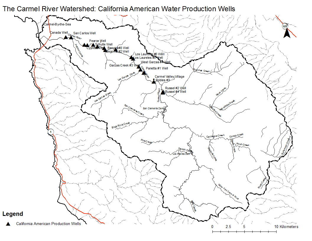
| − | [[Image:Carmel_Wells.png|200px|thumb]] | + | [[Image:Carmel_Wells.Map.png|200px|thumb]] |
* [[Media:Carmel_Wells.pdf|PDF file - for printing]] | * [[Media:Carmel_Wells.pdf|PDF file - for printing]] | ||
| − | * [[Media:Carmel_Wells.png|PNG file]] | + | * [[Media:Carmel_Wells.Map.png|PNG file]] |
| + | |||
| + | |||
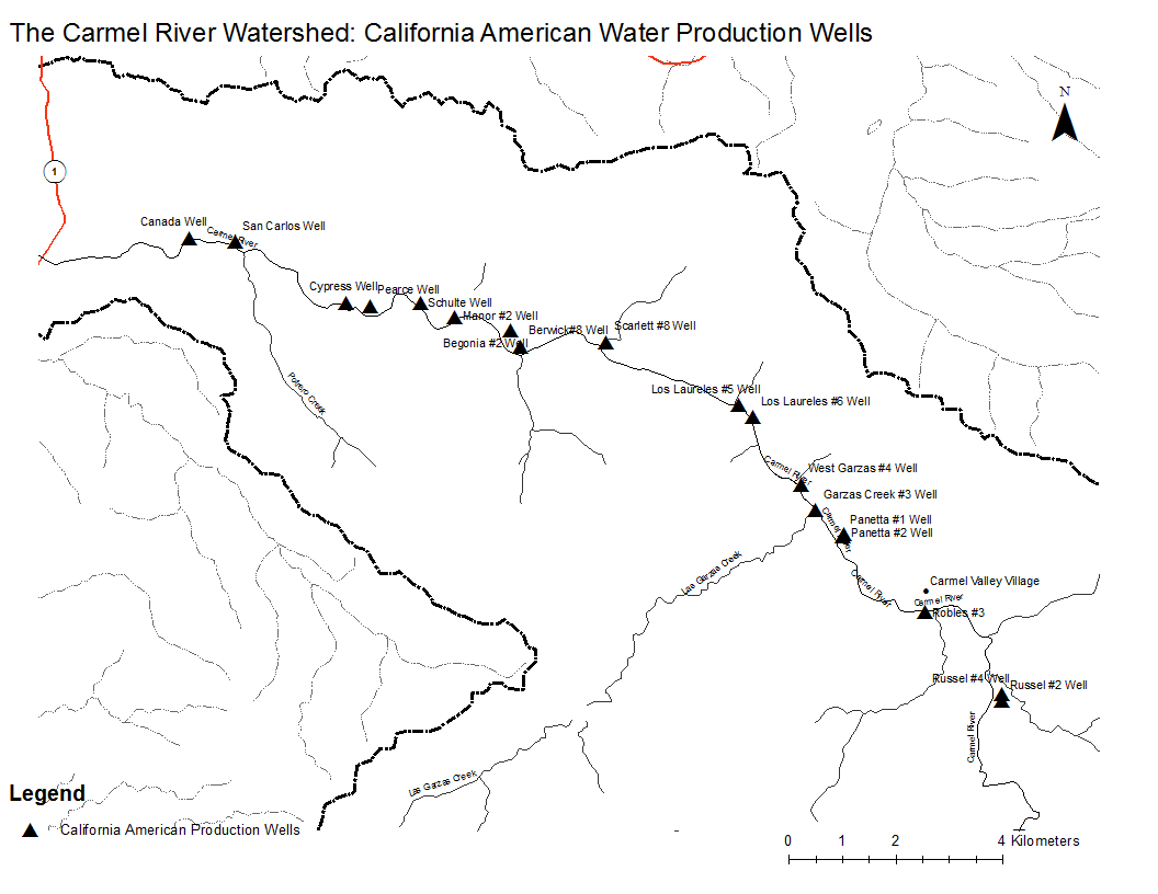
| + | [[Image:Carmel_WellsZoom.png|200px|thumb]] | ||
| + | * [[Media:Carmel_WellsZoom.pdf|PDF file - for printing]] | ||
| + | * [[Media:Carmel_WellsZoom.png|PNG file]] | ||
| + | |||
== Metadata == | == Metadata == | ||
* Original source of data: Monterey County - Rosenberg and [[Fred Watson]] at CSUMB. California American Water well data from CalAm Permit #21080 August 31, 2000 to the State Water Resource Control Board. | * Original source of data: Monterey County - Rosenberg and [[Fred Watson]] at CSUMB. California American Water well data from CalAm Permit #21080 August 31, 2000 to the State Water Resource Control Board. | ||
| − | * Map produced by: | + | * Map produced by: Emily Paddock |
* Projected Coordinate System: NAD_1983_UTM_Zone_10N | * Projected Coordinate System: NAD_1983_UTM_Zone_10N | ||
** Projection: Transverse_Mercator | ** Projection: Transverse_Mercator | ||
| Line 20: | Line 26: | ||
== Links == | == Links == | ||
| + | |||
| + | * [[Maps of the Carmel River Watershed]] | ||
Latest revision as of 08:55, 6 February 2011


Metadata
- Original source of data: Monterey County - Rosenberg and Fred Watson at CSUMB. California American Water well data from CalAm Permit #21080 August 31, 2000 to the State Water Resource Control Board.
- Map produced by: Emily Paddock
- Projected Coordinate System: NAD_1983_UTM_Zone_10N
- Projection: Transverse_Mercator
- Geographic Coordinate System: GCS_North_American_1983
- Datum: D_North_American_1983
- Prime Meridian: Greenwich
Processing Steps
- Retreived basemap and Carmel data
- Retreived CalAm well data and projected it from State_Plane_27_California_Zone_4 to NAD_1983_UTM_Zone_10N
- Added titles and legend formatting