Difference between revisions of "Carmel River Watershed: Map of Land Cover"
From CCoWS Wiki
(→Metadata) |
|||
| (One intermediate revision by one user not shown) | |||
| Line 1: | Line 1: | ||
[[Image:ENVS560_Map_LippertLucas.png|200px|thumb]] | [[Image:ENVS560_Map_LippertLucas.png|200px|thumb]] | ||
| − | * [[Media: | + | * [[Media:ENVS560_Map_LippertLucas.pdf|PDF file - for printing]] |
| − | * [[Media: | + | * [[Media:ENVS560_Map_LippertLucas.png|PNG file]] |
== Metadata == | == Metadata == | ||
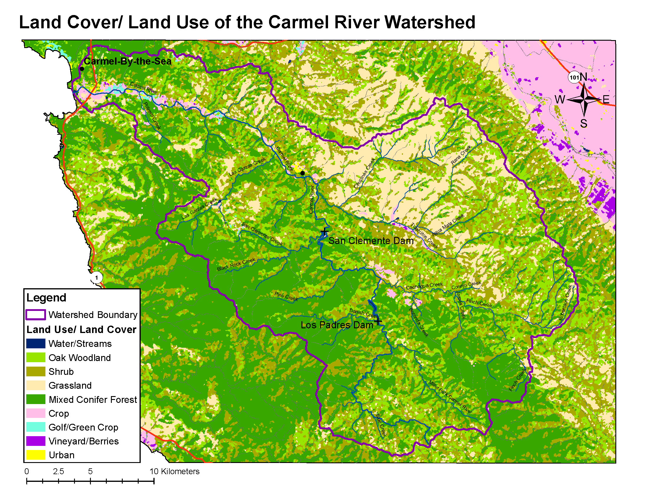
| − | * Original source of data: CSUMB Central Coast Watershed Studied Team (CCoWS) | + | * Original source of data: CSUMB Central Coast Watershed Studied Team (CCoWS) |
| + | ** http://ccows.csumb.edu/home/proj/2005/region3_lulc/region3_lulc.htm | ||
* Map produced by: David Nishijima | * Map produced by: David Nishijima | ||
* Projected Coordinate System: NAD_1983_UTM_Zone_10N | * Projected Coordinate System: NAD_1983_UTM_Zone_10N | ||
Latest revision as of 08:49, 6 February 2011

Metadata
- Original source of data: CSUMB Central Coast Watershed Studied Team (CCoWS)
- Map produced by: David Nishijima
- Projected Coordinate System: NAD_1983_UTM_Zone_10N
- Projection: Transverse_Mercatornal
- Geographic Coordinate System: GCS_North_American_1983
- Datum: D_North_American_1983
Processing Steps
- Retrieved land use/cover information from CCoWS website
- Added maps to base map
- Formatted legend, title, compass and scale