Difference between revisions of "Carmel River Watershed: Map of Land Cover"
From CCoWS Wiki
(→Metadata) |
(→Processing Steps) |
||
| Line 12: | Line 12: | ||
== Processing Steps == | == Processing Steps == | ||
| − | # | + | # Retrieved land use/cover information from CCoWS website |
| + | # Added maps to base map | ||
| + | # Formatted legend, title, compass and scale | ||
== Links == | == Links == | ||
* [[Maps of the Carmel River Watershed]] | * [[Maps of the Carmel River Watershed]] | ||
Revision as of 21:40, 1 April 2009

Metadata
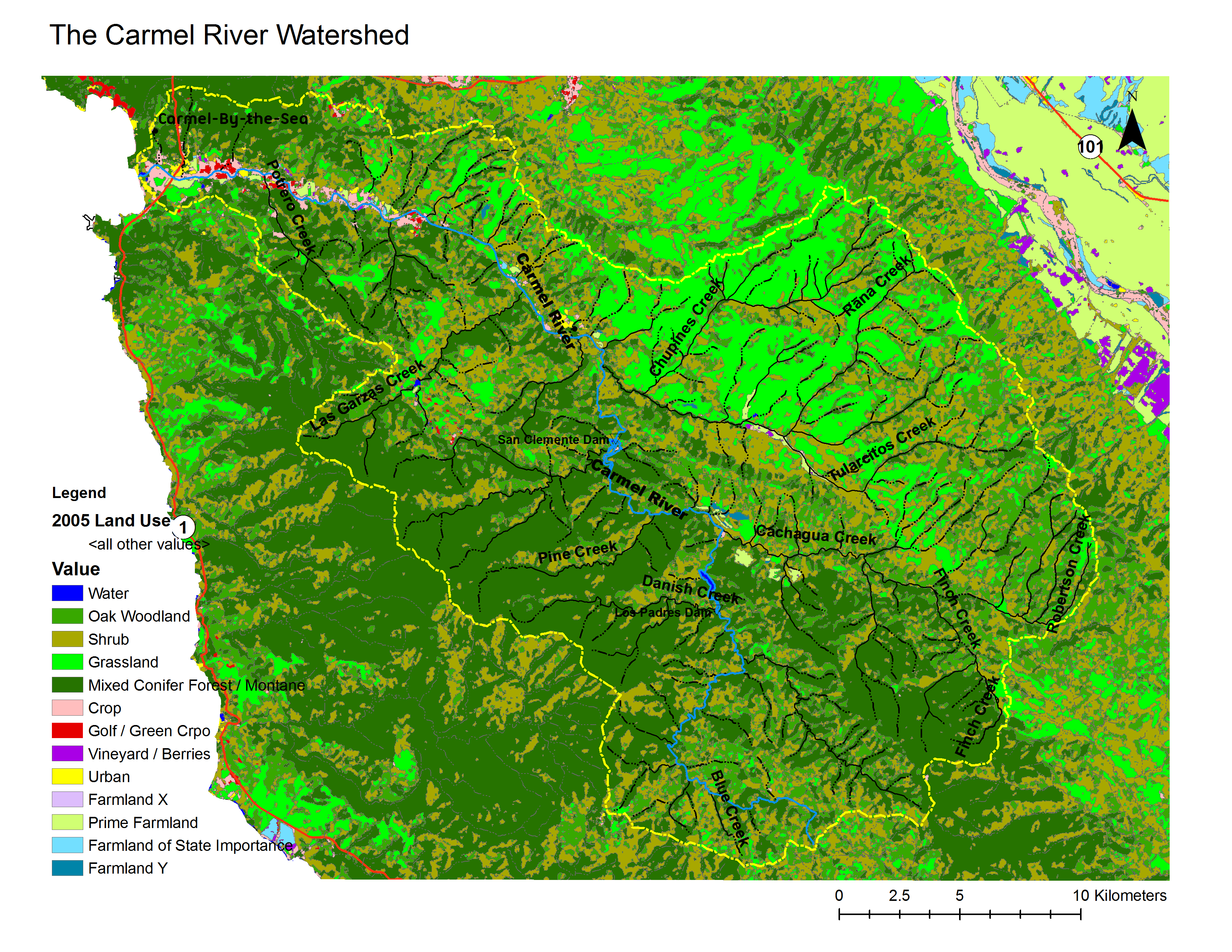
- Original source of data: CSUMB Central Coast Watershed Studied Team (CCoWS) [1].
- Map produced by: Arnett Young
- Projected Coordinate System: NAD_1983_UTM_Zone_10N Projection: Transverse_Mercatornal Meta data retrieved developed by
- Geographic Coordinate System: GCS_North_American_1983 Datum: D_North_American_1983
Processing Steps
- Retrieved land use/cover information from CCoWS website
- Added maps to base map
- Formatted legend, title, compass and scale