Difference between revisions of "Carmel River Watershed: Map of Land Cover"
From CCoWS Wiki
| Line 2: | Line 2: | ||
* [[Media:Carmel_land_use_and_land_cover2_USEME.pdf|PDF file - for printing]] | * [[Media:Carmel_land_use_and_land_cover2_USEME.pdf|PDF file - for printing]] | ||
* [[Media:Carmel_land_use_and_land_cover2_useme.png|PNG file]] | * [[Media:Carmel_land_use_and_land_cover2_useme.png|PNG file]] | ||
| − | |||
Revision as of 12:45, 11 February 2010

Metadata
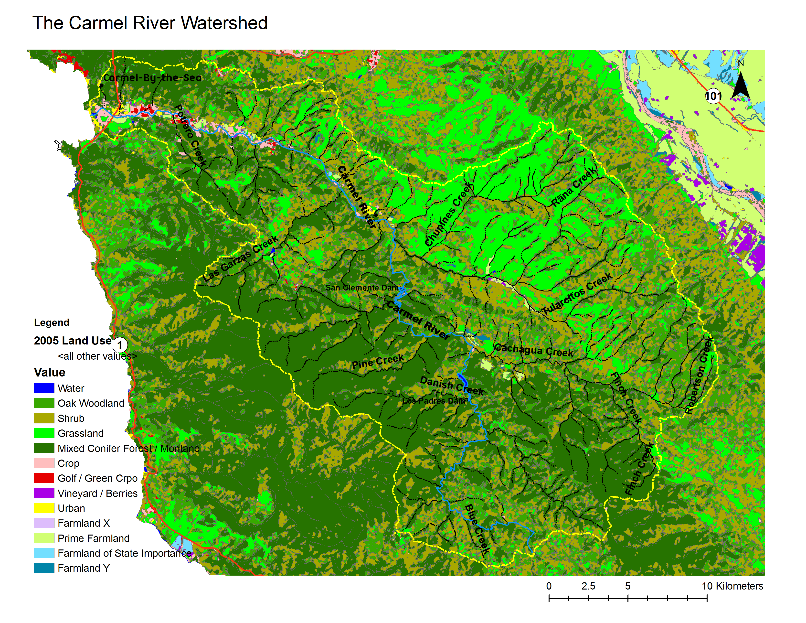
- Original source of data: CSUMB Central Coast Watershed Studied Team (CCoWS) [1].
- Map produced by: David Nishijima
- Projected Coordinate System: NAD_1983_UTM_Zone_10N
- Projection: Transverse_Mercatornal
- Geographic Coordinate System: GCS_North_American_1983
- Datum: D_North_American_1983
Processing Steps
- Retrieved land use/cover information from CCoWS website
- Added maps to base map
- Formatted legend, title, compass and scale