Difference between revisions of "Carneros Watershed: Historic Aerial Photography 1982"
From CCoWS Wiki
(→Processing Steps) |
|||
| (One intermediate revision by one user not shown) | |||
| Line 3: | Line 3: | ||
* [[Media:Carneros1982.pdf|PDF file - for printing]] | * [[Media:Carneros1982.pdf|PDF file - for printing]] | ||
* [[Media:Carneros1982.png|PNG file]] | * [[Media:Carneros1982.png|PNG file]] | ||
| + | |||
== Metadata == | == Metadata == | ||
| Line 21: | Line 22: | ||
* Images were obtained from [[http://glovis.usgs.gov/ GloVis]] | * Images were obtained from [[http://glovis.usgs.gov/ GloVis]] | ||
* Once the images were imported into ArcMap, they were georeferenced by hand using distinct features in the landscape | * Once the images were imported into ArcMap, they were georeferenced by hand using distinct features in the landscape | ||
| − | * After being placed in approximately the appropriate location, the images were rectified and the | + | * After being placed in approximately the appropriate location, the images were rectified and the borders of images were clipped using the "Extract by Mask" tool and a polygon shapefile |
* The extracted images were added to the ArcMap project and used to create the final product | * The extracted images were added to the ArcMap project and used to create the final product | ||
| − | |||
== Alternate versions == | == Alternate versions == | ||
Latest revision as of 17:46, 12 February 2011

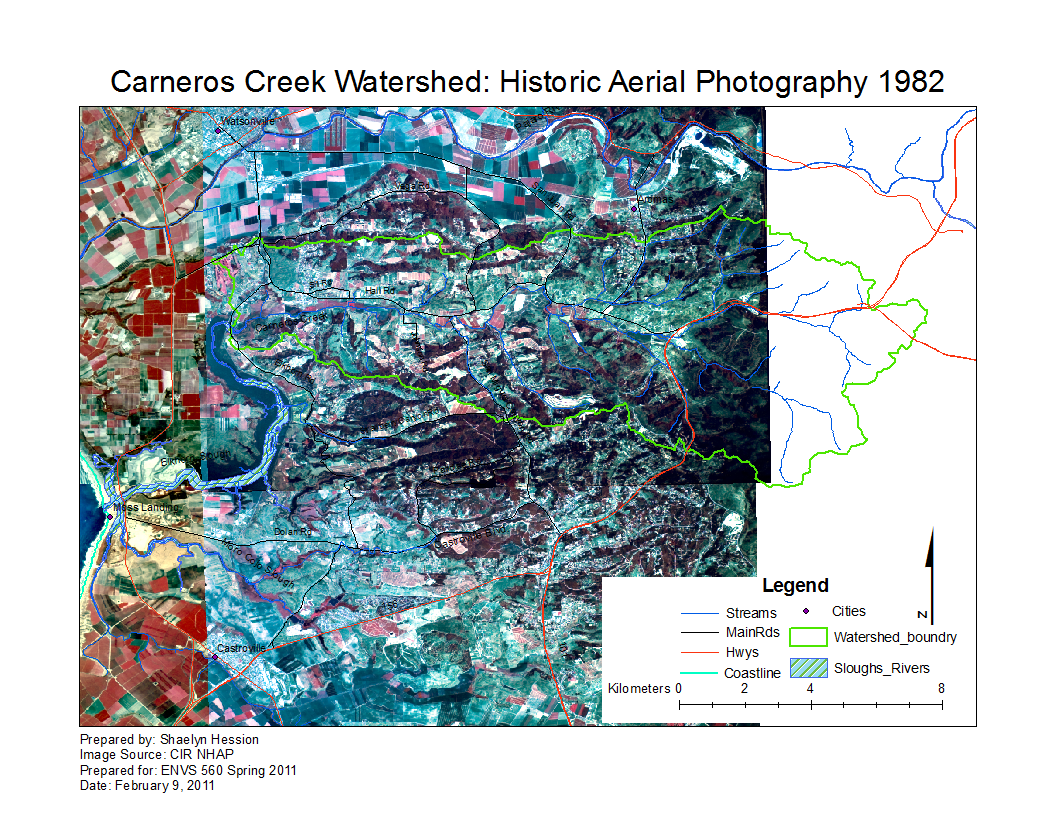
Metadata
- Original sources of data:
- Aerial Photos: CIR NHAP 1982 [Obtained from USGS Global Visualization (GloVis)]
- Hydrography: National Map hydrography data set
- Roads: National Map transportation data set
- Watershed boundary: Watershed analysis in ArcMap by Fred Watson based on National Map 1/3 arc-second elevation data
- Data analysis: Shaelyn Hession (Aerial Imagery); Fred Watson (watershed boundary)
- Map produced by: Shaelyn Hession
- Map produced using: ArcMap
- Coordinate system: Geographic Coordinate System - GCS_North_American_1983
- Datum: D_North_American_1983
Processing Steps
- Images were obtained from [GloVis]
- Once the images were imported into ArcMap, they were georeferenced by hand using distinct features in the landscape
- After being placed in approximately the appropriate location, the images were rectified and the borders of images were clipped using the "Extract by Mask" tool and a polygon shapefile
- The extracted images were added to the ArcMap project and used to create the final product
Alternate versions
- None