Difference between revisions of "Carneros Watershed: Map of Elevation"
From CCoWS Wiki
(New page: ==Metadata== * Original source of data: ** Elevation: based on USGS National Map 1/3 arc-section elevation data * Map produced by: Patty Cubanski * Map produced using: ArcMap * ...) |
(→Metadata) |
||
| (2 intermediate revisions by one user not shown) | |||
| Line 1: | Line 1: | ||
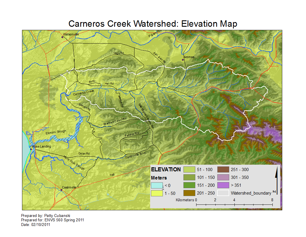
| + | [[Image:CarnerosWatershed_ElevationMap.png|200px|thumb|Carneros Watershed: Elevation]] | ||
| − | + | * [[Media:CarnerosWatershed_ElevationMap.pdf|PDF file - for printing]] | |
| + | * [[Media:CarnerosWatershed_ElevationMap.png|PNG file]] | ||
==Metadata== | ==Metadata== | ||
* Original source of data: | * Original source of data: | ||
** Elevation: based on USGS [[National Map]] 1/3 arc-section elevation data | ** Elevation: based on USGS [[National Map]] 1/3 arc-section elevation data | ||
| + | * Data analysis: [[Fred Watson]] (watershed boundary); Patty Cubanski (elevation) | ||
* Map produced by: Patty Cubanski | * Map produced by: Patty Cubanski | ||
| + | ** [[Carneros Watershed: Basemap]] produced by: Rose Ashbach | ||
* Map produced using: [[ArcMap]] | * Map produced using: [[ArcMap]] | ||
* Coordinate system: Geographic Coordinate System - GCS_North_American_1983 | * Coordinate system: Geographic Coordinate System - GCS_North_American_1983 | ||
| − | * Datum: D_North_American_1983 | + | * Datum: D_North_American_1983 |
==Alternate versions== | ==Alternate versions== | ||
Latest revision as of 15:31, 10 February 2011

Metadata
- Original source of data:
- Elevation: based on USGS National Map 1/3 arc-section elevation data
- Data analysis: Fred Watson (watershed boundary); Patty Cubanski (elevation)
- Map produced by: Patty Cubanski
- Carneros Watershed: Basemap produced by: Rose Ashbach
- Map produced using: ArcMap
- Coordinate system: Geographic Coordinate System - GCS_North_American_1983
- Datum: D_North_American_1983
Alternate versions
- none