Difference between revisions of "Carneros Watershed: Map of Precipitation and Stream Gages"
From CCoWS Wiki
| Line 10: | Line 10: | ||
** Roads: [[National Map]] transportation data set | ** Roads: [[National Map]] transportation data set | ||
** Watershed boundary: Watershed analysis in ArcMap by [[Fred Watson]] based on [[National Map]] 1/3 arc-second elevation data | ** Watershed boundary: Watershed analysis in ArcMap by [[Fred Watson]] based on [[National Map]] 1/3 arc-second elevation data | ||
| − | ** | + | ** CDEC Stations: CDEC Station Locator http://cdec.water.ca.gov/cgi-progs/mapper |
| − | ** | + | ** NCDC Stations: NCDC Station List for California http://www4.ncdc.noaa.gov/cgi-win/wwcgi.dll?wwDI~SelectStation~USA~CA |
| + | ** CIMIS Stations: CIMIS Station List http://wwwcimis.water.ca.gov/cimis/frontStationListData.do | ||
* Data analysis: [[Fred Watson]] (watershed boundary) | * Data analysis: [[Fred Watson]] (watershed boundary) | ||
* Map produced by: Rose Ashbach and Gabriela Alberola | * Map produced by: Rose Ashbach and Gabriela Alberola | ||
Revision as of 16:08, 10 February 2011

Metadata
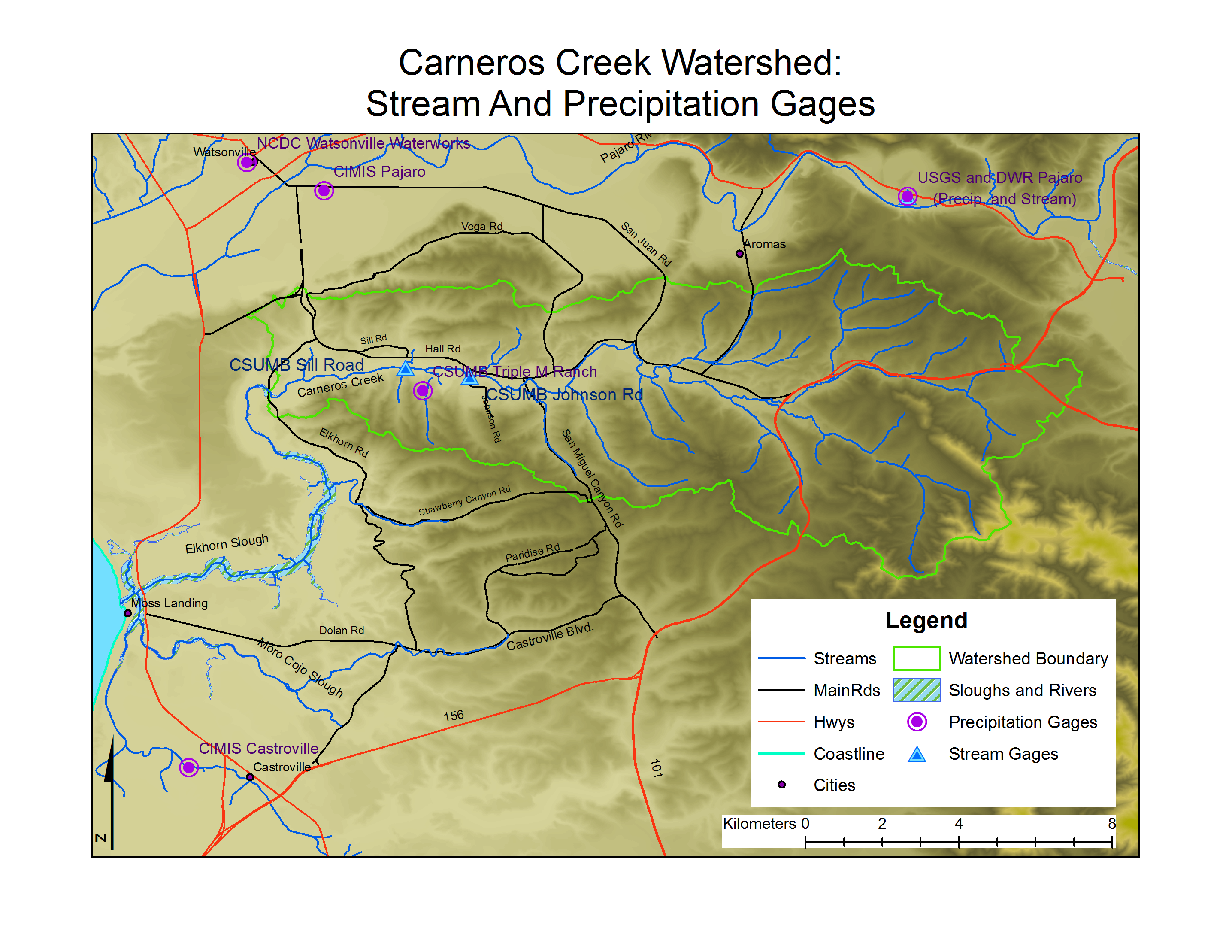
- Original source of data:
- Hydrography: National Map hydrography data set
- Roads: National Map transportation data set
- Watershed boundary: Watershed analysis in ArcMap by Fred Watson based on National Map 1/3 arc-second elevation data
- CDEC Stations: CDEC Station Locator http://cdec.water.ca.gov/cgi-progs/mapper
- NCDC Stations: NCDC Station List for California http://www4.ncdc.noaa.gov/cgi-win/wwcgi.dll?wwDI~SelectStation~USA~CA
- CIMIS Stations: CIMIS Station List http://wwwcimis.water.ca.gov/cimis/frontStationListData.do
- Data analysis: Fred Watson (watershed boundary)
- Map produced by: Rose Ashbach and Gabriela Alberola
- Map produced using: ArcMap
- Coordinate system: Geographic Coordinate System - GCS_North_American_1983
- Datum: D_North_American_1983
Alternate versions
- None