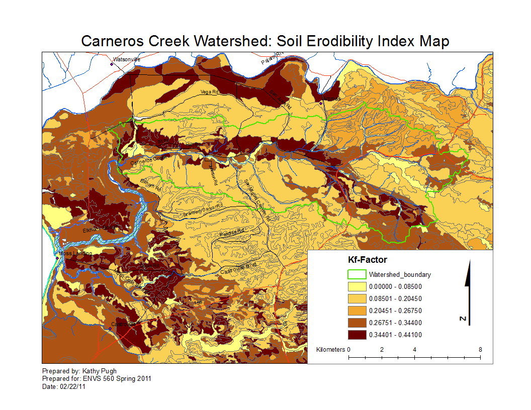
Carneros Watershed: Map of Soil Erodibility Index
From CCoWS Wiki

Metadata
- Original source of data:
- update
- update
- update
- Data analysis: Fred Watson
- Map produced by: Kathy Pugh
- Map produced using: ArcMap
- Coordinate system: Geographic Coordinate System - GCS_North_American_1983
- Datum: D_North_American_1983
Alternate versions
- None