Difference between revisions of "Carneros Watershed: Orthoimagery"
From CCoWS Wiki
(New page: == Metadata == * Original source of data: **Orthoimagery: National Agriculture Imagery Program (NAIP) 2009 ** Hydrography: National Map hydrography data set ** Roads: National Map...) |
(→Metadata) |
||
| (4 intermediate revisions by one user not shown) | |||
| Line 1: | Line 1: | ||
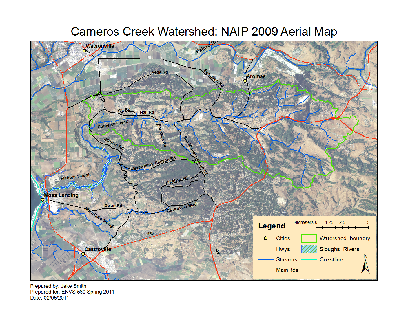
| + | [[Image:Carneros_Watershed_Aerial_NAIP.png|200px|thumb|Carneros Watershed: Basemap]] | ||
| + | |||
| + | * [[Media:Carneros_Watershed_Aerial_NAIP.pdf|PDF file - for printing]] | ||
| + | * [[Media:Carneros_Watershed_Aerial_NAIP.png|PNG file]] | ||
| + | |||
== Metadata == | == Metadata == | ||
| − | * Original source of data: | + | * Original source of data: [http://datagateway.nrcs.usda.gov/GDGOrder.aspx NRCS Data Gateway] |
| − | **Orthoimagery: National Agriculture Imagery Program (NAIP) 2009 | + | **Orthoimagery: National Agriculture Imagery Program (NAIP) 2009. Bands: 1-3 |
** Hydrography: [[National Map]] hydrography data set | ** Hydrography: [[National Map]] hydrography data set | ||
** Roads: [[National Map]] transportation data set | ** Roads: [[National Map]] transportation data set | ||
** Watershed boundary: Watershed analysis in ArcMap by [[Fred Watson]] based on [[National Map]] 1/3 arc-second elevation data | ** Watershed boundary: Watershed analysis in ArcMap by [[Fred Watson]] based on [[National Map]] 1/3 arc-second elevation data | ||
* Data analysis: [[Fred Watson]] (watershed boundary) | * Data analysis: [[Fred Watson]] (watershed boundary) | ||
| − | * Map produced by: | + | * Map produced by: Jake Smith |
* Map produced using: [[ArcMap]] | * Map produced using: [[ArcMap]] | ||
* Coordinate system: Geographic Coordinate System - GCS_North_American_1983 | * Coordinate system: Geographic Coordinate System - GCS_North_American_1983 | ||
* Datum: D_North_American_1983 | * Datum: D_North_American_1983 | ||
| + | |||
| + | == Alternate versions == | ||
| + | |||
| + | * None | ||
| + | |||
| + | == Links == | ||
| + | |||
| + | * [[Maps of the Carneros Watershed]] | ||
| + | * [[How to Post a Map on the Wiki]] | ||
Latest revision as of 13:21, 9 February 2011

Metadata
- Original source of data: NRCS Data Gateway
- Orthoimagery: National Agriculture Imagery Program (NAIP) 2009. Bands: 1-3
- Hydrography: National Map hydrography data set
- Roads: National Map transportation data set
- Watershed boundary: Watershed analysis in ArcMap by Fred Watson based on National Map 1/3 arc-second elevation data
- Data analysis: Fred Watson (watershed boundary)
- Map produced by: Jake Smith
- Map produced using: ArcMap
- Coordinate system: Geographic Coordinate System - GCS_North_American_1983
- Datum: D_North_American_1983
Alternate versions
- None