Difference between revisions of "File:CarnerosWatershed Landcover.png"
From CCoWS Wiki
(Replacing page with 'Carneros Watershed: Land Cover') |
|||
| Line 1: | Line 1: | ||
[[Image:CarnerosWatershed_LandCover.png|200px|thumb|Carneros Watershed: Land Cover]] | [[Image:CarnerosWatershed_LandCover.png|200px|thumb|Carneros Watershed: Land Cover]] | ||
| − | |||
| − | |||
| − | |||
| − | |||
| − | |||
| − | |||
| − | |||
| − | |||
| − | |||
| − | |||
| − | |||
| − | |||
| − | |||
| − | |||
| − | |||
| − | |||
| − | |||
| − | |||
| − | |||
| − | |||
| − | |||
| − | |||
| − | |||
| − | |||
| − | |||
Revision as of 08:44, 12 February 2011
File:CarnerosWatershed LandCover.png
Carneros Watershed: Land Cover
File history
Click on a date/time to view the file as it appeared at that time.
| Date/Time | Thumbnail | Dimensions | User | Comment | |
|---|---|---|---|---|---|
| current | 08:19, 12 February 2011 | 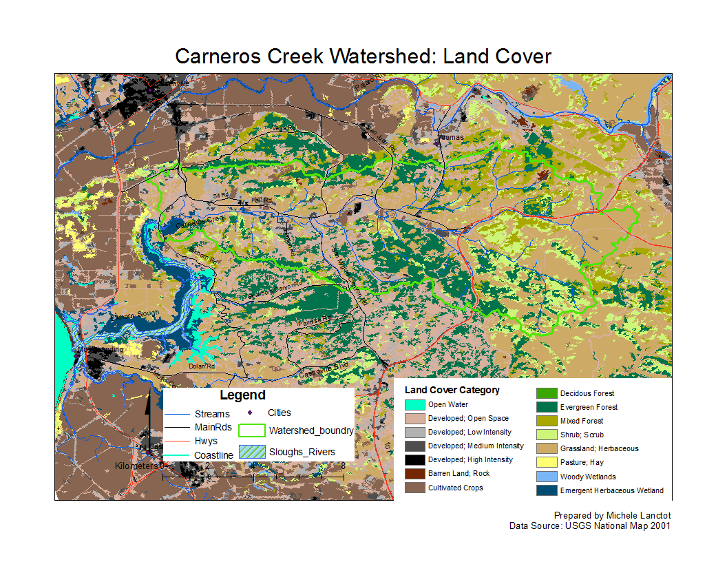 | 1,056 × 816 (224 KB) | Gabrielaa (Talk | contribs) |
- You cannot overwrite this file.
File usage
The following 3 pages link to this file: